Fairbank Topo Map Iowa
To zoom in, hover over the map of Fairbank
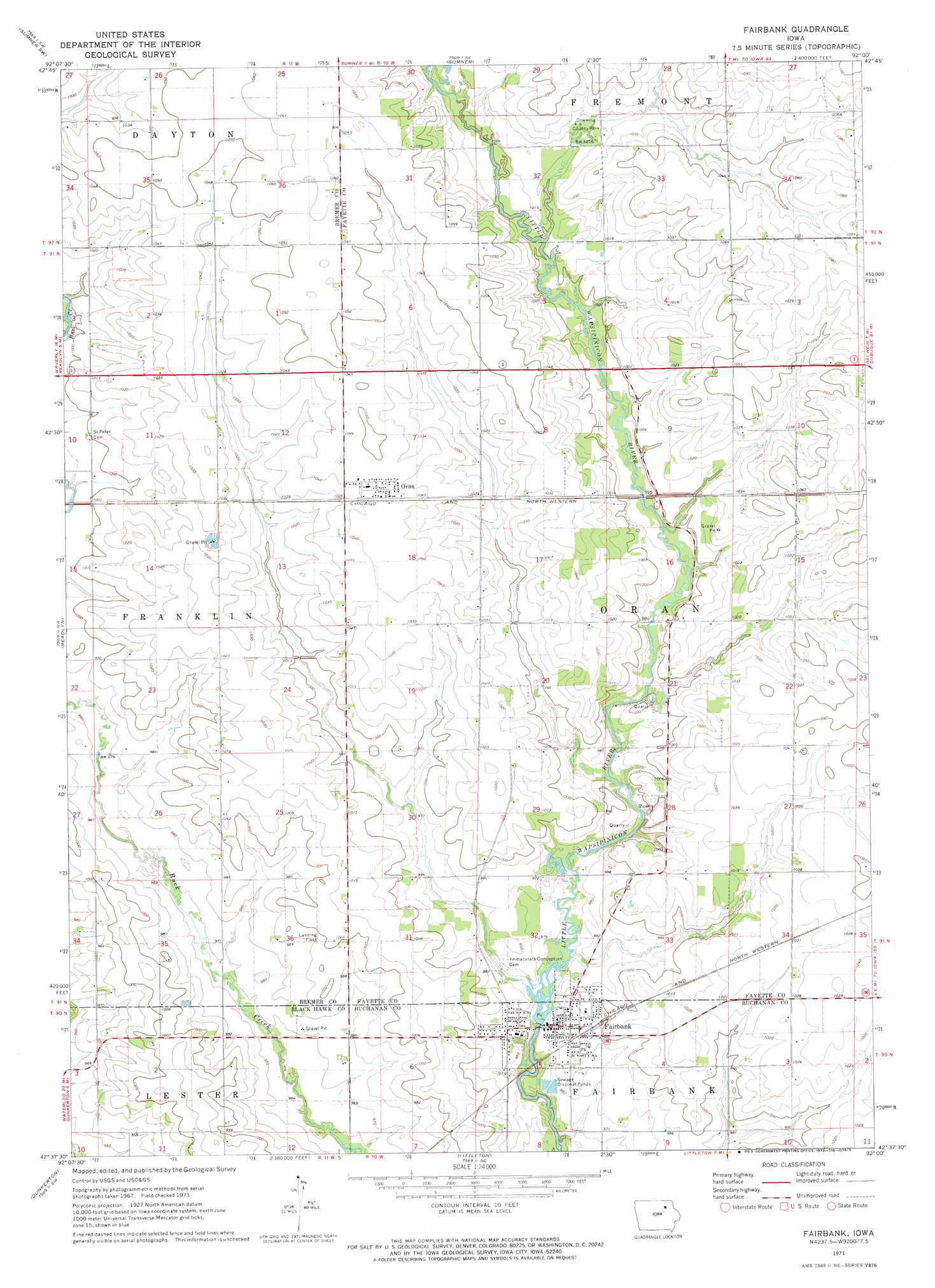
USGS Topo Quad 42092f1 - 1:24,000 scale
| Topo Map Name: | Fairbank |
| USGS Topo Quad ID: | 42092f1 |
| Print Size: | ca. 21 1/4" wide x 27" high |
| Southeast Coordinates: | 42.625° N latitude / 92° W longitude |
| Map Center Coordinates: | 42.6875° N latitude / 92.0625° W longitude |
| U.S. State: | IA |
| Filename: | o42092f1.jpg |
| Download Map JPG Image: | Fairbank topo map 1:24,000 scale |
| Map Type: | Topographic |
| Topo Series: | 7.5´ |
| Map Scale: | 1:24,000 |
| Source of Map Images: | United States Geological Survey (USGS) |
| Alternate Map Versions: |
Fairbank IA 1971, updated 1973 Download PDF Buy paper map Fairbank IA 2010 Download PDF Buy paper map Fairbank IA 2013 Download PDF Buy paper map Fairbank IA 2015 Download PDF Buy paper map |
1:24,000 Topo Quads surrounding Fairbank
Frederika |
Fredericksburg |
Alpha |
Hawkeye |
West Union |
Tripoli |
Sumner Sw |
Sumner |
Maynard |
Fayette |
Denver |
Readlyn |
Fairbank |
Oelwein |
Stanley |
Waterloo North |
Dunkerton |
Littleton |
Hazleton |
Oelwein Se |
Waterloo South |
Gilbertville |
Jesup |
Independence |
Quasqueton |
> Back to 42092e1 at 1:100,000 scale
> Back to 42092a1 at 1:250,000 scale
> Back to U.S. Topo Maps home
Fairbank topo map: Gazetteer
Fairbank: Parks
Downing County Park elevation 308m 1010′Siggelkov Park elevation 294m 964′
Fairbank: Populated Places
Fairbank elevation 301m 987′Miner elevation 312m 1023′
Oran elevation 318m 1043′
Fairbank: Post Offices
Fairbank Post Office elevation 296m 971′Penn Post Office (historical) elevation 315m 1033′
Fairbank digital topo map on disk
Buy this Fairbank topo map showing relief, roads, GPS coordinates and other geographical features, as a high-resolution digital map file on DVD: