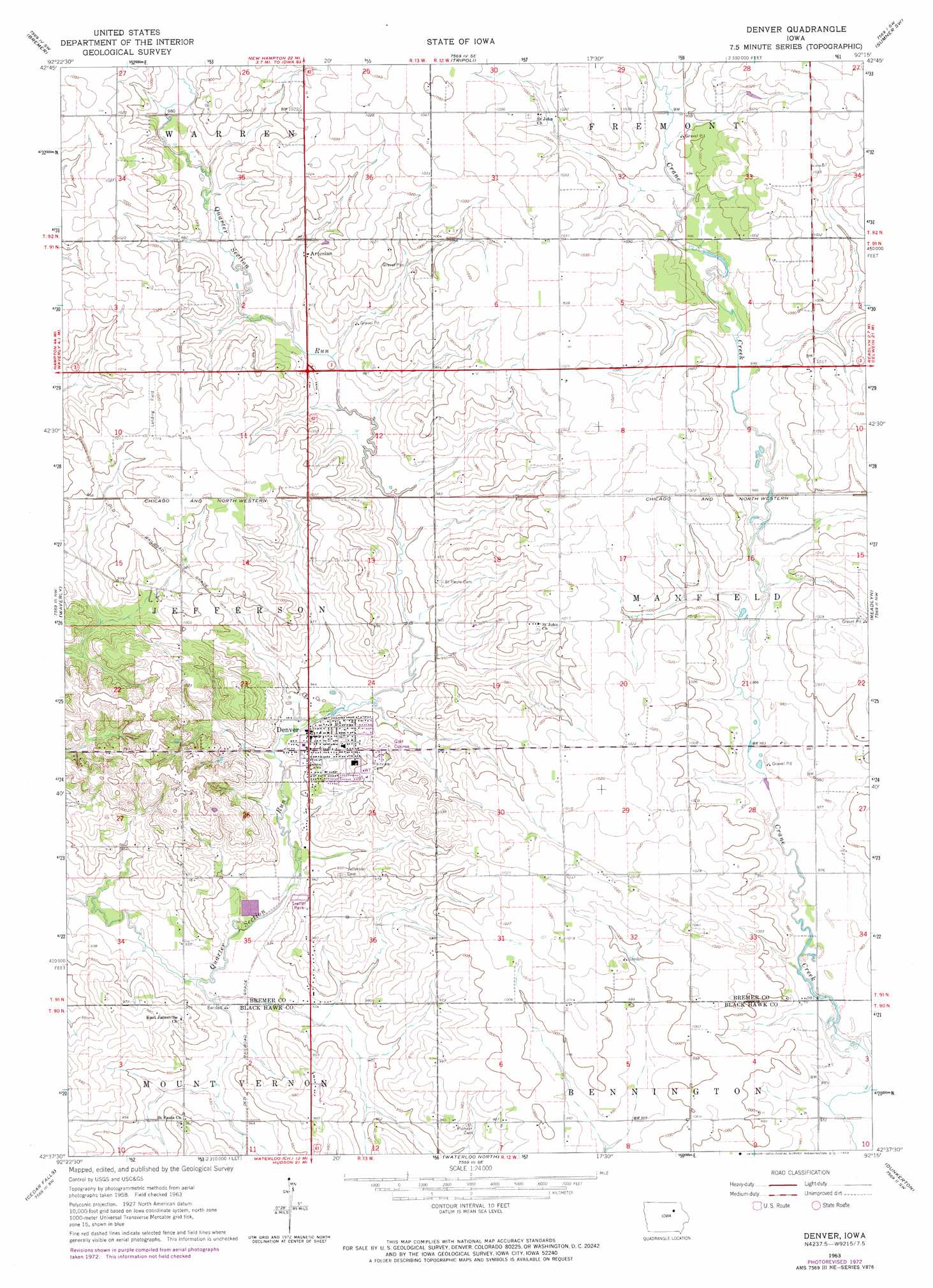
Denver Topo Map Iowa
To zoom in, hover over the map of Denver
USGS Topo Quad 42092f3 - 1:24,000 scale
| Topo Map Name: | Denver |
| USGS Topo Quad ID: | 42092f3 |
| Print Size: | ca. 21 1/4" wide x 27" high |
| Southeast Coordinates: | 42.625° N latitude / 92.25° W longitude |
| Map Center Coordinates: | 42.6875° N latitude / 92.3125° W longitude |
| U.S. State: | IA |
| Filename: | o42092f3.jpg |
| Download Map JPG Image: | Denver topo map 1:24,000 scale |
| Map Type: | Topographic |
| Topo Series: | 7.5´ |
| Map Scale: | 1:24,000 |
| Source of Map Images: | United States Geological Survey (USGS) |
| Alternate Map Versions: |
Denver IA 1963, updated 1964 Download PDF Buy paper map Denver IA 1963, updated 1973 Download PDF Buy paper map Denver IA 2010 Download PDF Buy paper map Denver IA 2013 Download PDF Buy paper map Denver IA 2015 Download PDF Buy paper map |
1:24,000 Topo Quads surrounding Denver
Nashua |
Tripoli Nw |
Frederika |
Fredericksburg |
Alpha |
Plainfield |
Bremer |
Tripoli |
Sumner Sw |
Sumner |
Shell Rock |
Waverly |
Denver |
Readlyn |
Fairbank |
New Hartford |
Cedar Falls |
Waterloo North |
Dunkerton |
Littleton |
Zaneta |
Hudson |
Waterloo South |
Gilbertville |
Jesup |
> Back to 42092e1 at 1:100,000 scale
> Back to 42092a1 at 1:250,000 scale
> Back to U.S. Topo Maps home
Denver topo map: Gazetteer
Denver: Bridges
Crane Creek Bridge elevation 296m 971′Denver: Parks
Brandt Park elevation 287m 941′Denver City Park elevation 289m 948′
Diercks Park elevation 289m 948′
Forrest Avenue Park elevation 289m 948′
Prestien Park elevation 289m 948′
Denver: Populated Places
Artesian elevation 300m 984′Denver elevation 289m 948′
Knittel elevation 308m 1010′
Meadow Lane Mobile Home Park elevation 287m 941′
Denver: Post Offices
Artesian Post Office (historical) elevation 300m 984′Breckenridge Post Office (historical) elevation 287m 941′
Crain Creek Post Office (historical) elevation 296m 971′
Denver Post Office elevation 289m 948′
Knittel Post Office (historical) elevation 308m 1010′
Maxfield Post Office (historical) elevation 309m 1013′
Nautrille Post Office (historical) elevation 291m 954′
Denver digital topo map on disk
Buy this Denver topo map showing relief, roads, GPS coordinates and other geographical features, as a high-resolution digital map file on DVD: