Greene Topo Map Iowa
To zoom in, hover over the map of Greene
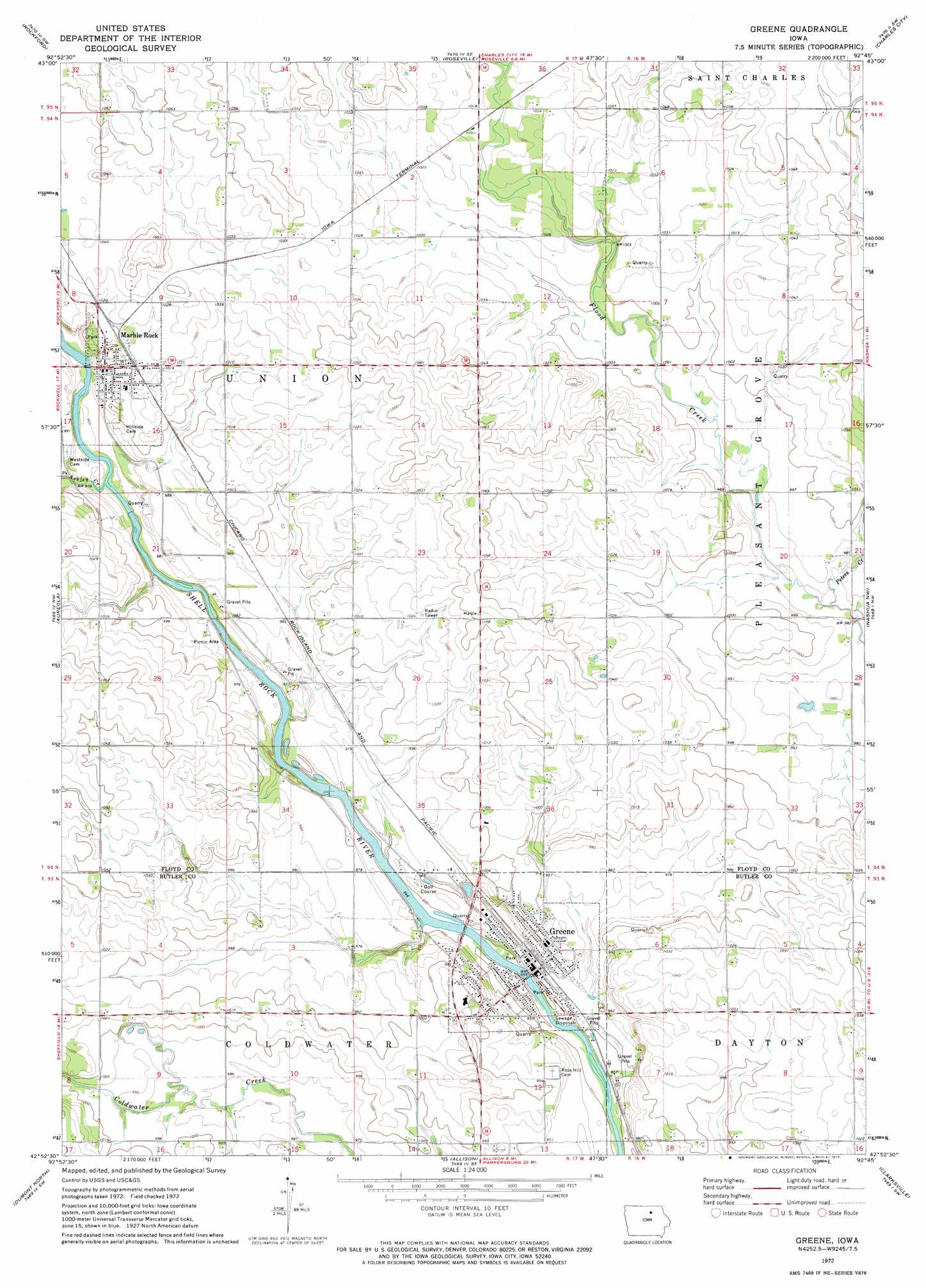
USGS Topo Quad 42092h7 - 1:24,000 scale
| Topo Map Name: | Greene |
| USGS Topo Quad ID: | 42092h7 |
| Print Size: | ca. 21 1/4" wide x 27" high |
| Southeast Coordinates: | 42.875° N latitude / 92.75° W longitude |
| Map Center Coordinates: | 42.9375° N latitude / 92.8125° W longitude |
| U.S. State: | IA |
| Filename: | o42092h7.jpg |
| Download Map JPG Image: | Greene topo map 1:24,000 scale |
| Map Type: | Topographic |
| Topo Series: | 7.5´ |
| Map Scale: | 1:24,000 |
| Source of Map Images: | United States Geological Survey (USGS) |
| Alternate Map Versions: |
Greene IA 1972, updated 1975 Download PDF Buy paper map Greene IA 2010 Download PDF Buy paper map Greene IA 2013 Download PDF Buy paper map Greene IA 2015 Download PDF Buy paper map |
1:24,000 Topo Quads surrounding Greene
Nora Springs |
Rudd |
Orchard |
Floyd |
Colwell |
Mason City Se |
Rockford |
Roseville |
Charles City |
Bassett |
Dougherty |
Aureola |
Greene |
Nashua Nw |
Nashua |
Hansell |
Dumont North |
Allison |
Clarksville |
Plainfield |
Ackley Ne |
Dumont South |
Butler Center |
Coster |
Shell Rock |
> Back to 42092e1 at 1:100,000 scale
> Back to 42092a1 at 1:250,000 scale
> Back to U.S. Topo Maps home
Greene topo map: Gazetteer
Greene: Bridges
Bradford Street Bridge elevation 292m 958′Greene: Parks
Depot Park elevation 291m 954′Greene Recreational Area elevation 290m 951′
Perrin Park elevation 289m 948′
Puhl Wildlife Area elevation 307m 1007′
Greene: Populated Places
Greene elevation 289m 948′Marble Rock elevation 305m 1000′
Greene: Post Offices
Greene Post Office elevation 290m 951′Marble Rock Post Office elevation 305m 1000′
Greene: Streams
Ackley Creek elevation 292m 958′Beaver Creek elevation 308m 1010′
Peters Creek elevation 296m 971′
Greene digital topo map on disk
Buy this Greene topo map showing relief, roads, GPS coordinates and other geographical features, as a high-resolution digital map file on DVD: