Duncombe Topo Map Iowa
To zoom in, hover over the map of Duncombe
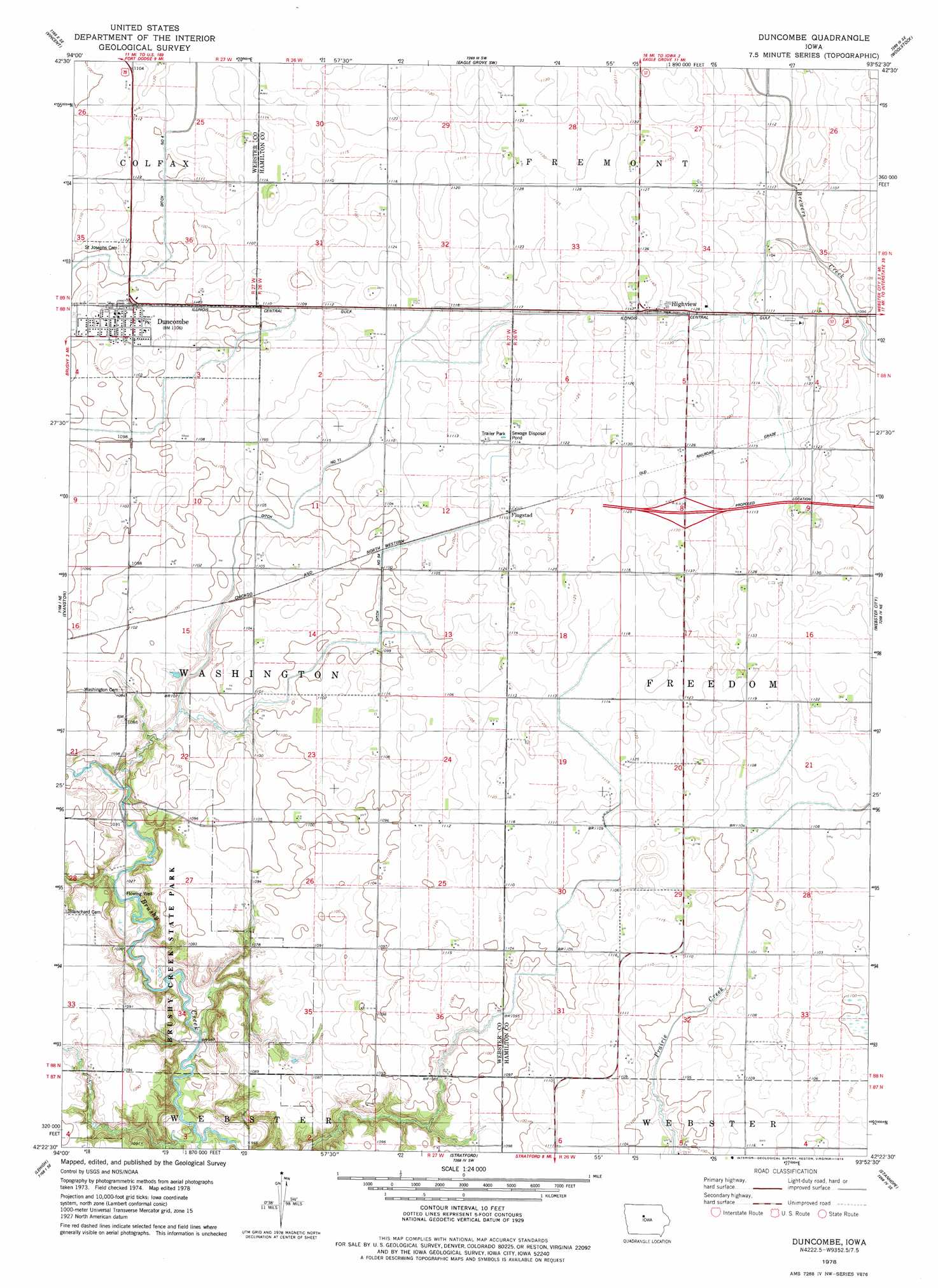
USGS Topo Quad 42093d8 - 1:24,000 scale
| Topo Map Name: | Duncombe |
| USGS Topo Quad ID: | 42093d8 |
| Print Size: | ca. 21 1/4" wide x 27" high |
| Southeast Coordinates: | 42.375° N latitude / 93.875° W longitude |
| Map Center Coordinates: | 42.4375° N latitude / 93.9375° W longitude |
| U.S. State: | IA |
| Filename: | o42093d8.jpg |
| Download Map JPG Image: | Duncombe topo map 1:24,000 scale |
| Map Type: | Topographic |
| Topo Series: | 7.5´ |
| Map Scale: | 1:24,000 |
| Source of Map Images: | United States Geological Survey (USGS) |
| Alternate Map Versions: |
Duncombe IA 1978, updated 1979 Download PDF Buy paper map Duncombe IA 2010 Download PDF Buy paper map Duncombe IA 2013 Download PDF Buy paper map Duncombe IA 2015 Download PDF Buy paper map |
1:24,000 Topo Quads surrounding Duncombe
Humboldt |
Thor |
Eagle Grove |
Holmes |
Clarion |
Fort Dodge North |
Vincent |
Eagle Grove Sw |
Woolstock |
Clarion Sw |
Fort Dodge South |
Evanston |
Duncombe |
Webster City |
Blairsburg |
Harcourt |
Lehigh |
Stratford |
Stanhope |
Jewell |
Lanyon |
Boxholm |
Fraser |
Mackey |
Ames Nw |
> Back to 42093a1 at 1:100,000 scale
> Back to 42092a1 at 1:250,000 scale
> Back to U.S. Topo Maps home
Duncombe topo map: Gazetteer
Duncombe: Parks
Brushy Creek State Park elevation 330m 1082′Gordon's Marsh Area elevation 339m 1112′
Prairie Pond Wildlife Area elevation 336m 1102′
Duncombe: Populated Places
Duncombe elevation 338m 1108′Flugstad (historical) elevation 341m 1118′
Highview elevation 344m 1128′
Duncombe: Post Offices
Duncombe Post Office elevation 338m 1108′Flugstad Post Office (historical) elevation 338m 1108′
Highview Post Office (historical) elevation 347m 1138′
Russell's Grove Post Office (historical) elevation 341m 1118′
Duncombe: Trails
Brushy Creek Trail elevation 332m 1089′Duncombe digital topo map on disk
Buy this Duncombe topo map showing relief, roads, GPS coordinates and other geographical features, as a high-resolution digital map file on DVD: