Dows East Topo Map Iowa
To zoom in, hover over the map of Dows East
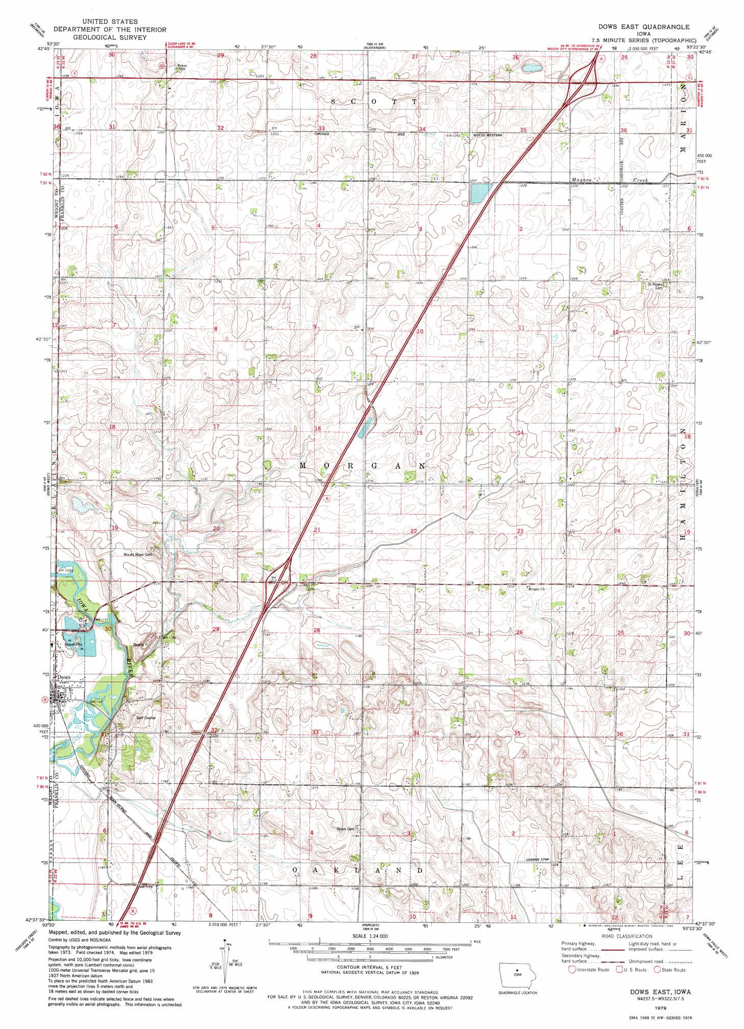
USGS Topo Quad 42093f4 - 1:24,000 scale
| Topo Map Name: | Dows East |
| USGS Topo Quad ID: | 42093f4 |
| Print Size: | ca. 21 1/4" wide x 27" high |
| Southeast Coordinates: | 42.625° N latitude / 93.375° W longitude |
| Map Center Coordinates: | 42.6875° N latitude / 93.4375° W longitude |
| U.S. State: | IA |
| Filename: | o42093f4.jpg |
| Download Map JPG Image: | Dows East topo map 1:24,000 scale |
| Map Type: | Topographic |
| Topo Series: | 7.5´ |
| Map Scale: | 1:24,000 |
| Source of Map Images: | United States Geological Survey (USGS) |
| Alternate Map Versions: |
Dows East IA 1979, updated 1980 Download PDF Buy paper map Dows East IA 2010 Download PDF Buy paper map Dows East IA 2013 Download PDF Buy paper map Dows East IA 2015 Download PDF Buy paper map |
1:24,000 Topo Quads surrounding Dows East
Olaf |
Goodell |
Thornton |
Swaledale |
Sheffield |
Cornelia |
Belmond |
Alexander |
Latimer |
Hampton North |
Clarion |
Dows West |
Dows East |
Coulter |
Hampton South |
Clarion Sw |
Sheldon Creek |
Popejoy |
Iowa Falls West |
Iowa Falls East |
Blairsburg |
Williams |
Buckeye West |
Buckeye East |
Owasa |
> Back to 42093e1 at 1:100,000 scale
> Back to 42092a1 at 1:250,000 scale
> Back to U.S. Topo Maps home
Dows East topo map: Gazetteer
Dows East: Crossings
Interchange 159 elevation 364m 1194′Interchange 165 elevation 379m 1243′
Dows East: Mines
Dows Quarry elevation 347m 1138′Dows East: Parks
Interstate Lake Park elevation 376m 1233′Toft County Park elevation 353m 1158′
Toft Wildlife Area elevation 349m 1145′
Dows East digital topo map on disk
Buy this Dows East topo map showing relief, roads, GPS coordinates and other geographical features, as a high-resolution digital map file on DVD: