Eagle Grove Topo Map Iowa
To zoom in, hover over the map of Eagle Grove
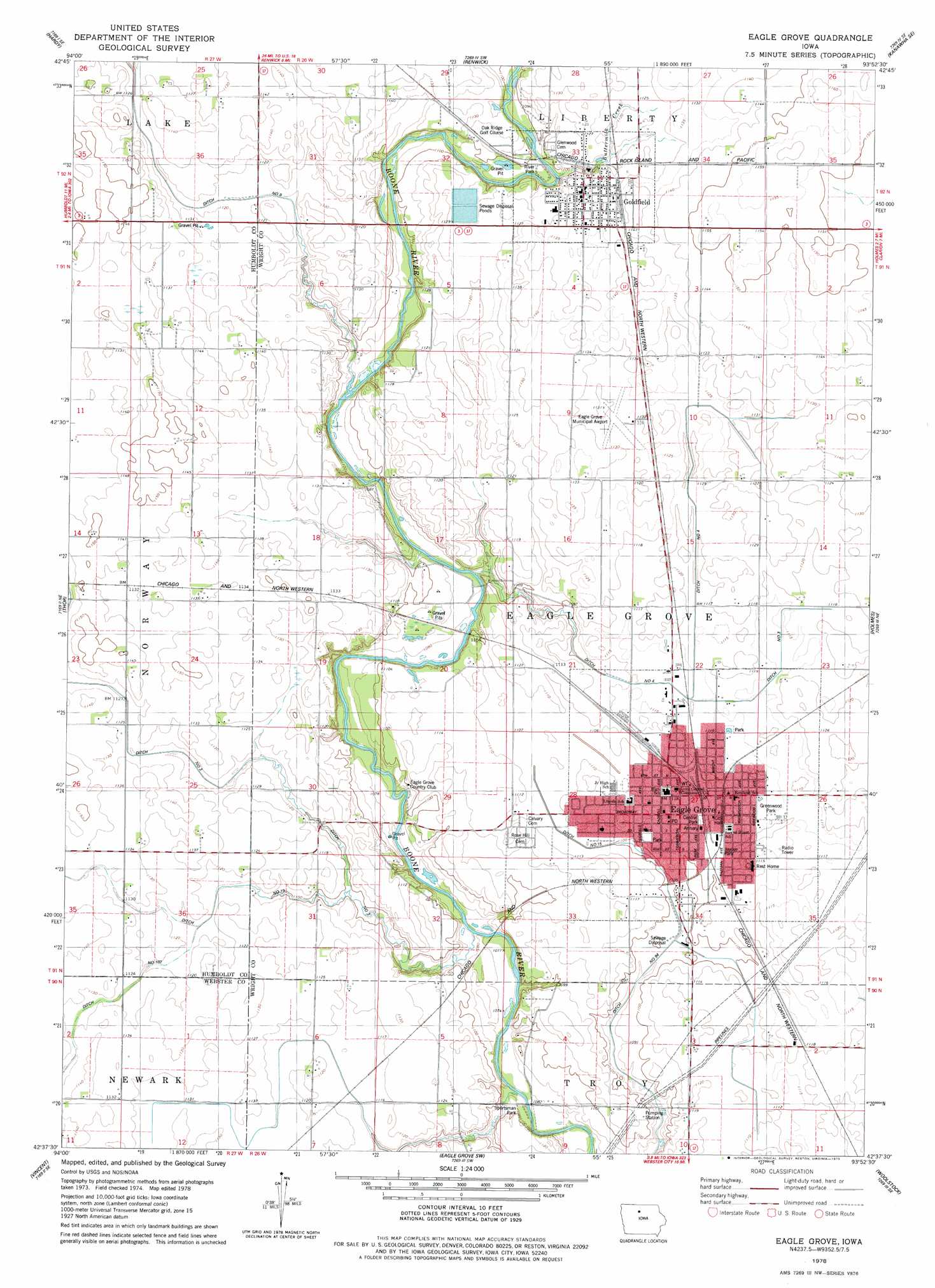
USGS Topo Quad 42093f8 - 1:24,000 scale
| Topo Map Name: | Eagle Grove |
| USGS Topo Quad ID: | 42093f8 |
| Print Size: | ca. 21 1/4" wide x 27" high |
| Southeast Coordinates: | 42.625° N latitude / 93.875° W longitude |
| Map Center Coordinates: | 42.6875° N latitude / 93.9375° W longitude |
| U.S. State: | IA |
| Filename: | o42093f8.jpg |
| Download Map JPG Image: | Eagle Grove topo map 1:24,000 scale |
| Map Type: | Topographic |
| Topo Series: | 7.5´ |
| Map Scale: | 1:24,000 |
| Source of Map Images: | United States Geological Survey (USGS) |
| Alternate Map Versions: |
Eagle Grove IA 1978, updated 1979 Download PDF Buy paper map Eagle Grove IA 2010 Download PDF Buy paper map Eagle Grove IA 2013 Download PDF Buy paper map Eagle Grove IA 2015 Download PDF Buy paper map |
1:24,000 Topo Quads surrounding Eagle Grove
Saint Joseph |
Lu Verne |
Corwith |
Kanawha |
Olaf |
Livermore |
Hardy |
Renwick |
Kanawha Se |
Cornelia |
Humboldt |
Thor |
Eagle Grove |
Holmes |
Clarion |
Fort Dodge North |
Vincent |
Eagle Grove Sw |
Woolstock |
Clarion Sw |
Fort Dodge South |
Evanston |
Duncombe |
Webster City |
Blairsburg |
> Back to 42093e1 at 1:100,000 scale
> Back to 42092a1 at 1:250,000 scale
> Back to U.S. Topo Maps home
Eagle Grove topo map: Gazetteer
Eagle Grove: Airports
Eagle Grove Municipal Airport elevation 344m 1128′Eagle Grove: Bridges
Goldfield Bridge elevation 332m 1089′Eagle Grove: Canals
Ditch Number 102 elevation 344m 1128′Ditch Number 15 elevation 335m 1099′
Ditch Number 19 elevation 341m 1118′
Ditch Number 25 elevation 339m 1112′
Ditch Number 4 elevation 336m 1102′
Ditch Number 94 elevation 328m 1076′
Eagle Grove: Parks
Central Park elevation 339m 1112′Greenwood Park elevation 339m 1112′
Hewitt Park elevation 339m 1112′
Jaycee Park elevation 337m 1105′
River Park elevation 333m 1092′
Sportsman Park elevation 327m 1072′
Eagle Grove: Populated Places
Eagle Grove elevation 340m 1115′Goldfield elevation 344m 1128′
Nuel (historical) elevation 343m 1125′
Eagle Grove: Post Offices
Eagle Grove Post Office elevation 340m 1115′Eagle Grove Post Office (historical) elevation 342m 1122′
Goldfield Post Office elevation 342m 1122′
Rosedale Post Office (historical) elevation 338m 1108′
Eagle Grove: Streams
Buttermilk Creek elevation 334m 1095′Eagle Grove digital topo map on disk
Buy this Eagle Grove topo map showing relief, roads, GPS coordinates and other geographical features, as a high-resolution digital map file on DVD: