Alexander Topo Map Iowa
To zoom in, hover over the map of Alexander
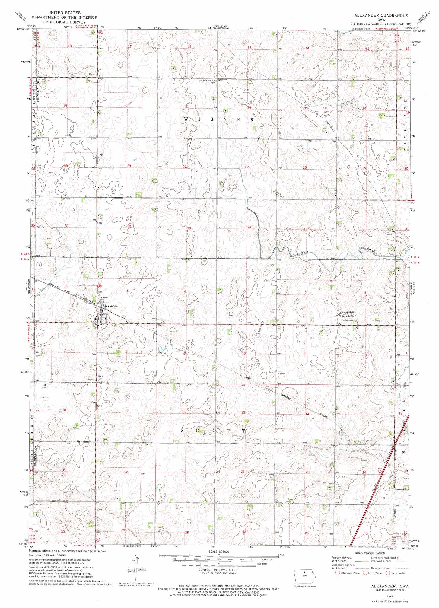
USGS Topo Quad 42093g4 - 1:24,000 scale
| Topo Map Name: | Alexander |
| USGS Topo Quad ID: | 42093g4 |
| Print Size: | ca. 21 1/4" wide x 27" high |
| Southeast Coordinates: | 42.75° N latitude / 93.375° W longitude |
| Map Center Coordinates: | 42.8125° N latitude / 93.4375° W longitude |
| U.S. State: | IA |
| Filename: | o42093g4.jpg |
| Download Map JPG Image: | Alexander topo map 1:24,000 scale |
| Map Type: | Topographic |
| Topo Series: | 7.5´ |
| Map Scale: | 1:24,000 |
| Source of Map Images: | United States Geological Survey (USGS) |
| Alternate Map Versions: |
Alexander IA 1972, updated 1975 Download PDF Buy paper map Alexander IA 2010 Download PDF Buy paper map Alexander IA 2013 Download PDF Buy paper map Alexander IA 2015 Download PDF Buy paper map |
1:24,000 Topo Quads surrounding Alexander
Duncan |
Garner |
Ventura Heights |
Burchinal |
Hanford |
Olaf |
Goodell |
Thornton |
Swaledale |
Sheffield |
Cornelia |
Belmond |
Alexander |
Latimer |
Hampton North |
Clarion |
Dows West |
Dows East |
Coulter |
Hampton South |
Clarion Sw |
Sheldon Creek |
Popejoy |
Iowa Falls West |
Iowa Falls East |
> Back to 42093e1 at 1:100,000 scale
> Back to 42092a1 at 1:250,000 scale
> Back to U.S. Topo Maps home
Alexander topo map: Gazetteer
Alexander: Parks
Hawkins Game Management Area elevation 381m 1250′Loomis Memorial Park elevation 388m 1272′
Alexander: Populated Places
Alexander elevation 387m 1269′Alexander: Post Offices
Alexander Post Office elevation 387m 1269′Alexander digital topo map on disk
Buy this Alexander topo map showing relief, roads, GPS coordinates and other geographical features, as a high-resolution digital map file on DVD: