Boxholm Topo Map Iowa
To zoom in, hover over the map of Boxholm
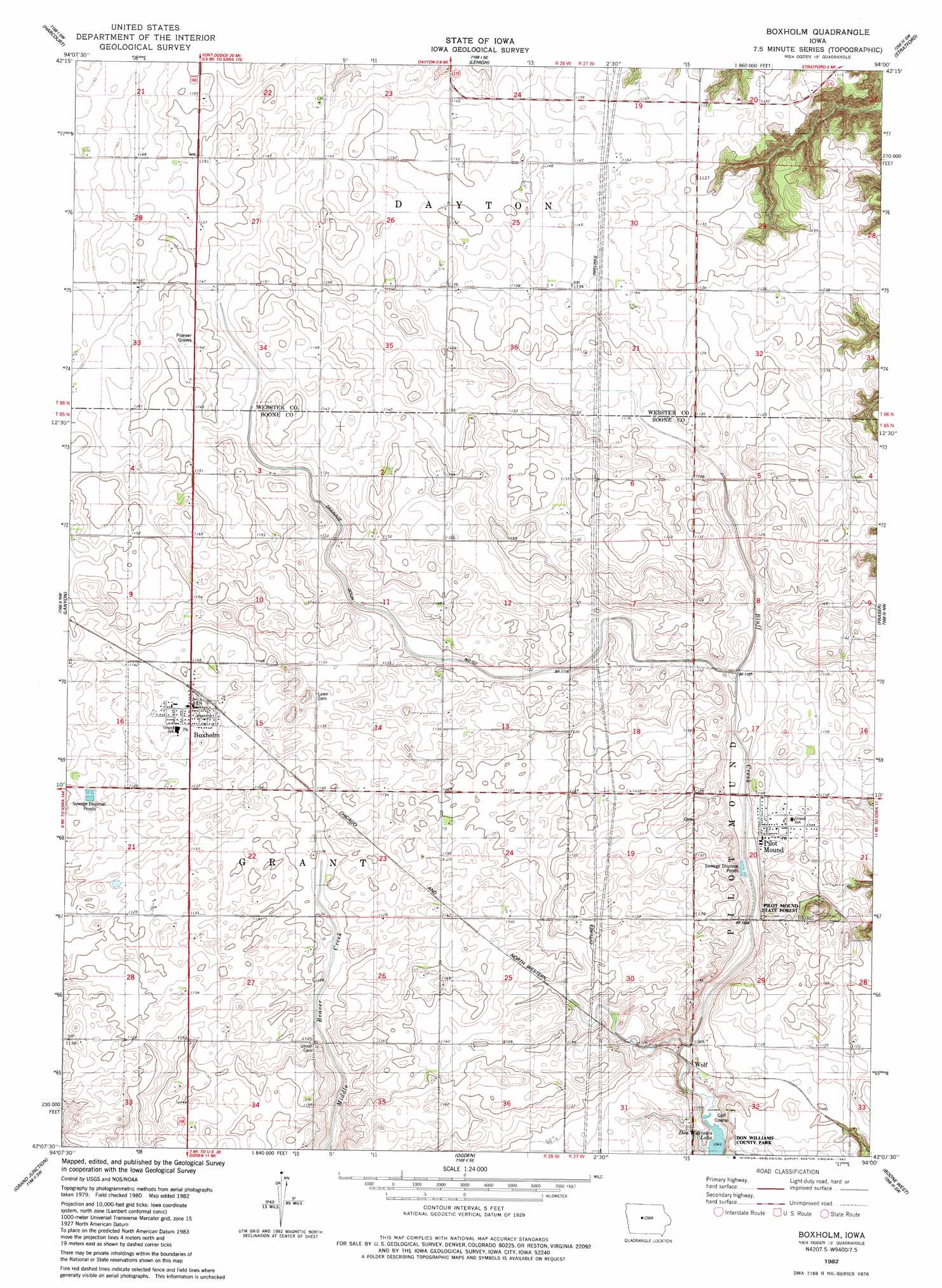
USGS Topo Quad 42094b1 - 1:24,000 scale
| Topo Map Name: | Boxholm |
| USGS Topo Quad ID: | 42094b1 |
| Print Size: | ca. 21 1/4" wide x 27" high |
| Southeast Coordinates: | 42.125° N latitude / 94° W longitude |
| Map Center Coordinates: | 42.1875° N latitude / 94.0625° W longitude |
| U.S. State: | IA |
| Filename: | o42094b1.jpg |
| Download Map JPG Image: | Boxholm topo map 1:24,000 scale |
| Map Type: | Topographic |
| Topo Series: | 7.5´ |
| Map Scale: | 1:24,000 |
| Source of Map Images: | United States Geological Survey (USGS) |
| Alternate Map Versions: |
Boxholm IA 1982, updated 1983 Download PDF Buy paper map Boxholm IA 2010 Download PDF Buy paper map Boxholm IA 2013 Download PDF Buy paper map Boxholm IA 2015 Download PDF Buy paper map |
1:24,000 Topo Quads surrounding Boxholm
Moorland |
Fort Dodge South |
Evanston |
Duncombe |
Webster City |
Gowrie |
Harcourt |
Lehigh |
Stratford |
Stanhope |
Paton |
Lanyon |
Boxholm |
Fraser |
Mackey |
Jefferson East |
Grand Junction |
Ogden |
Boone West |
Boone East |
Cooper |
Rippey |
Berkley |
Madrid Nw |
Luther |
> Back to 42094a1 at 1:100,000 scale
> Back to 42094a1 at 1:250,000 scale
> Back to U.S. Topo Maps home
Boxholm topo map: Gazetteer
Boxholm: Canals
Drainage Ditch Number 107 elevation 340m 1115′Boxholm: Forests
Pilot Mound State Forest elevation 362m 1187′Boxholm: Populated Places
Boxholm elevation 349m 1145′Pilot Mound elevation 338m 1108′
Wolf elevation 331m 1085′
Boxholm: Post Offices
Boxholm Post Office elevation 349m 1145′Casady Post Office (historical) elevation 346m 1135′
Pilot Mound Post Office elevation 338m 1108′
Boxholm digital topo map on disk
Buy this Boxholm topo map showing relief, roads, GPS coordinates and other geographical features, as a high-resolution digital map file on DVD: