Lehigh Topo Map Iowa
To zoom in, hover over the map of Lehigh
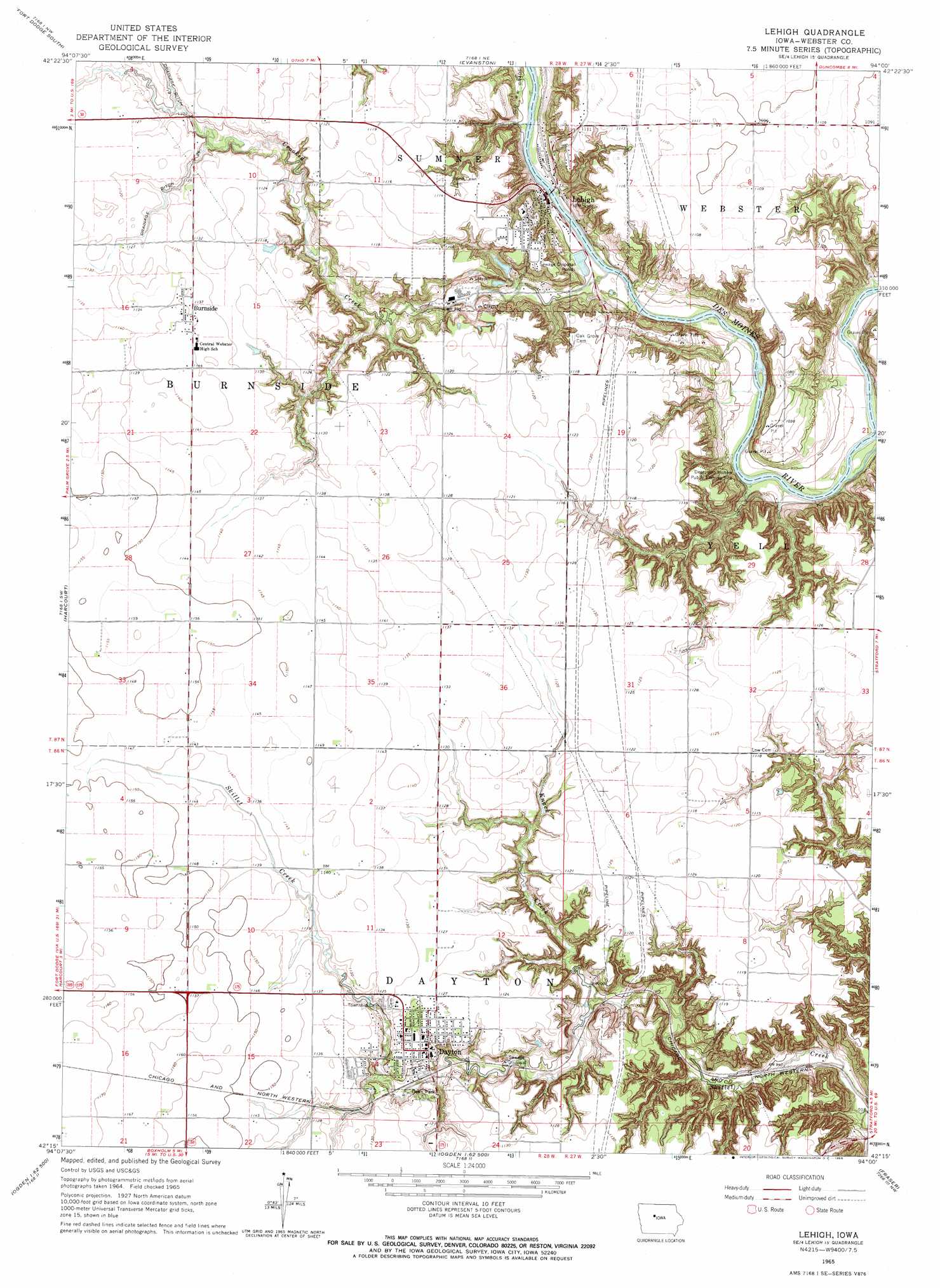
USGS Topo Quad 42094c1 - 1:24,000 scale
| Topo Map Name: | Lehigh |
| USGS Topo Quad ID: | 42094c1 |
| Print Size: | ca. 21 1/4" wide x 27" high |
| Southeast Coordinates: | 42.25° N latitude / 94° W longitude |
| Map Center Coordinates: | 42.3125° N latitude / 94.0625° W longitude |
| U.S. State: | IA |
| Filename: | o42094c1.jpg |
| Download Map JPG Image: | Lehigh topo map 1:24,000 scale |
| Map Type: | Topographic |
| Topo Series: | 7.5´ |
| Map Scale: | 1:24,000 |
| Source of Map Images: | United States Geological Survey (USGS) |
| Alternate Map Versions: |
Lehigh IA 1965, updated 1966 Download PDF Buy paper map Lehigh IA 2010 Download PDF Buy paper map Lehigh IA 2013 Download PDF Buy paper map Lehigh IA 2015 Download PDF Buy paper map |
1:24,000 Topo Quads surrounding Lehigh
Clare |
Fort Dodge North |
Vincent |
Eagle Grove Sw |
Woolstock |
Moorland |
Fort Dodge South |
Evanston |
Duncombe |
Webster City |
Gowrie |
Harcourt |
Lehigh |
Stratford |
Stanhope |
Paton |
Lanyon |
Boxholm |
Fraser |
Mackey |
Jefferson East |
Grand Junction |
Ogden |
Boone West |
Boone East |
> Back to 42094a1 at 1:100,000 scale
> Back to 42094a1 at 1:250,000 scale
> Back to U.S. Topo Maps home
Lehigh topo map: Gazetteer
Lehigh: Canals
Ditch Number Twentysix elevation 337m 1105′Lehigh: Parks
Deception Hollow Public Fishing Site elevation 284m 931′Lake Ole Park elevation 331m 1085′
Oak Park elevation 344m 1128′
Lehigh: Populated Places
Burnside elevation 347m 1138′Dayton elevation 342m 1122′
Lehigh elevation 293m 961′
Lehigh: Post Offices
Burnside Post Office elevation 347m 1138′Dayton Post Office elevation 343m 1125′
Hesperia Post Office (historical) elevation 336m 1102′
Lehigh Post Office elevation 293m 961′
Linnburg Post Office (historical) elevation 282m 925′
Lehigh: Streams
Crooked Creek elevation 283m 928′Knack Creek elevation 301m 987′
Lehigh: Valleys
Deception Hollow elevation 283m 928′Lehigh digital topo map on disk
Buy this Lehigh topo map showing relief, roads, GPS coordinates and other geographical features, as a high-resolution digital map file on DVD: