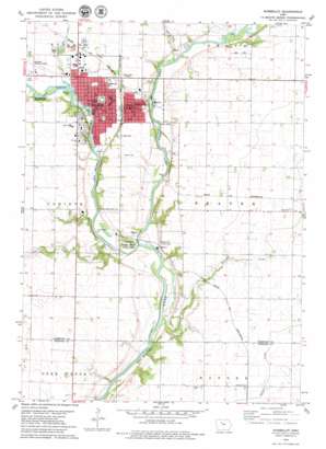
Humboldt Topo Map Iowa
To zoom in, hover over the map of Humboldt
USGS Topo Quad 42094f2 - 1:24,000 scale
| Topo Map Name: | Humboldt |
| USGS Topo Quad ID: | 42094f2 |
| Print Size: | ca. 21 1/4" wide x 27" high |
| Southeast Coordinates: | 42.625° N latitude / 94.125° W longitude |
| Map Center Coordinates: | 42.6875° N latitude / 94.1875° W longitude |
| U.S. State: | IA |
| Filename: | o42094f2.jpg |
| Download Map JPG Image: | Humboldt topo map 1:24,000 scale |
| Map Type: | Topographic |
| Topo Series: | 7.5´ |
| Map Scale: | 1:24,000 |
| Source of Map Images: | United States Geological Survey (USGS) |
| Alternate Map Versions: |
Humboldt IA 1979, updated 1979 Download PDF Buy paper map Humboldt IA 2010 Download PDF Buy paper map Humboldt IA 2013 Download PDF Buy paper map Humboldt IA 2015 Download PDF Buy paper map |
1:24,000 Topo Quads surrounding Humboldt
> Back to 42094e1 at 1:100,000 scale
> Back to 42094a1 at 1:250,000 scale
> Back to U.S. Topo Maps home
Humboldt topo map: Gazetteer
Humboldt: Airports
Humboldt Municipal Airport elevation 336m 1102′Humboldt: Dams
Joe Reasoner Dam elevation 329m 1079′Reasoner Dam elevation 329m 1079′
Humboldt: Mines
Pedersen Quarry elevation 339m 1112′Humboldt: Parks
Bicknell Park elevation 328m 1076′Dakota City River Park elevation 324m 1062′
Fay Hessian Fountain elevation 330m 1082′
Frank Gotch State Park elevation 319m 1046′
George Beebe Park elevation 326m 1069′
Hampson Hillside Park elevation 334m 1095′
Herb Zinnel Park elevation 340m 1115′
Iowa Park elevation 337m 1105′
John Brown Park elevation 330m 1082′
Lake Nokomis Park elevation 330m 1082′
Rainbow Drive Park elevation 338m 1108′
Riverside Park elevation 326m 1069′
Taft Park elevation 332m 1089′
Talisman Park elevation 329m 1079′
Tourist Park elevation 329m 1079′
West River Ball Diamonds elevation 331m 1085′
Worthington Park elevation 344m 1128′
Humboldt: Populated Places
Dakota City elevation 343m 1125′Humboldt elevation 330m 1082′
Jones Siding elevation 328m 1076′
Humboldt: Post Offices
Addison Post Office (historical) elevation 342m 1122′Dakota City Post Office elevation 345m 1131′
Humboldt Post Office elevation 331m 1085′
Sylvan Retreat Post Office (historical) elevation 342m 1122′
Humboldt: Reservoirs
Lake Nokomis elevation 329m 1079′Humboldt: Streams
Beaver Creek elevation 319m 1046′East Fork Des Moines River elevation 317m 1040′
Indian Creek elevation 321m 1053′
Humboldt: Trails
Cottonwood Trail elevation 326m 1069′Three Rivers Trail elevation 333m 1092′
Humboldt digital topo map on disk
Buy this Humboldt topo map showing relief, roads, GPS coordinates and other geographical features, as a high-resolution digital map file on DVD:


