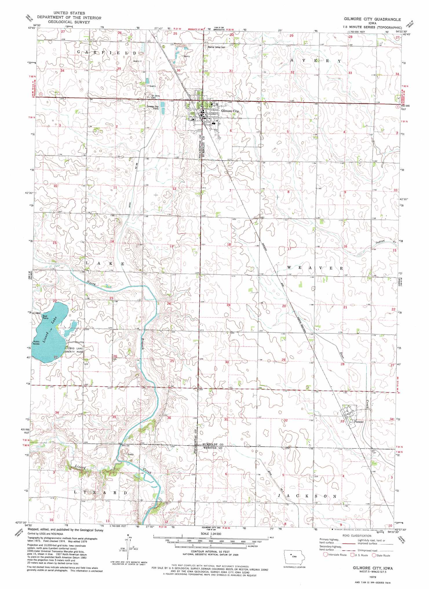
Gilmore City Topo Map Iowa
To zoom in, hover over the map of Gilmore City
USGS Topo Quad 42094f4 - 1:24,000 scale
| Topo Map Name: | Gilmore City |
| USGS Topo Quad ID: | 42094f4 |
| Print Size: | ca. 21 1/4" wide x 27" high |
| Southeast Coordinates: | 42.625° N latitude / 94.375° W longitude |
| Map Center Coordinates: | 42.6875° N latitude / 94.4375° W longitude |
| U.S. State: | IA |
| Filename: | o42094f4.jpg |
| Download Map JPG Image: | Gilmore City topo map 1:24,000 scale |
| Map Type: | Topographic |
| Topo Series: | 7.5´ |
| Map Scale: | 1:24,000 |
| Source of Map Images: | United States Geological Survey (USGS) |
| Alternate Map Versions: |
Gilmore City IA 1979, updated 1983 Download PDF Buy paper map Gilmore City IA 2010 Download PDF Buy paper map Gilmore City IA 2013 Download PDF Buy paper map Gilmore City IA 2015 Download PDF Buy paper map |
1:24,000 Topo Quads surrounding Gilmore City
Mallard |
Plover |
Unique |
West Bend Ne |
Saint Joseph |
Havelock |
Rolfe |
Bradgate |
Bode |
Livermore |
Pocahontas |
Palmer |
Gilmore City |
Umque |
Humboldt |
Pomeroy |
Manson |
Gilmore City Sw |
Clare |
Fort Dodge North |
Rockwell City |
Richard |
Knierim |
Moorland |
Fort Dodge South |
> Back to 42094e1 at 1:100,000 scale
> Back to 42094a1 at 1:250,000 scale
> Back to U.S. Topo Maps home
Gilmore City topo map: Gazetteer
Gilmore City: Canals
Drainage Ditch Number 168 elevation 362m 1187′Gilmore City: Parks
Lizard Lake Access elevation 364m 1194′Lizard Lake County Park elevation 364m 1194′
Lizard Lake Wildlife Management Area elevation 363m 1190′
Lizzard Creek Wildlife Area elevation 356m 1167′
Gilmore City: Populated Places
Gilmore City elevation 372m 1220′Pioneer elevation 362m 1187′
Stein's Rockin R Mobile Home Park elevation 376m 1233′
Gilmore City: Post Offices
Gilmore City Post Office elevation 375m 1230′Pioneer Post Office (historical) elevation 362m 1187′
Gilmore City: Streams
North Branch Lizard Creek elevation 362m 1187′Gilmore City digital topo map on disk
Buy this Gilmore City topo map showing relief, roads, GPS coordinates and other geographical features, as a high-resolution digital map file on DVD: