Plover Topo Map Iowa
To zoom in, hover over the map of Plover
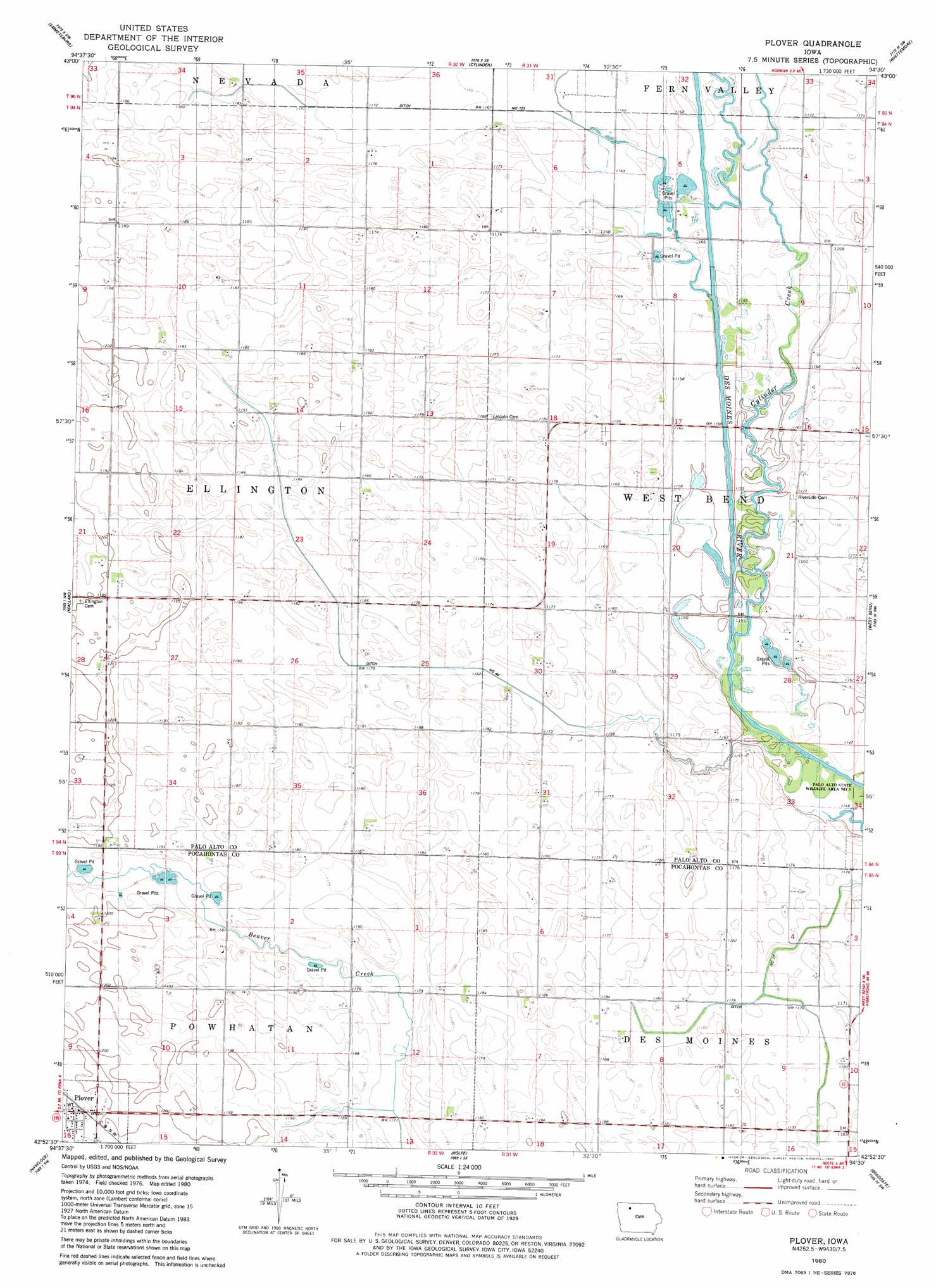
USGS Topo Quad 42094h5 - 1:24,000 scale
| Topo Map Name: | Plover |
| USGS Topo Quad ID: | 42094h5 |
| Print Size: | ca. 21 1/4" wide x 27" high |
| Southeast Coordinates: | 42.875° N latitude / 94.5° W longitude |
| Map Center Coordinates: | 42.9375° N latitude / 94.5625° W longitude |
| U.S. State: | IA |
| Filename: | o42094h5.jpg |
| Download Map JPG Image: | Plover topo map 1:24,000 scale |
| Map Type: | Topographic |
| Topo Series: | 7.5´ |
| Map Scale: | 1:24,000 |
| Source of Map Images: | United States Geological Survey (USGS) |
| Alternate Map Versions: |
Plover IA 1980, updated 1980 Download PDF Buy paper map Plover IA 2010 Download PDF Buy paper map Plover IA 2013 Download PDF Buy paper map Plover IA 2015 Download PDF Buy paper map |
1:24,000 Topo Quads surrounding Plover
Graettinger West |
Graettinger East |
Depew |
Fenton |
Lone Rock |
Ayrshire |
Emmetsburg |
Cylinder |
Whittemore |
Hobarton |
Rush Lake East |
Mallard |
Plover |
Unique |
West Bend Ne |
Laurens |
Havelock |
Rolfe |
Bradgate |
Bode |
Fonda Ne |
Pocahontas |
Palmer |
Gilmore City |
Umque |
> Back to 42094e1 at 1:100,000 scale
> Back to 42094a1 at 1:250,000 scale
> Back to U.S. Topo Maps home
Plover topo map: Gazetteer
Plover: Areas
River Runner Access elevation 351m 1151′Plover: Canals
Ditch Number 123 elevation 354m 1161′Ditch Number 17 elevation 354m 1161′
Ditch Number 48 elevation 354m 1161′
Plover: Parks
Meredith Park elevation 360m 1181′West Des Moines River Canoe Stop elevation 351m 1151′
West Fork Wetlands elevation 351m 1151′
Plover: Populated Places
Plover elevation 369m 1210′Plover: Post Offices
Plover Post Office elevation 369m 1210′Poplar Grove Post Office (historical) elevation 359m 1177′
Plover: Streams
Cylinder Creek elevation 354m 1161′Plover digital topo map on disk
Buy this Plover topo map showing relief, roads, GPS coordinates and other geographical features, as a high-resolution digital map file on DVD: