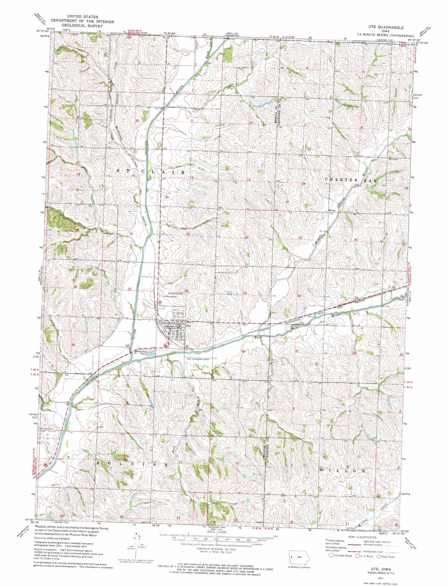
Ute Topo Map Iowa
To zoom in, hover over the map of Ute
USGS Topo Quad 42095a6 - 1:24,000 scale
| Topo Map Name: | Ute |
| USGS Topo Quad ID: | 42095a6 |
| Print Size: | ca. 21 1/4" wide x 27" high |
| Southeast Coordinates: | 42° N latitude / 95.625° W longitude |
| Map Center Coordinates: | 42.0625° N latitude / 95.6875° W longitude |
| U.S. State: | IA |
| Filename: | o42095a6.jpg |
| Download Map JPG Image: | Ute topo map 1:24,000 scale |
| Map Type: | Topographic |
| Topo Series: | 7.5´ |
| Map Scale: | 1:24,000 |
| Source of Map Images: | United States Geological Survey (USGS) |
| Alternate Map Versions: |
Ute IA 1971, updated 1973 Download PDF Buy paper map Ute IA 2010 Download PDF Buy paper map Ute IA 2013 Download PDF Buy paper map Ute IA 2015 Download PDF Buy paper map |
1:24,000 Topo Quads surrounding Ute
Oto |
Correctionville Se |
Holstein Sw |
Battle Creek |
Ida Grove |
Smithland |
Mapleton |
Danbury |
Ricketts |
Schleswig |
Castana |
Mapleton Se |
Ute |
Charter Oak |
Denison Sw |
Moorhead Nw |
Moorhead |
Dunlap Nw |
Dunlap Ne |
Dow City |
Pisgah |
Moorhead Se |
Dunlap Sw |
Dunlap |
Earling |
> Back to 42095a1 at 1:100,000 scale
> Back to 42094a1 at 1:250,000 scale
> Back to U.S. Topo Maps home
Ute topo map: Gazetteer
Ute: Bridges
East Soldier River Bridge elevation 359m 1177′Ute: Populated Places
Berne elevation 371m 1217′Ute elevation 379m 1243′
Ute: Post Offices
Saint Clair Post Office (historical) elevation 364m 1194′Ute Post Office elevation 379m 1243′
Ute: Streams
East Soldier River elevation 346m 1135′Middle Soldier River elevation 354m 1161′
Rock Creek elevation 348m 1141′
Rush Creek elevation 360m 1181′
Skunk Creek elevation 353m 1158′
Ute digital topo map on disk
Buy this Ute topo map showing relief, roads, GPS coordinates and other geographical features, as a high-resolution digital map file on DVD: