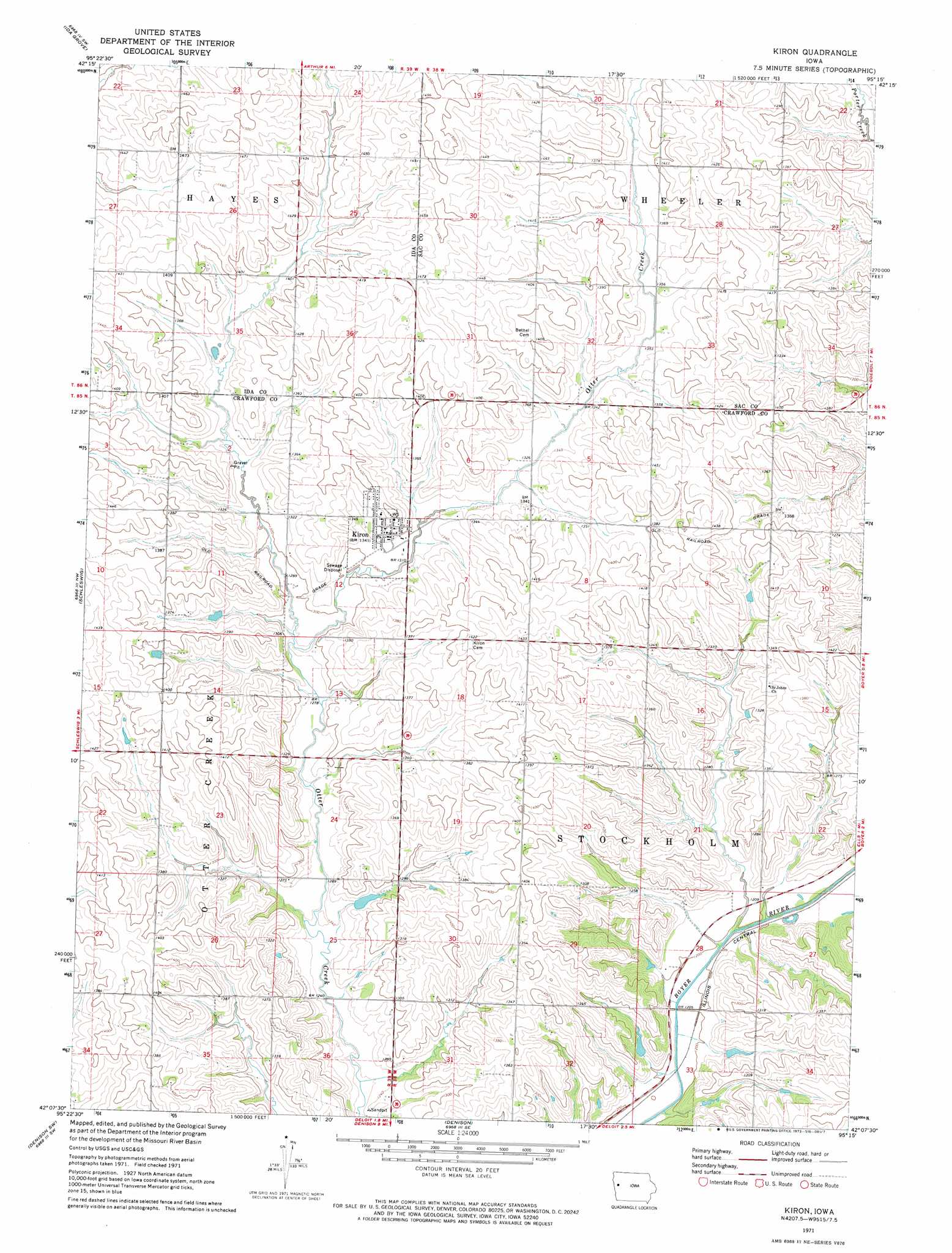
Kiron Topo Map Iowa
To zoom in, hover over the map of Kiron
USGS Topo Quad 42095b3 - 1:24,000 scale
| Topo Map Name: | Kiron |
| USGS Topo Quad ID: | 42095b3 |
| Print Size: | ca. 21 1/4" wide x 27" high |
| Southeast Coordinates: | 42.125° N latitude / 95.25° W longitude |
| Map Center Coordinates: | 42.1875° N latitude / 95.3125° W longitude |
| U.S. State: | IA |
| Filename: | o42095b3.jpg |
| Download Map JPG Image: | Kiron topo map 1:24,000 scale |
| Map Type: | Topographic |
| Topo Series: | 7.5´ |
| Map Scale: | 1:24,000 |
| Source of Map Images: | United States Geological Survey (USGS) |
| Alternate Map Versions: |
Kiron IA 1971, updated 1973 Download PDF Buy paper map Kiron IA 2010 Download PDF Buy paper map Kiron IA 2013 Download PDF Buy paper map Kiron IA 2015 Download PDF Buy paper map |
1:24,000 Topo Quads surrounding Kiron
Holstein |
Ida Grove Nw |
Schaller South |
Early |
Sac City West |
Battle Creek |
Ida Grove |
Odebolt West |
Odebolt East |
Lake View |
Ricketts |
Schleswig |
Kiron |
Boyer |
Vail Ne |
Charter Oak |
Denison Sw |
Denison |
Vail |
Arcadia |
Dunlap Ne |
Dow City |
Earling Ne |
Manilla |
Manning |
> Back to 42095a1 at 1:100,000 scale
> Back to 42094a1 at 1:250,000 scale
> Back to U.S. Topo Maps home
Kiron topo map: Gazetteer
Kiron: Parks
Otter Creek Nature Area elevation 371m 1217′Kiron: Populated Places
Kiron elevation 409m 1341′Kiron: Post Offices
Johnsonville Post Office (historical) elevation 429m 1407′Kiron Post Office elevation 409m 1341′
Kiron: Streams
East Otter Creek elevation 389m 1276′Newcom Creek elevation 414m 1358′
Kiron digital topo map on disk
Buy this Kiron topo map showing relief, roads, GPS coordinates and other geographical features, as a high-resolution digital map file on DVD: