Danbury Topo Map Iowa
To zoom in, hover over the map of Danbury
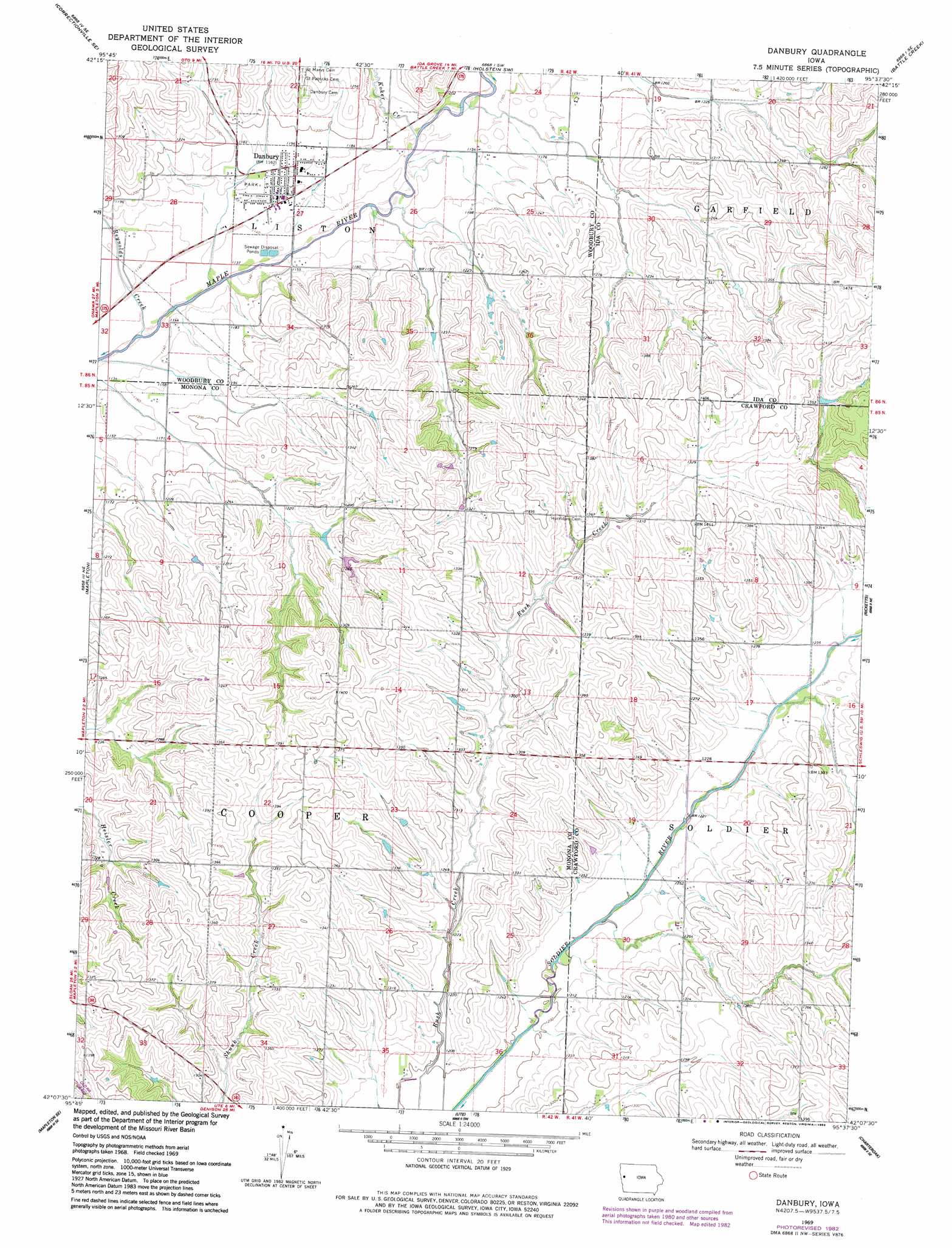
USGS Topo Quad 42095b6 - 1:24,000 scale
| Topo Map Name: | Danbury |
| USGS Topo Quad ID: | 42095b6 |
| Print Size: | ca. 21 1/4" wide x 27" high |
| Southeast Coordinates: | 42.125° N latitude / 95.625° W longitude |
| Map Center Coordinates: | 42.1875° N latitude / 95.6875° W longitude |
| U.S. State: | IA |
| Filename: | o42095b6.jpg |
| Download Map JPG Image: | Danbury topo map 1:24,000 scale |
| Map Type: | Topographic |
| Topo Series: | 7.5´ |
| Map Scale: | 1:24,000 |
| Source of Map Images: | United States Geological Survey (USGS) |
| Alternate Map Versions: |
Danbury IA 1969, updated 1971 Download PDF Buy paper map Danbury IA 1969, updated 1983 Download PDF Buy paper map Danbury IA 2010 Download PDF Buy paper map Danbury IA 2013 Download PDF Buy paper map Danbury IA 2015 Download PDF Buy paper map |
1:24,000 Topo Quads surrounding Danbury
Correctionville Nw |
Correctionville |
Cushing |
Holstein |
Ida Grove Nw |
Oto |
Correctionville Se |
Holstein Sw |
Battle Creek |
Ida Grove |
Smithland |
Mapleton |
Danbury |
Ricketts |
Schleswig |
Castana |
Mapleton Se |
Ute |
Charter Oak |
Denison Sw |
Moorhead Nw |
Moorhead |
Dunlap Nw |
Dunlap Ne |
Dow City |
> Back to 42095a1 at 1:100,000 scale
> Back to 42094a1 at 1:250,000 scale
> Back to U.S. Topo Maps home
Danbury topo map: Gazetteer
Danbury: Populated Places
Danbury elevation 354m 1161′Danbury: Post Offices
Adrian Post Office (historical) elevation 398m 1305′Danbury Post Office elevation 355m 1164′
Danbury: Streams
Koker Creek elevation 347m 1138′Reynolds Creek elevation 342m 1122′
Danbury digital topo map on disk
Buy this Danbury topo map showing relief, roads, GPS coordinates and other geographical features, as a high-resolution digital map file on DVD: