Alta Topo Map Iowa
To zoom in, hover over the map of Alta
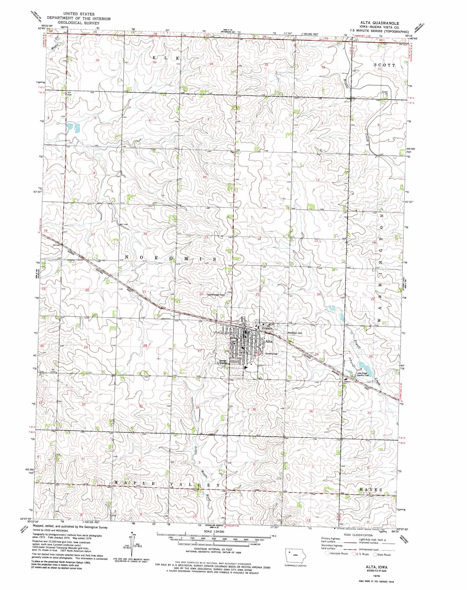
USGS Topo Quad 42095f3 - 1:24,000 scale
| Topo Map Name: | Alta |
| USGS Topo Quad ID: | 42095f3 |
| Print Size: | ca. 21 1/4" wide x 27" high |
| Southeast Coordinates: | 42.625° N latitude / 95.25° W longitude |
| Map Center Coordinates: | 42.6875° N latitude / 95.3125° W longitude |
| U.S. State: | IA |
| Filename: | o42095f3.jpg |
| Download Map JPG Image: | Alta topo map 1:24,000 scale |
| Map Type: | Topographic |
| Topo Series: | 7.5´ |
| Map Scale: | 1:24,000 |
| Source of Map Images: | United States Geological Survey (USGS) |
| Alternate Map Versions: |
Alta IA 1979, updated 1986 Download PDF Buy paper map Alta IA 2010 Download PDF Buy paper map Alta IA 2013 Download PDF Buy paper map Alta IA 2015 Download PDF Buy paper map |
1:24,000 Topo Quads surrounding Alta
Sutherland West |
Sutherland East |
Peterson |
Sioux Rapids |
Webb |
Cherokee North |
Peterson Sw |
Peterson Se |
Rembrandt |
Sioux Rapids Se |
Cherokee South |
Aurelia |
Alta |
Storm Lake |
Storm Lake Ne |
Quimby Se |
Galva |
Schaller North |
Lakeside |
Newell West |
Holstein |
Ida Grove Nw |
Schaller South |
Early |
Sac City West |
> Back to 42095e1 at 1:100,000 scale
> Back to 42094a1 at 1:250,000 scale
> Back to U.S. Topo Maps home
Alta topo map: Gazetteer
Alta: Populated Places
Alta elevation 454m 1489′Alta: Post Offices
Alta Post Office elevation 464m 1522′Alta digital topo map on disk
Buy this Alta topo map showing relief, roads, GPS coordinates and other geographical features, as a high-resolution digital map file on DVD: