Aurelia Topo Map Iowa
To zoom in, hover over the map of Aurelia
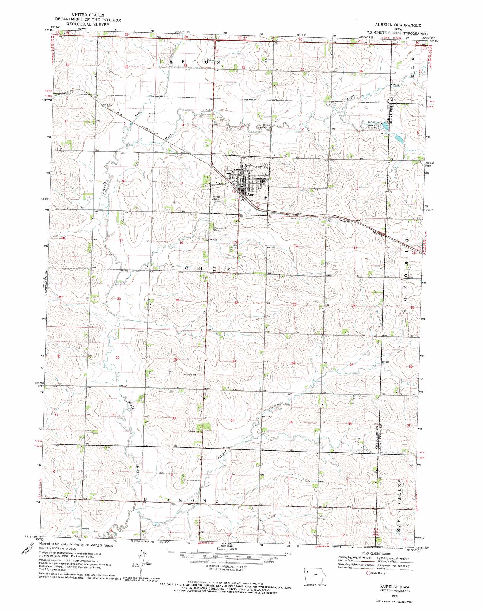
USGS Topo Quad 42095f4 - 1:24,000 scale
| Topo Map Name: | Aurelia |
| USGS Topo Quad ID: | 42095f4 |
| Print Size: | ca. 21 1/4" wide x 27" high |
| Southeast Coordinates: | 42.625° N latitude / 95.375° W longitude |
| Map Center Coordinates: | 42.6875° N latitude / 95.4375° W longitude |
| U.S. State: | IA |
| Filename: | o42095f4.jpg |
| Download Map JPG Image: | Aurelia topo map 1:24,000 scale |
| Map Type: | Topographic |
| Topo Series: | 7.5´ |
| Map Scale: | 1:24,000 |
| Source of Map Images: | United States Geological Survey (USGS) |
| Alternate Map Versions: |
Aurelia IA 1969, updated 1971 Download PDF Buy paper map Aurelia IA 2010 Download PDF Buy paper map Aurelia IA 2013 Download PDF Buy paper map Aurelia IA 2015 Download PDF Buy paper map |
1:24,000 Topo Quads surrounding Aurelia
Paullina |
Sutherland West |
Sutherland East |
Peterson |
Sioux Rapids |
Cleghorn |
Cherokee North |
Peterson Sw |
Peterson Se |
Rembrandt |
Quimby |
Cherokee South |
Aurelia |
Alta |
Storm Lake |
Washta |
Quimby Se |
Galva |
Schaller North |
Lakeside |
Cushing |
Holstein |
Ida Grove Nw |
Schaller South |
Early |
> Back to 42095e1 at 1:100,000 scale
> Back to 42094a1 at 1:250,000 scale
> Back to U.S. Topo Maps home
Aurelia topo map: Gazetteer
Aurelia: Areas
Prescott Prairie elevation 427m 1400′Aurelia: Lakes
Larson Lake elevation 417m 1368′Aurelia: Parks
Larson Lake County Park elevation 417m 1368′Nester Stiles State Preserve elevation 412m 1351′
Aurelia: Populated Places
Aurelia elevation 424m 1391′Southern Acres Mobile Estates elevation 420m 1377′
Aurelia: Post Offices
Aurelia Post Office elevation 424m 1391′Aurelia: Streams
Maple Creek elevation 406m 1332′Pitcher Creek elevation 397m 1302′
Aurelia digital topo map on disk
Buy this Aurelia topo map showing relief, roads, GPS coordinates and other geographical features, as a high-resolution digital map file on DVD: