Fielding Topo Map Iowa
To zoom in, hover over the map of Fielding
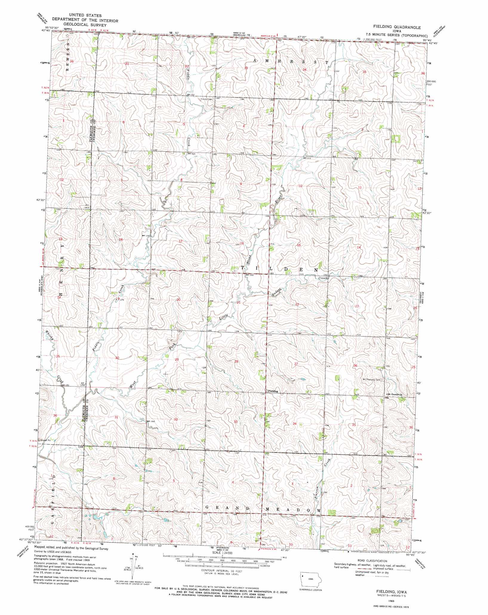
USGS Topo Quad 42095f7 - 1:24,000 scale
| Topo Map Name: | Fielding |
| USGS Topo Quad ID: | 42095f7 |
| Print Size: | ca. 21 1/4" wide x 27" high |
| Southeast Coordinates: | 42.625° N latitude / 95.75° W longitude |
| Map Center Coordinates: | 42.6875° N latitude / 95.8125° W longitude |
| U.S. State: | IA |
| Filename: | o42095f7.jpg |
| Download Map JPG Image: | Fielding topo map 1:24,000 scale |
| Map Type: | Topographic |
| Topo Series: | 7.5´ |
| Map Scale: | 1:24,000 |
| Source of Map Images: | United States Geological Survey (USGS) |
| Alternate Map Versions: |
Fielding IA 1969, updated 1971 Download PDF Buy paper map Fielding IA 2010 Download PDF Buy paper map Fielding IA 2013 Download PDF Buy paper map Fielding IA 2015 Download PDF Buy paper map |
1:24,000 Topo Quads surrounding Fielding
Alton |
Granville West |
Granville East |
Paullina |
Sutherland West |
Oyens |
Remsen |
Marcus |
Cleghorn |
Cherokee North |
Union Center |
Kingsley Nw |
Fielding |
Quimby |
Cherokee South |
Union Center Se |
Kingsley |
Pierson |
Washta |
Quimby Se |
Moville |
Correctionville Nw |
Correctionville |
Cushing |
Holstein |
> Back to 42095e1 at 1:100,000 scale
> Back to 42094a1 at 1:250,000 scale
> Back to U.S. Topo Maps home
Fielding topo map: Gazetteer
Fielding: Populated Places
Fielding elevation 426m 1397′Fielding: Post Offices
Fielding Post Office (historical) elevation 426m 1397′Fielding: Streams
Badger Creek elevation 393m 1289′Fiddle Creek elevation 381m 1250′
Whisky Creek elevation 381m 1250′
Fielding digital topo map on disk
Buy this Fielding topo map showing relief, roads, GPS coordinates and other geographical features, as a high-resolution digital map file on DVD: