Peterson Sw Topo Map Iowa
To zoom in, hover over the map of Peterson Sw
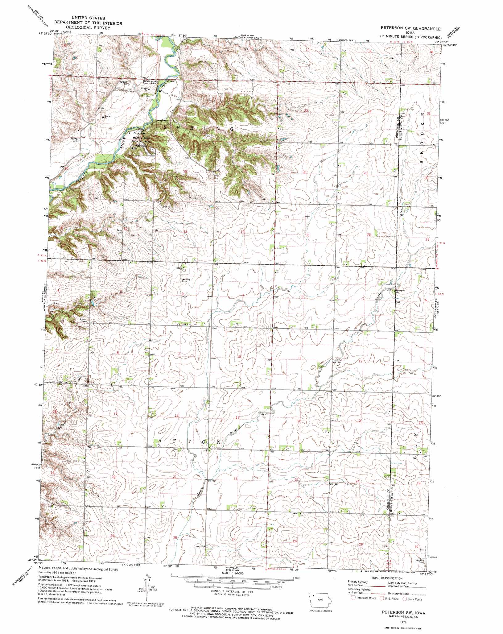
USGS Topo Quad 42095g4 - 1:24,000 scale
| Topo Map Name: | Peterson Sw |
| USGS Topo Quad ID: | 42095g4 |
| Print Size: | ca. 21 1/4" wide x 27" high |
| Southeast Coordinates: | 42.75° N latitude / 95.375° W longitude |
| Map Center Coordinates: | 42.8125° N latitude / 95.4375° W longitude |
| U.S. State: | IA |
| Filename: | o42095g4.jpg |
| Download Map JPG Image: | Peterson Sw topo map 1:24,000 scale |
| Map Type: | Topographic |
| Topo Series: | 7.5´ |
| Map Scale: | 1:24,000 |
| Source of Map Images: | United States Geological Survey (USGS) |
| Alternate Map Versions: |
Peterson SW IA 1971, updated 1973 Download PDF Buy paper map Peterson SW IA 2010 Download PDF Buy paper map Peterson SW IA 2013 Download PDF Buy paper map Peterson SW IA 2015 Download PDF Buy paper map |
1:24,000 Topo Quads surrounding Peterson Sw
Primghar |
Gaza |
Hartley Sw |
Royal |
Creenville |
Paullina |
Sutherland West |
Sutherland East |
Peterson |
Sioux Rapids |
Cleghorn |
Cherokee North |
Peterson Sw |
Peterson Se |
Rembrandt |
Quimby |
Cherokee South |
Aurelia |
Alta |
Storm Lake |
Washta |
Quimby Se |
Galva |
Schaller North |
Lakeside |
> Back to 42095e1 at 1:100,000 scale
> Back to 42094a1 at 1:250,000 scale
> Back to U.S. Topo Maps home
Peterson Sw topo map: Gazetteer
Peterson Sw: Parks
Martin Area County Park elevation 393m 1289′Nelson Area County Park elevation 365m 1197′
Peterson Sw digital topo map on disk
Buy this Peterson Sw topo map showing relief, roads, GPS coordinates and other geographical features, as a high-resolution digital map file on DVD: