Emerson Se Topo Map Nebraska
To zoom in, hover over the map of Emerson Se
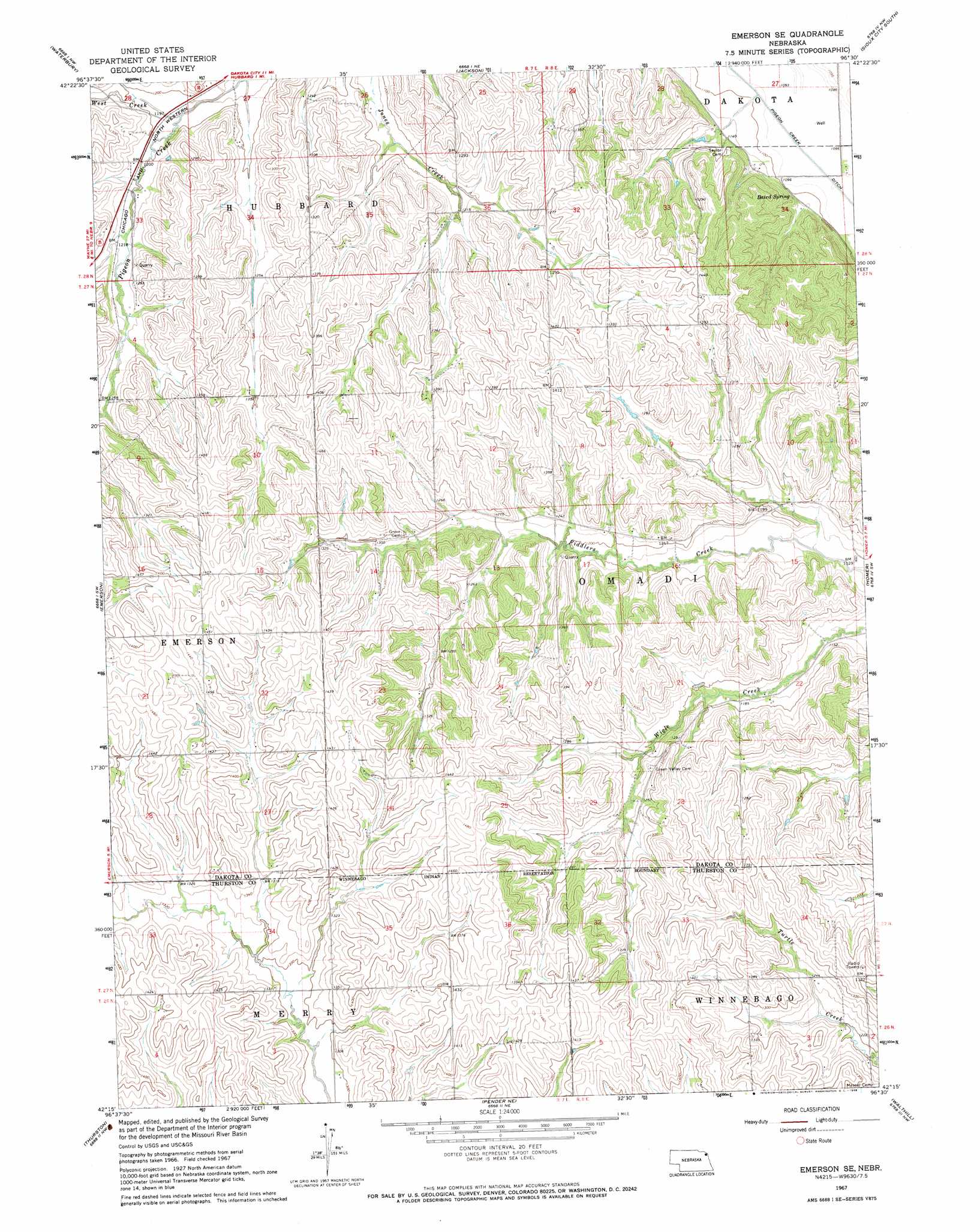
USGS Topo Quad 42096c5 - 1:24,000 scale
| Topo Map Name: | Emerson Se |
| USGS Topo Quad ID: | 42096c5 |
| Print Size: | ca. 21 1/4" wide x 27" high |
| Southeast Coordinates: | 42.25° N latitude / 96.5° W longitude |
| Map Center Coordinates: | 42.3125° N latitude / 96.5625° W longitude |
| U.S. State: | NE |
| Filename: | O42096C5.jpg |
| Download Map JPG Image: | Emerson Se topo map 1:24,000 scale |
| Map Type: | Topographic |
| Topo Series: | 7.5´ |
| Map Scale: | 1:24,000 |
| Source of Map Images: | United States Geological Survey (USGS) |
| Alternate Map Versions: |
Emerson SE NE 1967, updated 1969 Download PDF Buy paper map Emerson SE NE 2011 Download PDF Buy paper map Emerson SE NE 2014 Download PDF Buy paper map |
1:24,000 Topo Quads surrounding Emerson Se
Martinsburg |
Ponca |
Jefferson |
Sioux City North |
James |
Allen |
Waterbury |
Jackson |
Sioux City South |
Sergeant Bluff |
Wakefield |
Emerson |
Emerson Se |
Homer |
Salix |
Altona Ne |
Thurston |
Pender Ne |
Walthill |
Albaton |
Altona Se |
Pender |
Bancroft |
Walthill Sw |
Macy |
> Back to 42096a1 at 1:100,000 scale
> Back to 42096a1 at 1:250,000 scale
> Back to U.S. Topo Maps home
Emerson Se topo map: Gazetteer
Emerson Se: Dams
Hirch Dam elevation 350m 1148′Emerson Se: Parks
Basswood Ridge State Wildlife Management Area elevation 381m 1250′Emerson Se: Reservoirs
Hirch Reservoir elevation 350m 1148′Emerson Se: Springs
Baird Spring elevation 346m 1135′Emerson Se: Streams
West Creek elevation 359m 1177′Emerson Se digital topo map on disk
Buy this Emerson Se topo map showing relief, roads, GPS coordinates and other geographical features, as a high-resolution digital map file on DVD: