Union Center Se Topo Map Iowa
To zoom in, hover over the map of Union Center Se
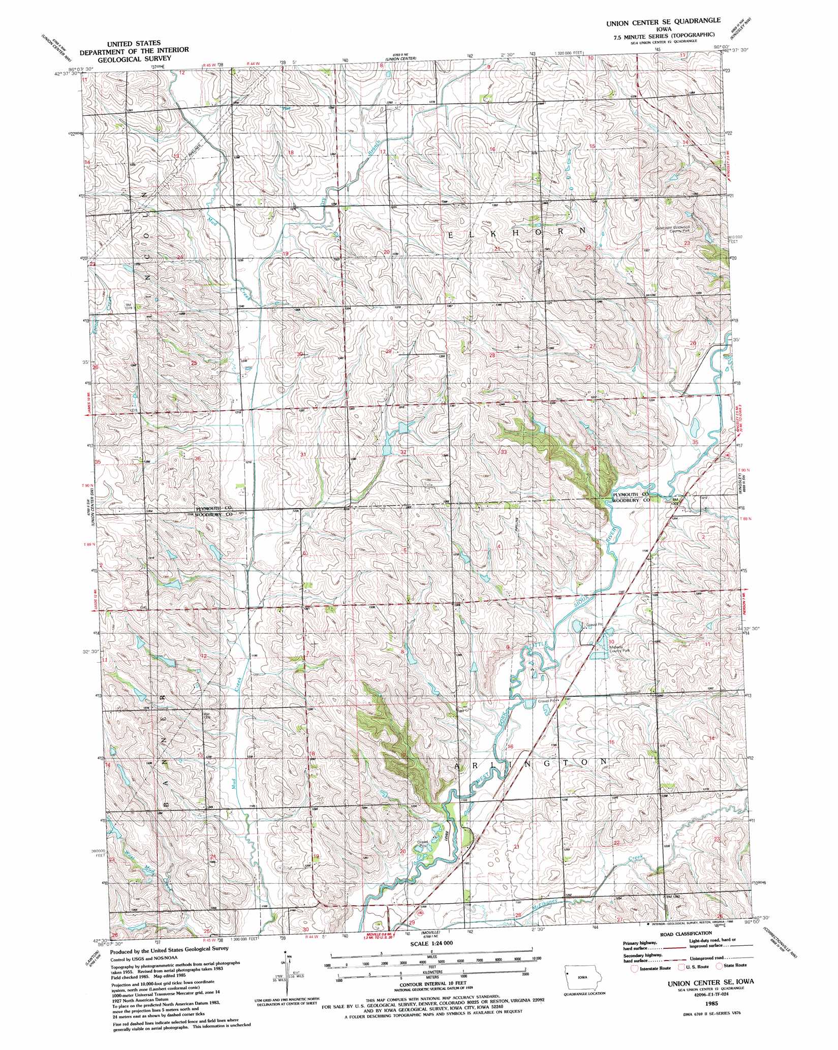
USGS Topo Quad 42096e1 - 1:24,000 scale
| Topo Map Name: | Union Center Se |
| USGS Topo Quad ID: | 42096e1 |
| Print Size: | ca. 21 1/4" wide x 27" high |
| Southeast Coordinates: | 42.5° N latitude / 96° W longitude |
| Map Center Coordinates: | 42.5625° N latitude / 96.0625° W longitude |
| U.S. State: | IA |
| Filename: | o42096e1.jpg |
| Download Map JPG Image: | Union Center Se topo map 1:24,000 scale |
| Map Type: | Topographic |
| Topo Series: | 7.5´ |
| Map Scale: | 1:24,000 |
| Source of Map Images: | United States Geological Survey (USGS) |
| Alternate Map Versions: |
Union Center SE IA 1985, updated 1986 Download PDF Buy paper map Union Center SE IA 2010 Download PDF Buy paper map Union Center SE IA 2013 Download PDF Buy paper map Union Center SE IA 2015 Download PDF Buy paper map |
1:24,000 Topo Quads surrounding Union Center Se
Brunsville |
Le Mars |
Oyens |
Remsen |
Marcus |
Hinton |
Union Center Nw |
Union Center |
Kingsley Nw |
Fielding |
James |
Union Center Sw |
Union Center Se |
Kingsley |
Pierson |
Sergeant Bluff |
Lawton |
Moville |
Correctionville Nw |
Correctionville |
Salix |
Luton |
Climbing Hill |
Oto |
Correctionville Se |
> Back to 42096e1 at 1:100,000 scale
> Back to 42096a1 at 1:250,000 scale
> Back to U.S. Topo Maps home
Union Center Se topo map: Gazetteer
Union Center Se: Parks
Midway County Park elevation 359m 1177′Midway Park elevation 361m 1184′
Southeast Wildwood County Park elevation 402m 1318′
Union Center Se: Streams
Dry Branch elevation 372m 1220′Union Center Se digital topo map on disk
Buy this Union Center Se topo map showing relief, roads, GPS coordinates and other geographical features, as a high-resolution digital map file on DVD: