Creighton Topo Map Nebraska
To zoom in, hover over the map of Creighton
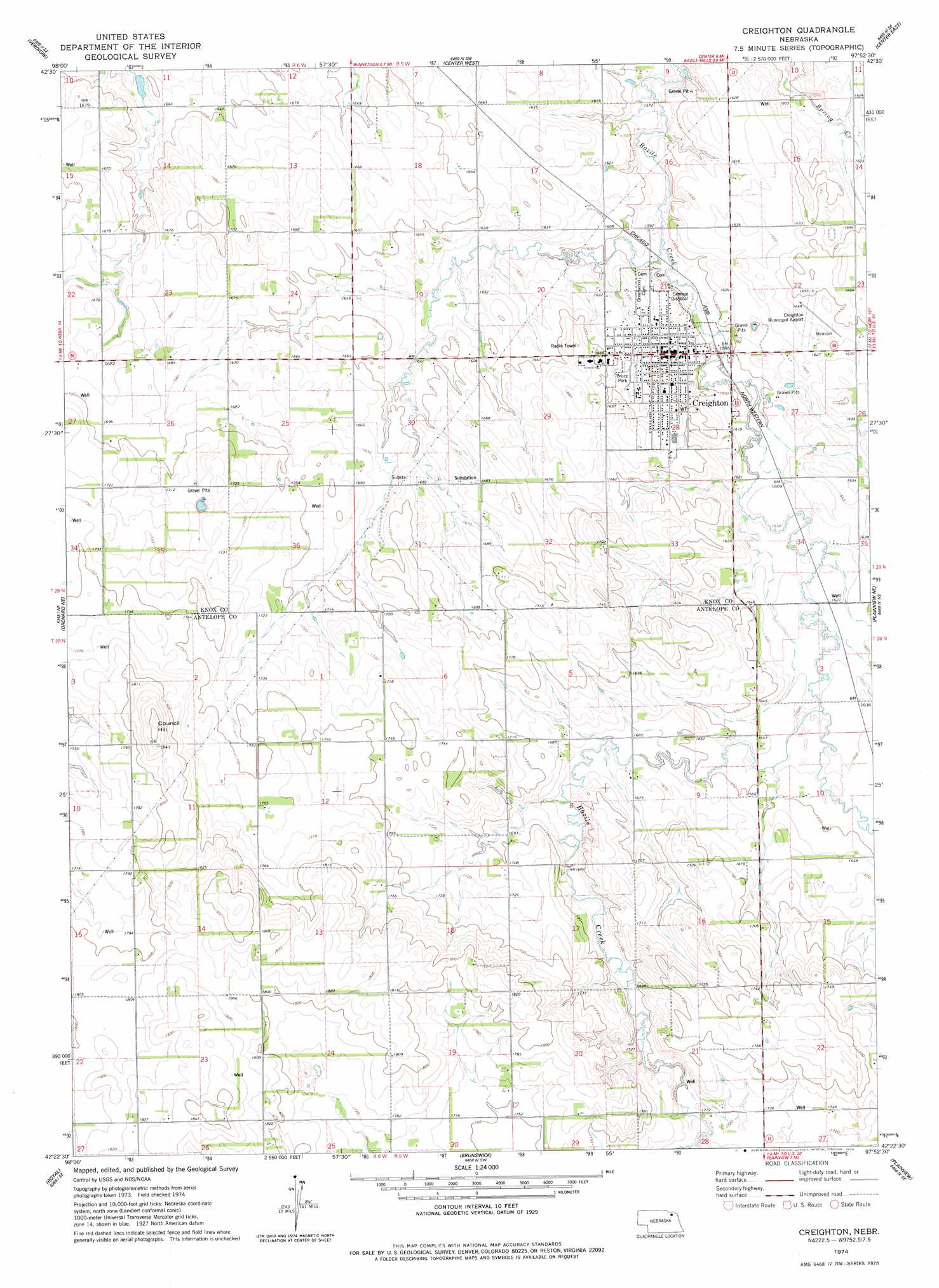
USGS Topo Quad 42097d8 - 1:24,000 scale
| Topo Map Name: | Creighton |
| USGS Topo Quad ID: | 42097d8 |
| Print Size: | ca. 21 1/4" wide x 27" high |
| Southeast Coordinates: | 42.375° N latitude / 97.875° W longitude |
| Map Center Coordinates: | 42.4375° N latitude / 97.9375° W longitude |
| U.S. State: | NE |
| Filename: | O42097D8.jpg |
| Download Map JPG Image: | Creighton topo map 1:24,000 scale |
| Map Type: | Topographic |
| Topo Series: | 7.5´ |
| Map Scale: | 1:24,000 |
| Source of Map Images: | United States Geological Survey (USGS) |
| Alternate Map Versions: |
Creighton NE 1974, updated 1978 Download PDF Buy paper map Creighton NE 2011 Download PDF Buy paper map Creighton NE 2014 Download PDF Buy paper map |
1:24,000 Topo Quads surrounding Creighton
Pishelville |
Verdigre Ne |
Sparta |
Howe Creek |
Lindy |
Walnut |
Verdigre |
Center West |
Center East |
Bloomfield |
Orchard Nw |
Orchard Ne |
Creighton |
Plainview Ne |
Midland |
Orchard |
Royal |
Brunswick |
Plainview |
Foster |
Clearwater |
Neligh |
Tilden Nw |
Tilden Ne |
Pierce Nw |
> Back to 42097a1 at 1:100,000 scale
> Back to 42096a1 at 1:250,000 scale
> Back to U.S. Topo Maps home
Creighton topo map: Gazetteer
Creighton: Airports
Creighton Municipal Airport elevation 501m 1643′Creighton: Parks
Bruce Park elevation 501m 1643′Greg Paesi Memorial Field elevation 501m 1643′
Creighton: Populated Places
Creighton elevation 500m 1640′Creighton: Post Offices
Creighton Post Office elevation 501m 1643′Creighton: Summits
Council Hill elevation 567m 1860′Creighton digital topo map on disk
Buy this Creighton topo map showing relief, roads, GPS coordinates and other geographical features, as a high-resolution digital map file on DVD: