Bloomfield Topo Map Nebraska
To zoom in, hover over the map of Bloomfield
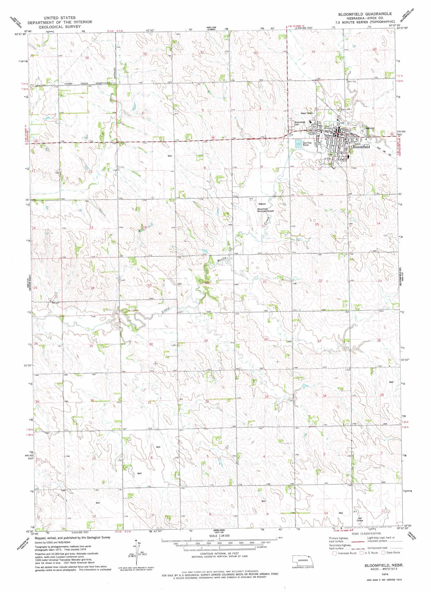
USGS Topo Quad 42097e6 - 1:24,000 scale
| Topo Map Name: | Bloomfield |
| USGS Topo Quad ID: | 42097e6 |
| Print Size: | ca. 21 1/4" wide x 27" high |
| Southeast Coordinates: | 42.5° N latitude / 97.625° W longitude |
| Map Center Coordinates: | 42.5625° N latitude / 97.6875° W longitude |
| U.S. State: | NE |
| Filename: | O42097E6.jpg |
| Download Map JPG Image: | Bloomfield topo map 1:24,000 scale |
| Map Type: | Topographic |
| Topo Series: | 7.5´ |
| Map Scale: | 1:24,000 |
| Source of Map Images: | United States Geological Survey (USGS) |
| Alternate Map Versions: |
Bloomfield NE 1974, updated 1978 Download PDF Buy paper map Bloomfield NE 1977, updated 1979 Download PDF Buy paper map Bloomfield NE 2011 Download PDF Buy paper map Bloomfield NE 2014 Download PDF Buy paper map |
1:24,000 Topo Quads surrounding Bloomfield
Springfield |
Santee |
Bon Homme Colony |
Tabor Se |
Gavins Point Dam |
Sparta |
Howe Creek |
Lindy |
Bloomfield Ne |
Crofton |
Center West |
Center East |
Bloomfield |
Bloomfield Se |
Hartington Sw |
Creighton |
Plainview Ne |
Midland |
Wausa |
Magnet |
Brunswick |
Plainview |
Foster |
Osmond |
Randolph Sw |
> Back to 42097e1 at 1:100,000 scale
> Back to 42096a1 at 1:250,000 scale
> Back to U.S. Topo Maps home
Bloomfield topo map: Gazetteer
Bloomfield: Airports
Bloomfield Municipal Airport elevation 508m 1666′Bloomfield: Parks
Bloomfield City Park elevation 517m 1696′Bloomfield: Populated Places
Bloomfield elevation 518m 1699′Bloomfield Trailer Court elevation 518m 1699′
Bloomfield: Post Offices
Bloomfield Post Office elevation 517m 1696′Bloomfield digital topo map on disk
Buy this Bloomfield topo map showing relief, roads, GPS coordinates and other geographical features, as a high-resolution digital map file on DVD: