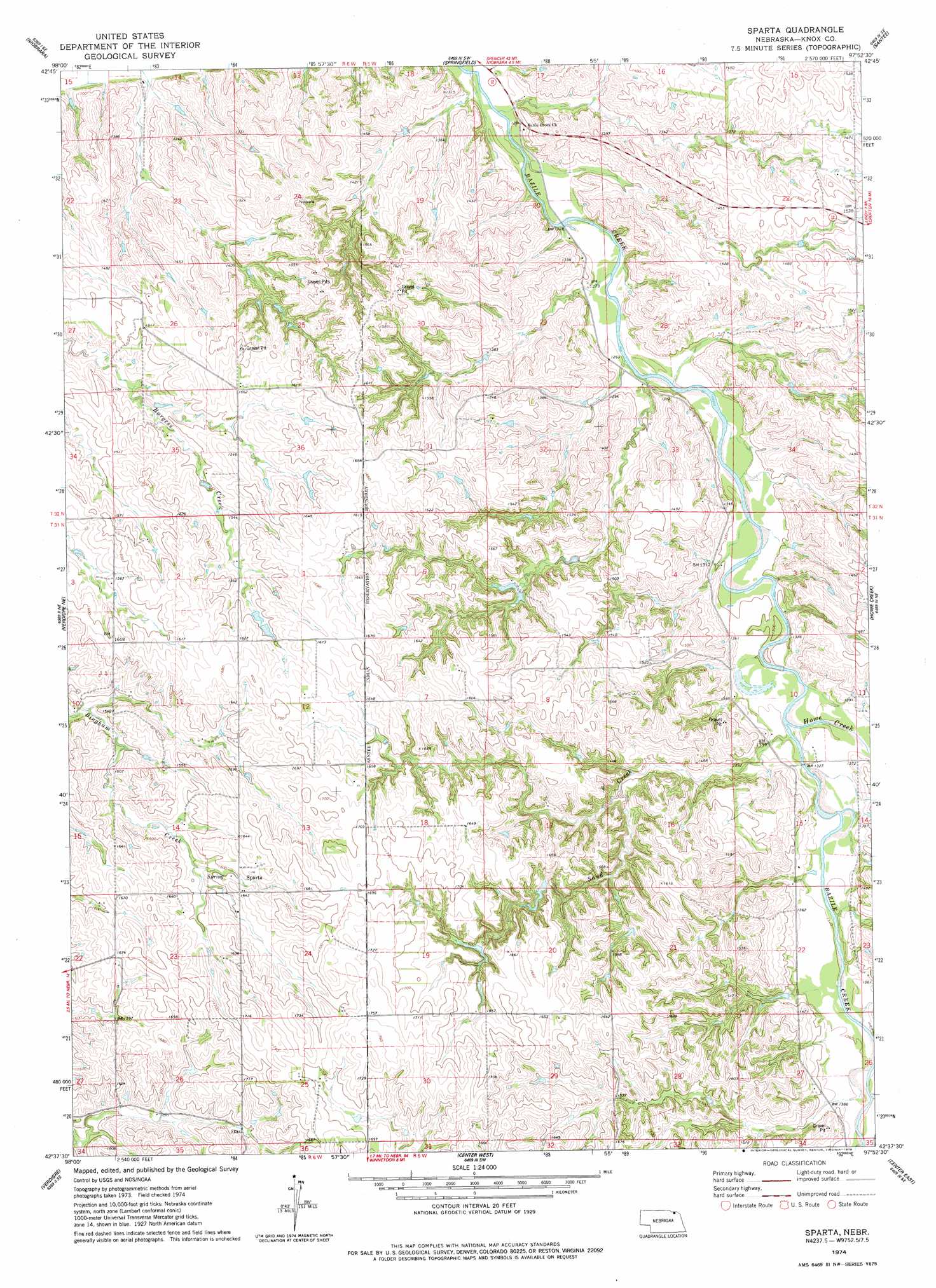
Sparta Topo Map Nebraska
To zoom in, hover over the map of Sparta
USGS Topo Quad 42097f8 - 1:24,000 scale
| Topo Map Name: | Sparta |
| USGS Topo Quad ID: | 42097f8 |
| Print Size: | ca. 21 1/4" wide x 27" high |
| Southeast Coordinates: | 42.625° N latitude / 97.875° W longitude |
| Map Center Coordinates: | 42.6875° N latitude / 97.9375° W longitude |
| U.S. State: | NE |
| Filename: | O42097F8.jpg |
| Download Map JPG Image: | Sparta topo map 1:24,000 scale |
| Map Type: | Topographic |
| Topo Series: | 7.5´ |
| Map Scale: | 1:24,000 |
| Source of Map Images: | United States Geological Survey (USGS) |
| Alternate Map Versions: |
Sparta NE 1974, updated 1978 Download PDF Buy paper map Sparta NE 2011 Download PDF Buy paper map Sparta NE 2014 Download PDF Buy paper map |
1:24,000 Topo Quads surrounding Sparta
Niobrara Nw |
Niobrara Ne |
Kingsburg |
Tyndall |
Tabor |
Verdel |
Niobrara |
Springfield |
Santee |
Bon Homme Colony |
Pishelville |
Verdigre Ne |
Sparta |
Howe Creek |
Lindy |
Walnut |
Verdigre |
Center West |
Center East |
Bloomfield |
Orchard Nw |
Orchard Ne |
Creighton |
Plainview Ne |
Midland |
> Back to 42097e1 at 1:100,000 scale
> Back to 42096a1 at 1:250,000 scale
> Back to U.S. Topo Maps home
Sparta topo map: Gazetteer
Sparta: Dams
Vakoc Dam elevation 414m 1358′Sparta: Populated Places
Sparta elevation 501m 1643′Sparta: Post Offices
Sparta Post Office (historical) elevation 501m 1643′Sparta: Reservoirs
Vakoc Reservoir elevation 414m 1358′Sparta: Streams
Howe Creek elevation 402m 1318′Sand Creek elevation 401m 1315′
Sparta digital topo map on disk
Buy this Sparta topo map showing relief, roads, GPS coordinates and other geographical features, as a high-resolution digital map file on DVD: