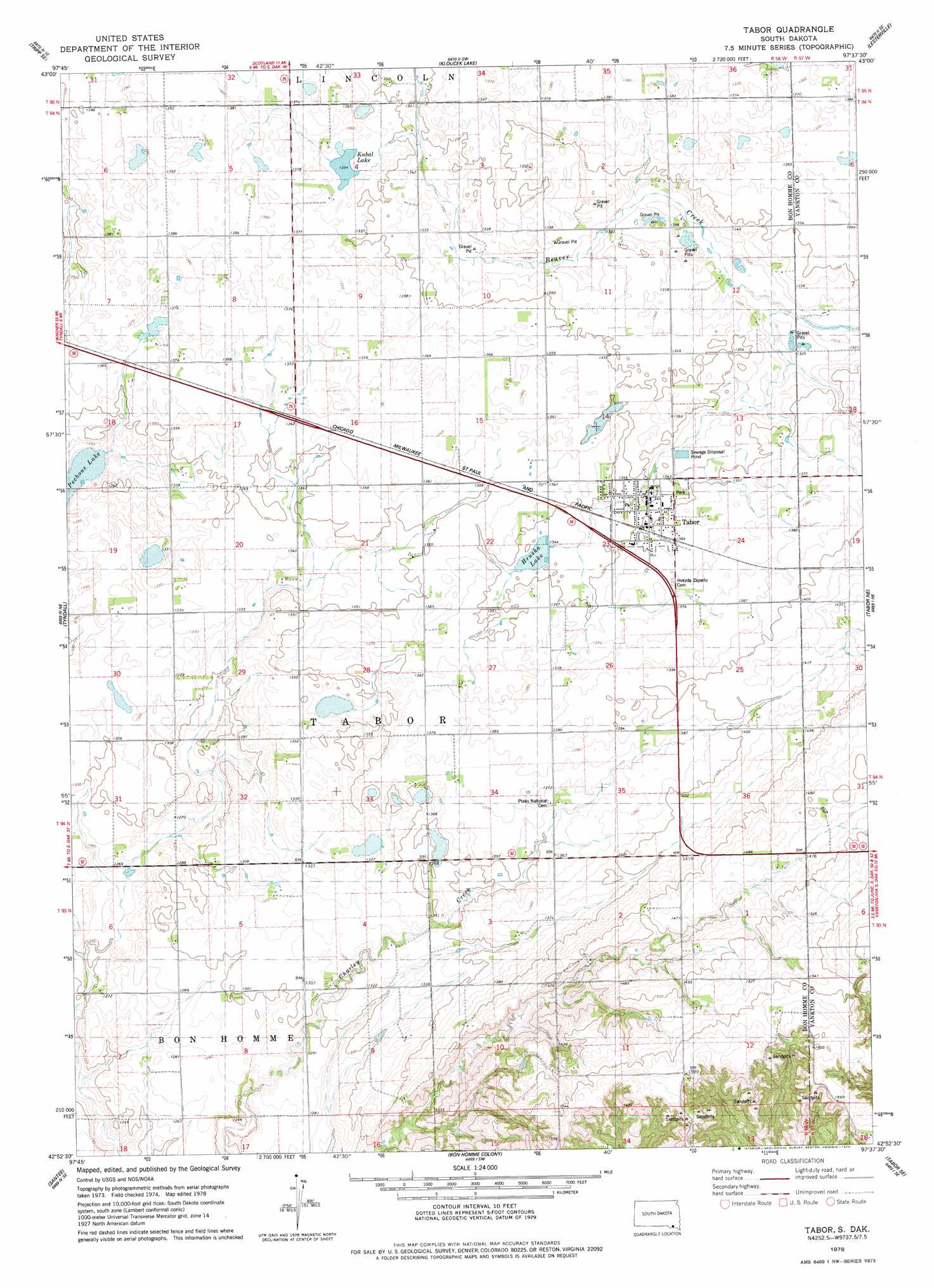
Tabor Topo Map South Dakota
To zoom in, hover over the map of Tabor
USGS Topo Quad 42097h6 - 1:24,000 scale
| Topo Map Name: | Tabor |
| USGS Topo Quad ID: | 42097h6 |
| Print Size: | ca. 21 1/4" wide x 27" high |
| Southeast Coordinates: | 42.875° N latitude / 97.625° W longitude |
| Map Center Coordinates: | 42.9375° N latitude / 97.6875° W longitude |
| U.S. State: | SD |
| Filename: | o42097h6.jpg |
| Download Map JPG Image: | Tabor topo map 1:24,000 scale |
| Map Type: | Topographic |
| Topo Series: | 7.5´ |
| Map Scale: | 1:24,000 |
| Source of Map Images: | United States Geological Survey (USGS) |
| Alternate Map Versions: |
Tabor SD 1978, updated 1979 Download PDF Buy paper map Tabor SD 2012 Download PDF Buy paper map Tabor SD 2015 Download PDF Buy paper map |
1:24,000 Topo Quads surrounding Tabor
Tripp |
Kaylor |
Scotland |
Menno |
Midway |
Haucks Lake |
Tripp Se |
Kloucek Lake |
Lesterville |
Jamesville |
Kingsburg |
Tyndall |
Tabor |
Tabor Ne |
Yankton |
Springfield |
Santee |
Bon Homme Colony |
Tabor Se |
Gavins Point Dam |
Sparta |
Howe Creek |
Lindy |
Bloomfield Ne |
Crofton |
> Back to 42097e1 at 1:100,000 scale
> Back to 42096a1 at 1:250,000 scale
> Back to U.S. Topo Maps home
Tabor topo map: Gazetteer
Tabor: Lakes
Hruska Lake elevation 411m 1348′Kubal Lake elevation 413m 1354′
Pechous Lake elevation 403m 1322′
Tabor: Populated Places
Tabor elevation 411m 1348′Tabor digital topo map on disk
Buy this Tabor topo map showing relief, roads, GPS coordinates and other geographical features, as a high-resolution digital map file on DVD: