Goose Lake Ne Topo Map Nebraska
To zoom in, hover over the map of Goose Lake Ne
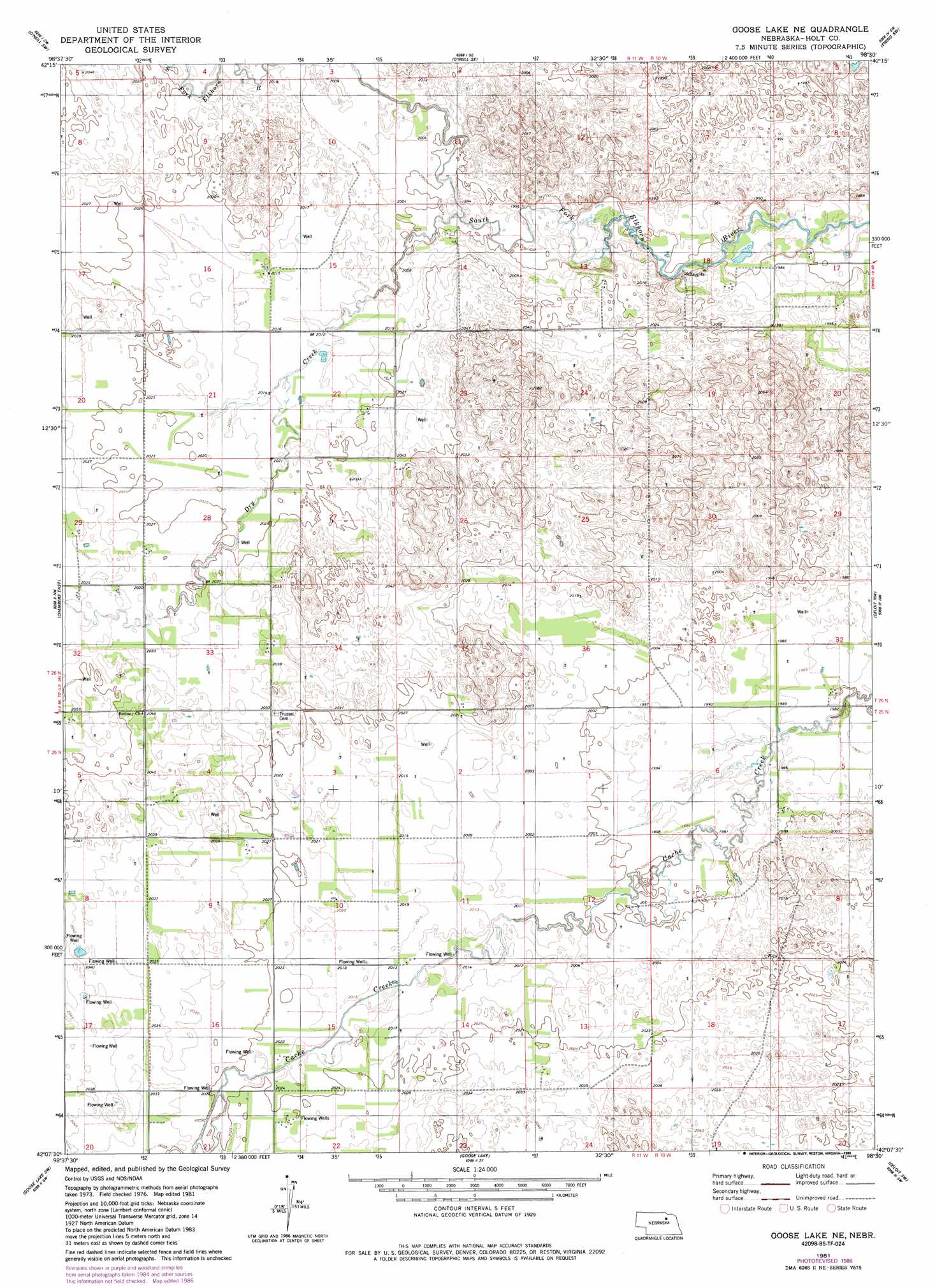
USGS Topo Quad 42098b5 - 1:24,000 scale
| Topo Map Name: | Goose Lake Ne |
| USGS Topo Quad ID: | 42098b5 |
| Print Size: | ca. 21 1/4" wide x 27" high |
| Southeast Coordinates: | 42.125° N latitude / 98.5° W longitude |
| Map Center Coordinates: | 42.1875° N latitude / 98.5625° W longitude |
| U.S. State: | NE |
| Filename: | O42098B5.jpg |
| Download Map JPG Image: | Goose Lake Ne topo map 1:24,000 scale |
| Map Type: | Topographic |
| Topo Series: | 7.5´ |
| Map Scale: | 1:24,000 |
| Source of Map Images: | United States Geological Survey (USGS) |
| Alternate Map Versions: |
Goose Lake NE NE 1981, updated 1981 Download PDF Buy paper map Goose Lake NE NE 1981, updated 1982 Download PDF Buy paper map Goose Lake NE NE 1981, updated 1986 Download PDF Buy paper map Goose Lake NE NE 2011 Download PDF Buy paper map Goose Lake NE NE 2014 Download PDF Buy paper map |
1:24,000 Topo Quads surrounding Goose Lake Ne
Emmet |
O'Neill |
Inman |
Page |
Venus |
Emmet Se |
O'Neill Sw |
O'Neill Se |
Ewing Sw |
Ewing |
Chambers West |
Chambers East |
Goose Lake Ne |
Deloit Nw |
Deloit Ne |
Miles Ranch |
Goose Lake Sw |
Goose Lake |
Deloit Sw |
Deloit |
Gables |
Bartlett Nw |
Bartlett |
Spalding 2 Nw |
Spalding 2 Ne |
> Back to 42098a1 at 1:100,000 scale
> Back to 42098a1 at 1:250,000 scale
> Back to U.S. Topo Maps home
Goose Lake Ne topo map: Gazetteer
Goose Lake Ne: Airports
Vandersnick Airport elevation 617m 2024′Goose Lake Ne: Streams
Dry Creek elevation 606m 1988′Goose Lake Ne digital topo map on disk
Buy this Goose Lake Ne topo map showing relief, roads, GPS coordinates and other geographical features, as a high-resolution digital map file on DVD: