Chambers East Topo Map Nebraska
To zoom in, hover over the map of Chambers East
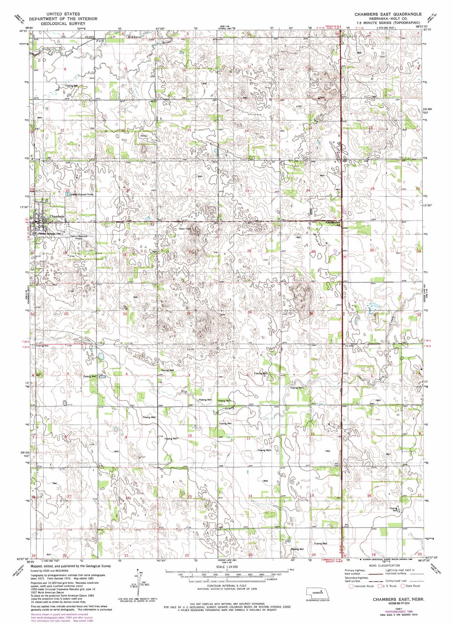
USGS Topo Quad 42098b6 - 1:24,000 scale
| Topo Map Name: | Chambers East |
| USGS Topo Quad ID: | 42098b6 |
| Print Size: | ca. 21 1/4" wide x 27" high |
| Southeast Coordinates: | 42.125° N latitude / 98.625° W longitude |
| Map Center Coordinates: | 42.1875° N latitude / 98.6875° W longitude |
| U.S. State: | NE |
| Filename: | O42098B6.jpg |
| Download Map JPG Image: | Chambers East topo map 1:24,000 scale |
| Map Type: | Topographic |
| Topo Series: | 7.5´ |
| Map Scale: | 1:24,000 |
| Source of Map Images: | United States Geological Survey (USGS) |
| Alternate Map Versions: |
Chambers East NE 1981, updated 1981 Download PDF Buy paper map Chambers East NE 1981, updated 1986 Download PDF Buy paper map Chambers East NE 2011 Download PDF Buy paper map Chambers East NE 2014 Download PDF Buy paper map |
1:24,000 Topo Quads surrounding Chambers East
Emmet Nw |
Emmet |
O'Neill |
Inman |
Page |
Emmet Sw |
Emmet Se |
O'Neill Sw |
O'Neill Se |
Ewing Sw |
Amelia |
Chambers West |
Chambers East |
Goose Lake Ne |
Deloit Nw |
Chain Lake |
Miles Ranch |
Goose Lake Sw |
Goose Lake |
Deloit Sw |
Gables Nw |
Gables |
Bartlett Nw |
Bartlett |
Spalding 2 Nw |
> Back to 42098a1 at 1:100,000 scale
> Back to 42098a1 at 1:250,000 scale
> Back to U.S. Topo Maps home
Chambers East topo map: Gazetteer
Chambers East: Airports
Perkins Memorial Airpark elevation 646m 2119′Chambers East: Parks
Perkins Memorial Park elevation 646m 2119′Chambers East: Populated Places
Chambers elevation 646m 2119′Chambers East: Post Offices
Chambers Post Office elevation 646m 2119′Chambers East digital topo map on disk
Buy this Chambers East topo map showing relief, roads, GPS coordinates and other geographical features, as a high-resolution digital map file on DVD: