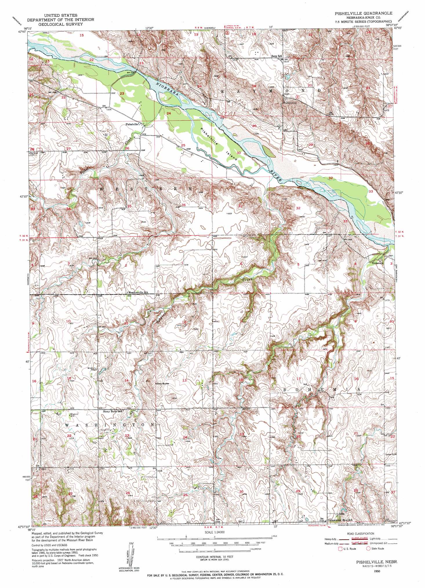
Pishelville Topo Map Nebraska
To zoom in, hover over the map of Pishelville
USGS Topo Quad 42098f2 - 1:24,000 scale
| Topo Map Name: | Pishelville |
| USGS Topo Quad ID: | 42098f2 |
| Print Size: | ca. 21 1/4" wide x 27" high |
| Southeast Coordinates: | 42.625° N latitude / 98.125° W longitude |
| Map Center Coordinates: | 42.6875° N latitude / 98.1875° W longitude |
| U.S. State: | NE |
| Filename: | O42098F2.jpg |
| Download Map JPG Image: | Pishelville topo map 1:24,000 scale |
| Map Type: | Topographic |
| Topo Series: | 7.5´ |
| Map Scale: | 1:24,000 |
| Source of Map Images: | United States Geological Survey (USGS) |
| Alternate Map Versions: |
Pishelville NE 1950, updated 1952 Download PDF Buy paper map Pishelville NE 2011 Download PDF Buy paper map Pishelville NE 2014 Download PDF Buy paper map |
1:24,000 Topo Quads surrounding Pishelville
Marty |
Lynch Ne |
Niobrara Nw |
Niobrara Ne |
Kingsburg |
Lynch |
Monowi |
Verdel |
Niobrara |
Springfield |
Dorsey Nw |
Dorsey |
Pishelville |
Verdigre Ne |
Sparta |
Dorsey Sw |
Star |
Walnut |
Verdigre |
Center West |
Page |
Venus |
Orchard Nw |
Orchard Ne |
Creighton |
> Back to 42098e1 at 1:100,000 scale
> Back to 42098a1 at 1:250,000 scale
> Back to U.S. Topo Maps home
Pishelville topo map: Gazetteer
Pishelville: Dams
Bartos Dam Number 2 elevation 496m 1627′Farnik Dam elevation 472m 1548′
Haineraich Dam elevation 445m 1459′
Vonasek Dam elevation 468m 1535′
Pishelville: Islands
Pishelville Island elevation 397m 1302′Pishelville: Parks
Bohemia Prairie State Wildlife Management Area elevation 457m 1499′Pishelville: Populated Places
Dukeville elevation 399m 1309′Jelen elevation 485m 1591′
Pishelville elevation 403m 1322′
Pishelville: Post Offices
Dukeville Post Office (historical) elevation 399m 1309′Jelen Post Office (historical) elevation 485m 1591′
Pishelville Post Office (historical) elevation 403m 1322′
Pishelville: Reservoirs
Bartos Reservoir Number 2 elevation 496m 1627′Farnik Reservoir elevation 472m 1548′
Haineraich Reservoir elevation 445m 1459′
Vonasek Reservoir elevation 468m 1535′
Pishelville: Streams
Pishel Creek elevation 400m 1312′Soldier Creek elevation 394m 1292′
Pishelville: Summits
Stony Butte elevation 515m 1689′Pishelville digital topo map on disk
Buy this Pishelville topo map showing relief, roads, GPS coordinates and other geographical features, as a high-resolution digital map file on DVD: