Dorsey Topo Map Nebraska
To zoom in, hover over the map of Dorsey
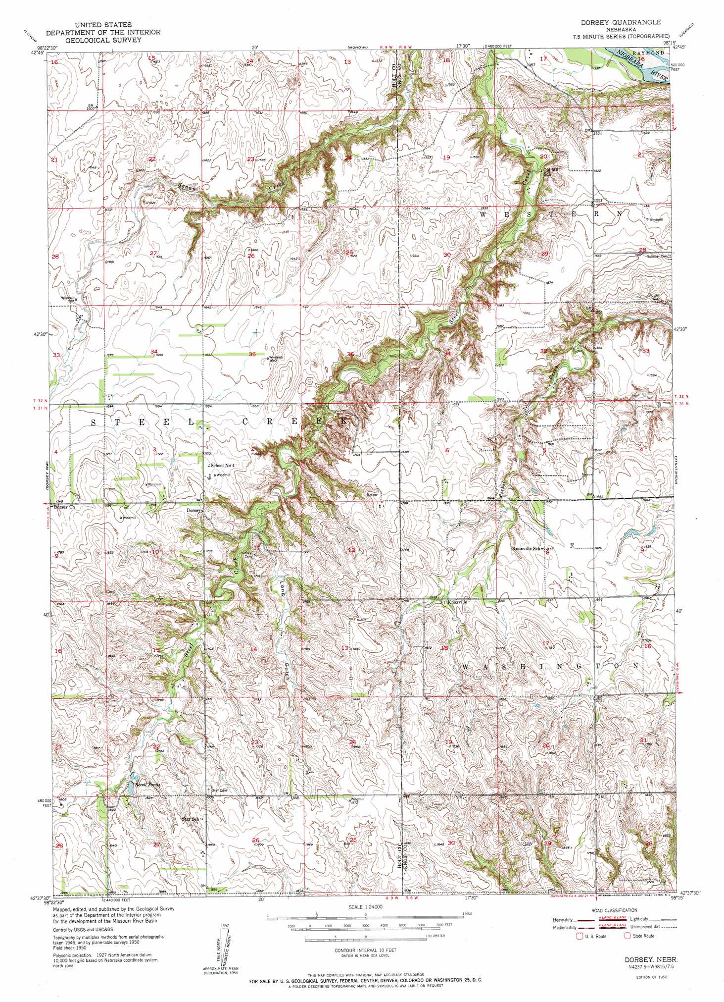
USGS Topo Quad 42098f3 - 1:24,000 scale
| Topo Map Name: | Dorsey |
| USGS Topo Quad ID: | 42098f3 |
| Print Size: | ca. 21 1/4" wide x 27" high |
| Southeast Coordinates: | 42.625° N latitude / 98.25° W longitude |
| Map Center Coordinates: | 42.6875° N latitude / 98.3125° W longitude |
| U.S. State: | NE |
| Filename: | O42098F3.jpg |
| Download Map JPG Image: | Dorsey topo map 1:24,000 scale |
| Map Type: | Topographic |
| Topo Series: | 7.5´ |
| Map Scale: | 1:24,000 |
| Source of Map Images: | United States Geological Survey (USGS) |
| Alternate Map Versions: |
Dorsey NE 1952 Download PDF Buy paper map Dorsey NE 2011 Download PDF Buy paper map Dorsey NE 2014 Download PDF Buy paper map |
1:24,000 Topo Quads surrounding Dorsey
Gross |
Marty |
Lynch Ne |
Niobrara Nw |
Niobrara Ne |
Bristow |
Lynch |
Monowi |
Verdel |
Niobrara |
Meek Ne |
Dorsey Nw |
Dorsey |
Pishelville |
Verdigre Ne |
Opportunity |
Dorsey Sw |
Star |
Walnut |
Verdigre |
Inman |
Page |
Venus |
Orchard Nw |
Orchard Ne |
> Back to 42098e1 at 1:100,000 scale
> Back to 42098a1 at 1:250,000 scale
> Back to U.S. Topo Maps home
Dorsey topo map: Gazetteer
Dorsey: Dams
Bartos Dam elevation 502m 1646′Bartos Dam Number 2 elevation 505m 1656′
Revell Dam elevation 543m 1781′
Dorsey: Populated Places
Dorsey elevation 536m 1758′Knoxville elevation 515m 1689′
Dorsey: Post Offices
Dorsey Post Office (historical) elevation 536m 1758′Knoxville Post Office (historical) elevation 515m 1689′
Dorsey: Reservoirs
Bartos Reservoir elevation 502m 1646′Bartos Reservoir Number 2 elevation 505m 1656′
Revell Ponds elevation 537m 1761′
Revell Reservoir elevation 543m 1781′
Dorsey: Valleys
Long Gulch elevation 493m 1617′Dorsey digital topo map on disk
Buy this Dorsey topo map showing relief, roads, GPS coordinates and other geographical features, as a high-resolution digital map file on DVD: