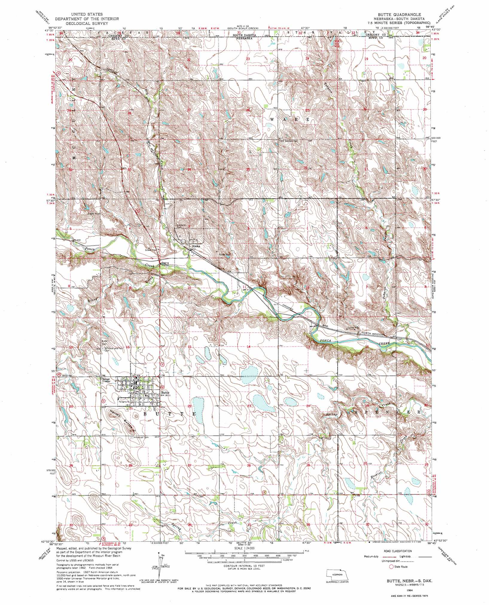
Butte Topo Map Nebraska
To zoom in, hover over the map of Butte
USGS Topo Quad 42098h7 - 1:24,000 scale
| Topo Map Name: | Butte |
| USGS Topo Quad ID: | 42098h7 |
| Print Size: | ca. 21 1/4" wide x 27" high |
| Southeast Coordinates: | 42.875° N latitude / 98.75° W longitude |
| Map Center Coordinates: | 42.9375° N latitude / 98.8125° W longitude |
| U.S. States: | NE, SD |
| Filename: | O42098H7.jpg |
| Download Map JPG Image: | Butte topo map 1:24,000 scale |
| Map Type: | Topographic |
| Topo Series: | 7.5´ |
| Map Scale: | 1:24,000 |
| Source of Map Images: | United States Geological Survey (USGS) |
| Alternate Map Versions: |
Butte NE 1964, updated 1965 Download PDF Buy paper map Butte NE 2011 Download PDF Buy paper map Butte NE 2014 Download PDF Buy paper map |
1:24,000 Topo Quads surrounding Butte
Herrick Ne |
Whetstone Bay |
Campbell Creek |
Lake Andes Nw |
Lake Andes |
Saint Charles |
Bonesteel |
South Scalp Creek |
Lake Andes Sw |
Fort Randall Dam |
Naper |
Butte Nw |
Butte |
Spencer North |
Gross |
Dustin |
Butte Sw |
Butte Se |
Spencer South |
Bristow |
Stuart Ne |
Atkinson Nw |
Atkinson Ne |
Meek |
Meek Ne |
> Back to 42098e1 at 1:100,000 scale
> Back to 42098a1 at 1:250,000 scale
> Back to U.S. Topo Maps home
Butte topo map: Gazetteer
Butte: Dams
Lampman Dam Number 1 elevation 518m 1699′Lechtenberg-Lampman Dam elevation 512m 1679′
Reiman Dam elevation 510m 1673′
Reiser Dam elevation 499m 1637′
Butte: Parks
Butte City Park elevation 552m 1811′Butte: Populated Places
Anoka elevation 502m 1646′Butte elevation 552m 1811′
Butte: Post Offices
Anoka Post Office (historical) elevation 502m 1646′Butte Post Office elevation 552m 1811′
Butte: Reservoirs
Lampman Reservoir Number 1 elevation 518m 1699′Lechtenberg-Lampman Reservoir elevation 512m 1679′
Reiman Reservoir elevation 510m 1673′
Reiser Reservoir elevation 499m 1637′
Butte: Streams
Dizzy Creek elevation 489m 1604′Dry Creek elevation 493m 1617′
Dry Creek elevation 492m 1614′
Tobacco Creek elevation 480m 1574′
Tobacco Creek elevation 480m 1574′
Butte: Summits
Harvey Buttes elevation 578m 1896′Butte digital topo map on disk
Buy this Butte topo map showing relief, roads, GPS coordinates and other geographical features, as a high-resolution digital map file on DVD: