Lambs Lake Topo Map Nebraska
To zoom in, hover over the map of Lambs Lake
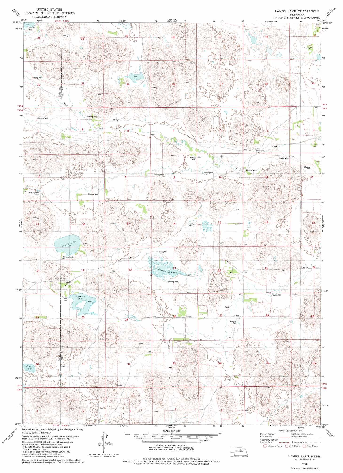
USGS Topo Quad 42099c2 - 1:24,000 scale
| Topo Map Name: | Lambs Lake |
| USGS Topo Quad ID: | 42099c2 |
| Print Size: | ca. 21 1/4" wide x 27" high |
| Southeast Coordinates: | 42.25° N latitude / 99.125° W longitude |
| Map Center Coordinates: | 42.3125° N latitude / 99.1875° W longitude |
| U.S. State: | NE |
| Filename: | O42099C2.jpg |
| Download Map JPG Image: | Lambs Lake topo map 1:24,000 scale |
| Map Type: | Topographic |
| Topo Series: | 7.5´ |
| Map Scale: | 1:24,000 |
| Source of Map Images: | United States Geological Survey (USGS) |
| Alternate Map Versions: |
Lambs Lake NE 1982, updated 1982 Download PDF Buy paper map Lambs Lake NE 2011 Download PDF Buy paper map Lambs Lake NE 2014 Download PDF Buy paper map |
1:24,000 Topo Quads surrounding Lambs Lake
Newport Sw |
Newport |
Stuart |
Stuart Se |
Atkinson |
Linke Lake |
Pony Lake |
Dora Lake |
Lambs Lake Ne |
Emmet Nw |
Stockdale Lake |
Sybrant |
Lambs Lake |
Cottonwood Lake |
Emmet Sw |
Stonehouse Ranch Nw |
Stonehouse Ranch Ne |
Bruner Lake |
Swan Lake |
Amelia |
Stonehouse Ranch Sw |
Stonehouse Ranch |
Carson Lake |
Abbott Ranch |
Chain Lake |
> Back to 42099a1 at 1:100,000 scale
> Back to 42098a1 at 1:250,000 scale
> Back to U.S. Topo Maps home
Lambs Lake topo map: Gazetteer
Lambs Lake: Lakes
Brown Lake elevation 717m 2352′Clear Lake elevation 729m 2391′
Lambs Lake elevation 708m 2322′
Overton Lake elevation 720m 2362′
Lambs Lake digital topo map on disk
Buy this Lambs Lake topo map showing relief, roads, GPS coordinates and other geographical features, as a high-resolution digital map file on DVD: