Stockdale Lake Topo Map Nebraska
To zoom in, hover over the map of Stockdale Lake
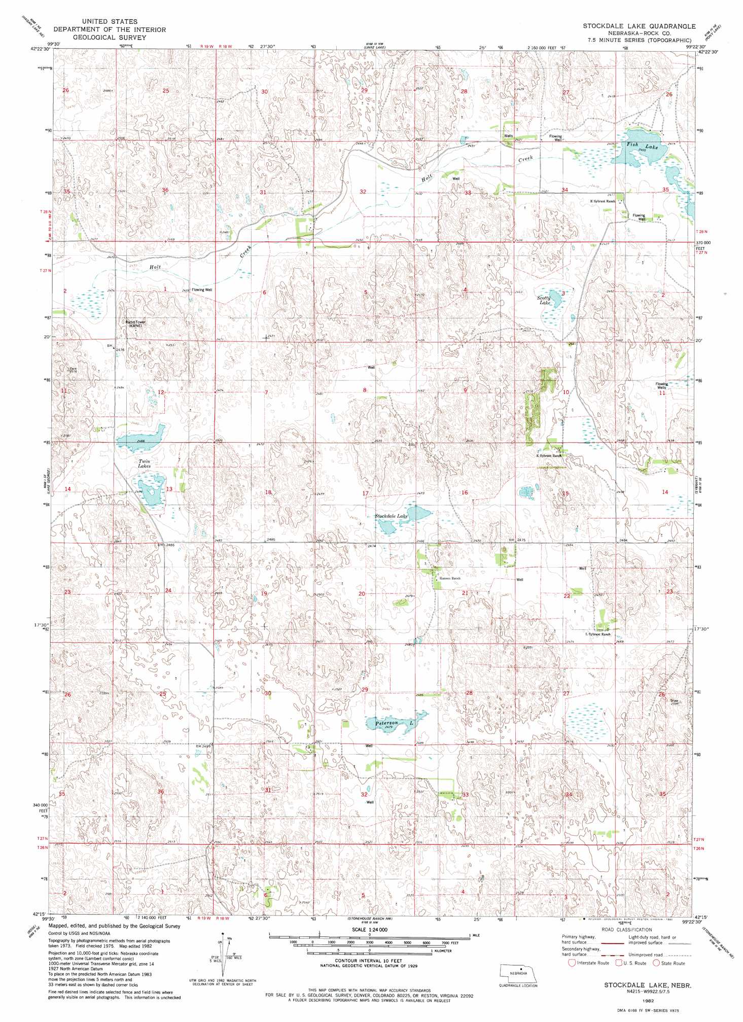
USGS Topo Quad 42099c4 - 1:24,000 scale
| Topo Map Name: | Stockdale Lake |
| USGS Topo Quad ID: | 42099c4 |
| Print Size: | ca. 21 1/4" wide x 27" high |
| Southeast Coordinates: | 42.25° N latitude / 99.375° W longitude |
| Map Center Coordinates: | 42.3125° N latitude / 99.4375° W longitude |
| U.S. State: | NE |
| Filename: | O42099C4.jpg |
| Download Map JPG Image: | Stockdale Lake topo map 1:24,000 scale |
| Map Type: | Topographic |
| Topo Series: | 7.5´ |
| Map Scale: | 1:24,000 |
| Source of Map Images: | United States Geological Survey (USGS) |
| Alternate Map Versions: |
Stockdale Lake NE 1982, updated 1982 Download PDF Buy paper map Stockdale Lake NE 2011 Download PDF Buy paper map Stockdale Lake NE 2014 Download PDF Buy paper map |
1:24,000 Topo Quads surrounding Stockdale Lake
Long Pine |
Bassett |
Newport Sw |
Newport |
Stuart |
Hagan Lake Nw |
Hagan Lake Ne |
Linke Lake |
Pony Lake |
Dora Lake |
Hagan Lake |
Lake George |
Stockdale Lake |
Sybrant |
Lambs Lake |
Paramount Valley |
Rose |
Stonehouse Ranch Nw |
Stonehouse Ranch Ne |
Bruner Lake |
Boiling Spring |
Shovel Dot Ranch |
Stonehouse Ranch Sw |
Stonehouse Ranch |
Carson Lake |
> Back to 42099a1 at 1:100,000 scale
> Back to 42098a1 at 1:250,000 scale
> Back to U.S. Topo Maps home
Stockdale Lake topo map: Gazetteer
Stockdale Lake: Lakes
Fish Lake elevation 733m 2404′Peterson Lake elevation 755m 2477′
Scotty Lake elevation 738m 2421′
Stockdale Lake elevation 753m 2470′
Twin Lakes elevation 751m 2463′
Stockdale Lake digital topo map on disk
Buy this Stockdale Lake topo map showing relief, roads, GPS coordinates and other geographical features, as a high-resolution digital map file on DVD: