Raven Sw Topo Map Nebraska
To zoom in, hover over the map of Raven Sw
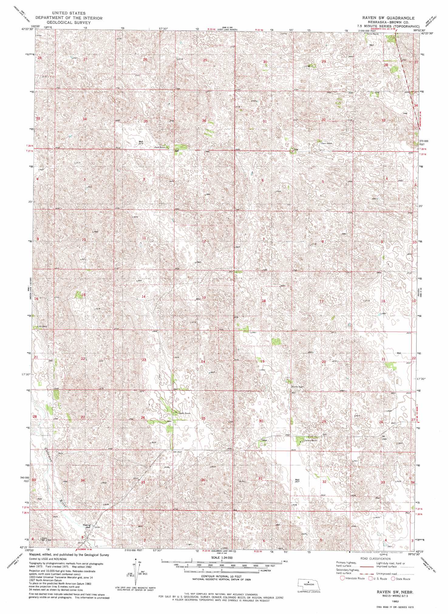
USGS Topo Quad 42099c8 - 1:24,000 scale
| Topo Map Name: | Raven Sw |
| USGS Topo Quad ID: | 42099c8 |
| Print Size: | ca. 21 1/4" wide x 27" high |
| Southeast Coordinates: | 42.25° N latitude / 99.875° W longitude |
| Map Center Coordinates: | 42.3125° N latitude / 99.9375° W longitude |
| U.S. State: | NE |
| Filename: | O42099C8.jpg |
| Download Map JPG Image: | Raven Sw topo map 1:24,000 scale |
| Map Type: | Topographic |
| Topo Series: | 7.5´ |
| Map Scale: | 1:24,000 |
| Source of Map Images: | United States Geological Survey (USGS) |
| Alternate Map Versions: |
Raven SW NE 1982, updated 1982 Download PDF Buy paper map Raven SW NE 2011 Download PDF Buy paper map Raven SW NE 2014 Download PDF Buy paper map |
1:24,000 Topo Quads surrounding Raven Sw
Brush Creek |
Johnstown |
Ainsworth Sw |
Ainsworth |
Long Pine |
Harr Valley |
White Cap Hill |
Lost Lake Ranch |
Hofeld Lake |
Hagan Lake Nw |
Skull Lake |
Philbrick Lake |
Raven Sw |
Raven |
Hagan Lake |
Elsmere |
Koshopah Ne |
Goldman Lake Nw |
Goldman Lake Ne |
Paramount Valley |
Koshopah Sw |
Koshopah |
Goldman Lake |
Goldman Lake Se |
Boiling Spring |
> Back to 42099a1 at 1:100,000 scale
> Back to 42098a1 at 1:250,000 scale
> Back to U.S. Topo Maps home
No gazetteer data is available for the Raven Sw topo map sheet.
Raven Sw digital topo map on disk
Buy this Raven Sw topo map showing relief, roads, GPS coordinates and other geographical features, as a high-resolution digital map file on DVD: