Koshopah Ne Topo Map Nebraska
To zoom in, hover over the map of Koshopah Ne
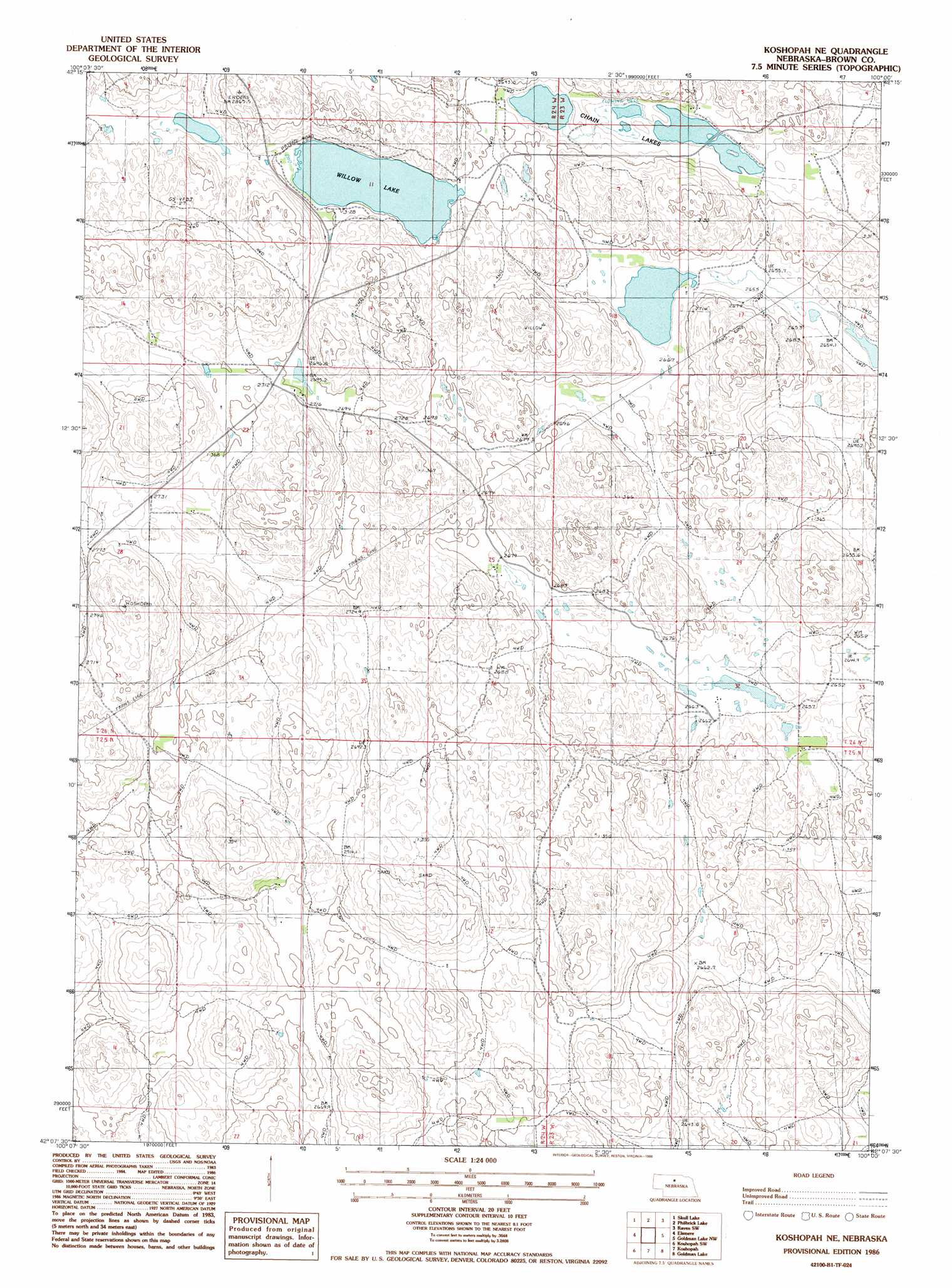
USGS Topo Quad 42100b1 - 1:24,000 scale
| Topo Map Name: | Koshopah Ne |
| USGS Topo Quad ID: | 42100b1 |
| Print Size: | ca. 21 1/4" wide x 27" high |
| Southeast Coordinates: | 42.125° N latitude / 100° W longitude |
| Map Center Coordinates: | 42.1875° N latitude / 100.0625° W longitude |
| U.S. State: | NE |
| Filename: | O42100b1.jpg |
| Download Map JPG Image: | Koshopah Ne topo map 1:24,000 scale |
| Map Type: | Topographic |
| Topo Series: | 7.5´ |
| Map Scale: | 1:24,000 |
| Source of Map Images: | United States Geological Survey (USGS) |
| Alternate Map Versions: |
Koshopah NE NE 1986, updated 1986 Download PDF Buy paper map Koshopah NE NE 2011 Download PDF Buy paper map Koshopah NE NE 2014 Download PDF Buy paper map |
1:24,000 Topo Quads surrounding Koshopah Ne
Wilson Valley |
Harr Valley |
White Cap Hill |
Lost Lake Ranch |
Hofeld Lake |
Long Lake Se |
Skull Lake |
Philbrick Lake |
Raven Sw |
Raven |
Purdum Ne |
Elsmere |
Koshopah Ne |
Goldman Lake Nw |
Goldman Lake Ne |
Purdum |
Koshopah Sw |
Koshopah |
Goldman Lake |
Goldman Lake Se |
Halsey |
Dunning Nw |
Dunning Ne |
Brewster Nw |
Brewster |
> Back to 42100a1 at 1:100,000 scale
> Back to 42100a1 at 1:250,000 scale
> Back to U.S. Topo Maps home
Koshopah Ne topo map: Gazetteer
Koshopah Ne: Lakes
Chain Lakes elevation 811m 2660′Diamond Lake elevation 810m 2657′
Willow Lake elevation 821m 2693′
Koshopah Ne digital topo map on disk
Buy this Koshopah Ne topo map showing relief, roads, GPS coordinates and other geographical features, as a high-resolution digital map file on DVD: