Crookston West Topo Map Nebraska
To zoom in, hover over the map of Crookston West
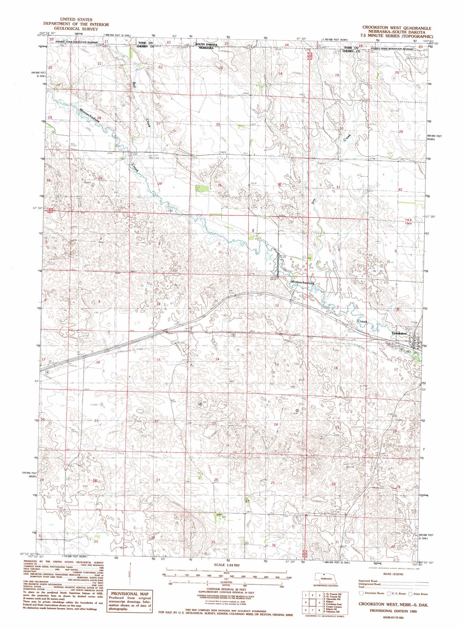
USGS Topo Quad 42100h7 - 1:24,000 scale
| Topo Map Name: | Crookston West |
| USGS Topo Quad ID: | 42100h7 |
| Print Size: | ca. 21 1/4" wide x 27" high |
| Southeast Coordinates: | 42.875° N latitude / 100.75° W longitude |
| Map Center Coordinates: | 42.9375° N latitude / 100.8125° W longitude |
| U.S. States: | NE, SD |
| Filename: | O42100h7.jpg |
| Download Map JPG Image: | Crookston West topo map 1:24,000 scale |
| Map Type: | Topographic |
| Topo Series: | 7.5´ |
| Map Scale: | 1:24,000 |
| Source of Map Images: | United States Geological Survey (USGS) |
| Alternate Map Versions: |
Crookston West NE 1985, updated 1985 Download PDF Buy paper map Crookston West NE 2011 Download PDF Buy paper map Crookston West NE 2014 Download PDF Buy paper map |
1:24,000 Topo Quads surrounding Crookston West
Iron Shell Flat East |
Saint Francis |
Rosebud |
Olsonville Nw |
Olsonville |
Spring Creek |
Saint Francis Sw |
Saint Francis Se |
Olsonville Sw |
Olsonville Se |
Nenzel |
Kilgore |
Crookston West |
Crookston East |
Valentine North |
Cody Se |
Cooper Canyon |
Kilgore Se |
Valentine Sw |
Valentine South |
Powderhorn Valley |
Kennedy Nw |
Snake River Falls |
Hudson Lake |
Ell Lake |
> Back to 42100e1 at 1:100,000 scale
> Back to 42100a1 at 1:250,000 scale
> Back to U.S. Topo Maps home
Crookston West topo map: Gazetteer
Crookston West: Populated Places
Crookston elevation 822m 2696′Crookston West: Post Offices
Crookston Post Office elevation 820m 2690′Crookston West: Streams
Bull Creek elevation 834m 2736′Bull Creek elevation 834m 2736′
Bull Creek elevation 834m 2736′
Dry Creek elevation 817m 2680′
Dry Creek elevation 817m 2680′
Dry Creek elevation 817m 2680′
Crookston West digital topo map on disk
Buy this Crookston West topo map showing relief, roads, GPS coordinates and other geographical features, as a high-resolution digital map file on DVD: