Whitman Topo Map Nebraska
To zoom in, hover over the map of Whitman
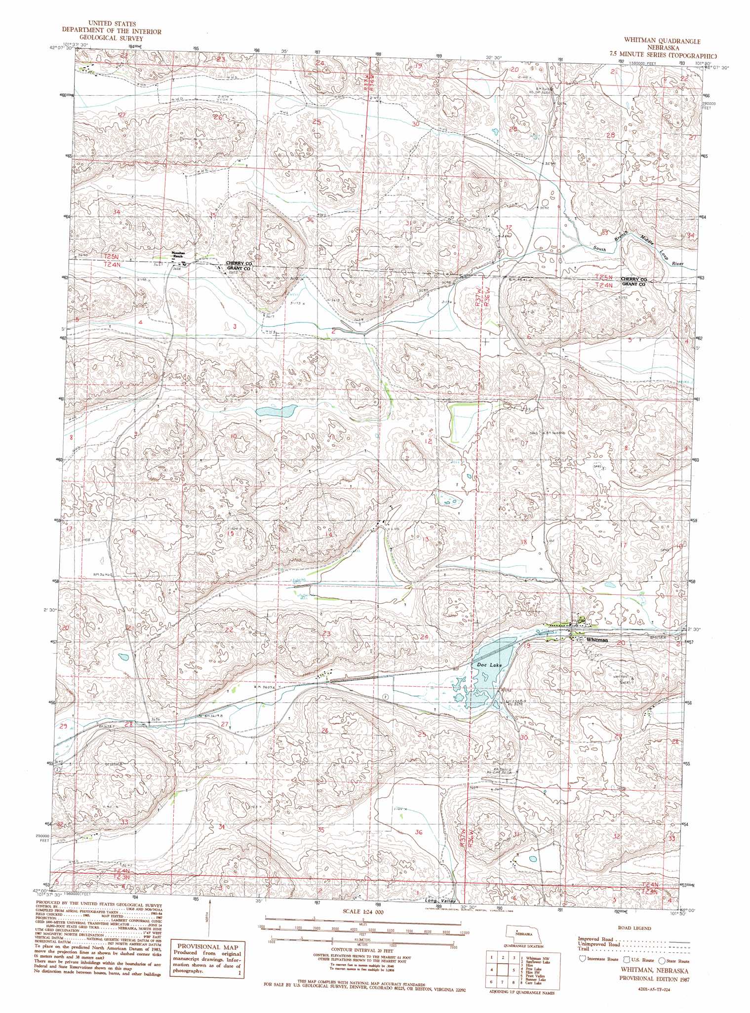
USGS Topo Quad 42101a5 - 1:24,000 scale
| Topo Map Name: | Whitman |
| USGS Topo Quad ID: | 42101a5 |
| Print Size: | ca. 21 1/4" wide x 27" high |
| Southeast Coordinates: | 42° N latitude / 101.5° W longitude |
| Map Center Coordinates: | 42.0625° N latitude / 101.5625° W longitude |
| U.S. State: | NE |
| Filename: | O42101A5.jpg |
| Download Map JPG Image: | Whitman topo map 1:24,000 scale |
| Map Type: | Topographic |
| Topo Series: | 7.5´ |
| Map Scale: | 1:24,000 |
| Source of Map Images: | United States Geological Survey (USGS) |
| Alternate Map Versions: |
Whitman NE 1987, updated 1988 Download PDF Buy paper map Whitman NE 2011 Download PDF Buy paper map Whitman NE 2014 Download PDF Buy paper map |
1:24,000 Topo Quads surrounding Whitman
Bristol Lake |
School Section Lake |
Hill Lake |
Big Willow Lake |
Sevenmile Hill |
Mother Lake |
Whitman Nw |
Sunflower Lake |
Hire |
Hire Ne |
Hyannis North |
Frye Lake |
Whitman |
Hire Sw |
Hire Se |
Hyannis South |
Moran Lake |
Bunner Lake |
Carr Lake |
Carr Lake Ne |
George Lake Se |
Spring Valley |
Rothwell Lake |
Haney Lake |
Jefford Lake |
> Back to 42101a1 at 1:100,000 scale
> Back to 42100a1 at 1:250,000 scale
> Back to U.S. Topo Maps home
Whitman topo map: Gazetteer
Whitman: Areas
Sand Hills elevation 1141m 3743′Whitman: Lakes
Doc Lake elevation 1095m 3592′Whitman: Populated Places
Whitman elevation 1098m 3602′Whitman: Post Offices
Whitman Post Office elevation 1098m 3602′Whitman digital topo map on disk
Buy this Whitman topo map showing relief, roads, GPS coordinates and other geographical features, as a high-resolution digital map file on DVD: