Coleman Lake Topo Map Nebraska
To zoom in, hover over the map of Coleman Lake
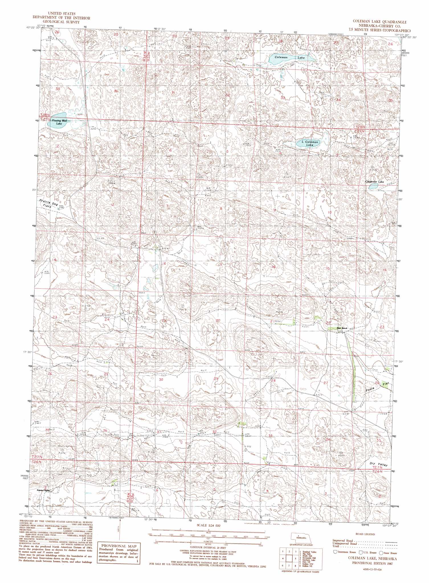
USGS Topo Quad 42101c2 - 1:24,000 scale
| Topo Map Name: | Coleman Lake |
| USGS Topo Quad ID: | 42101c2 |
| Print Size: | ca. 21 1/4" wide x 27" high |
| Southeast Coordinates: | 42.25° N latitude / 101.125° W longitude |
| Map Center Coordinates: | 42.3125° N latitude / 101.1875° W longitude |
| U.S. State: | NE |
| Filename: | O42101C2.jpg |
| Download Map JPG Image: | Coleman Lake topo map 1:24,000 scale |
| Map Type: | Topographic |
| Topo Series: | 7.5´ |
| Map Scale: | 1:24,000 |
| Source of Map Images: | United States Geological Survey (USGS) |
| Alternate Map Versions: |
Coleman Lake NE 1987, updated 1987 Download PDF Buy paper map Coleman Lake NE 2011 Download PDF Buy paper map Coleman Lake NE 2014 Download PDF Buy paper map |
1:24,000 Topo Quads surrounding Coleman Lake
Indian Hill |
Farm Flat |
Powderhorn Valley Sw |
Chesterfield Flats |
Windmill Lake |
Wolf Lake |
Rosebud Valley |
Big Falls |
Brush Hill |
Square Lake |
Big Willow Lake |
Sevenmile Hill |
Coleman Lake |
Mayhew Lake |
Allen Valley |
Hire |
Hire Ne |
Mullen Nw |
Mullen Ne |
Barnet Valley |
Hire Sw |
Hire Se |
Hecla |
Mullen |
Seneca Sw |
> Back to 42101a1 at 1:100,000 scale
> Back to 42100a1 at 1:250,000 scale
> Back to U.S. Topo Maps home
Coleman Lake topo map: Gazetteer
Coleman Lake: Flats
Prairie Dog Flats elevation 1034m 3392′Coleman Lake: Lakes
Carpenter Lake elevation 999m 3277′Coleman Lake elevation 997m 3270′
Flowing Well Lake elevation 1015m 3330′
Little Coleman Lake elevation 997m 3270′
Coleman Lake digital topo map on disk
Buy this Coleman Lake topo map showing relief, roads, GPS coordinates and other geographical features, as a high-resolution digital map file on DVD: