School Section Lake Topo Map Nebraska
To zoom in, hover over the map of School Section Lake
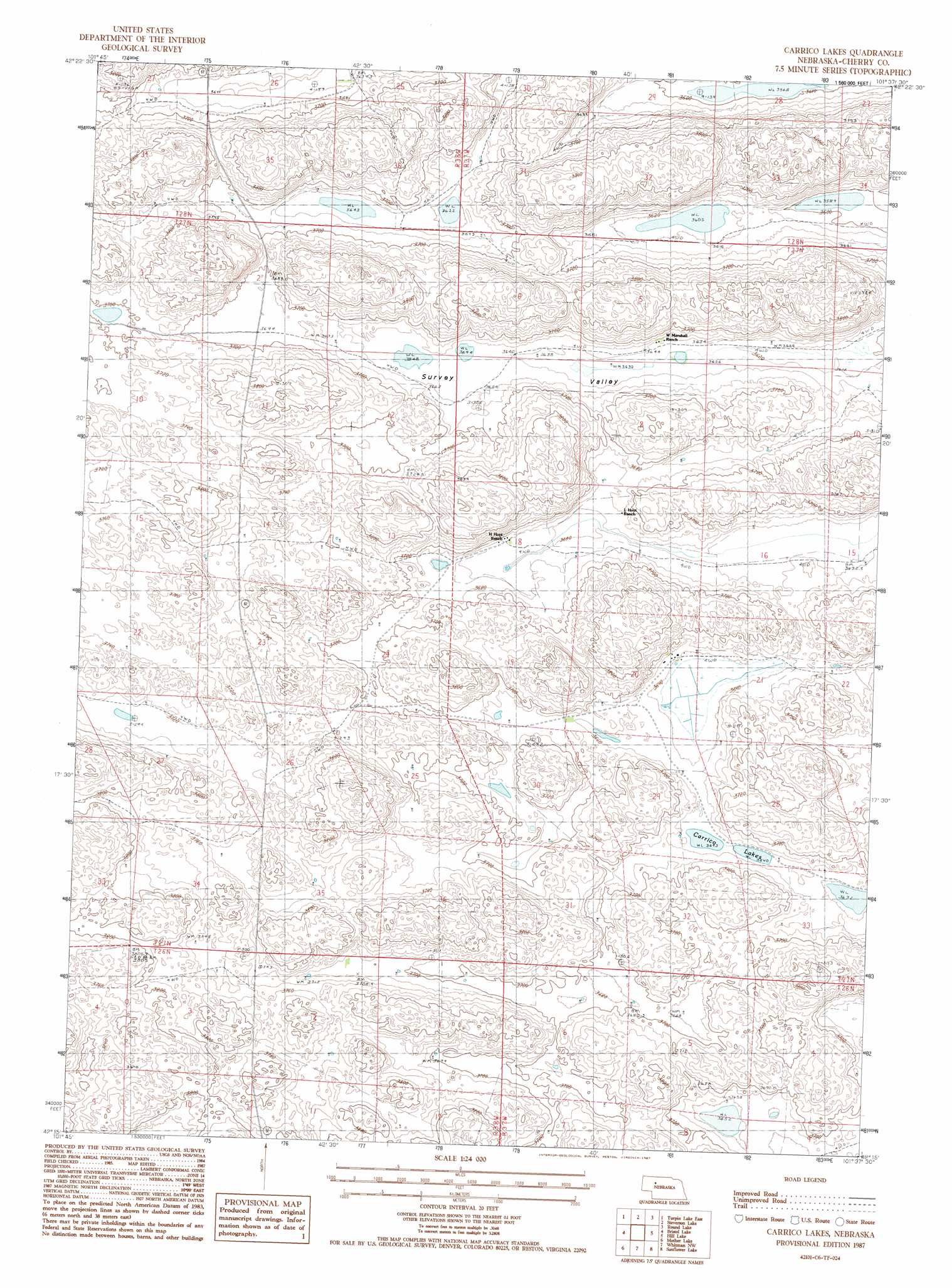
USGS Topo Quad 42101c6 - 1:24,000 scale
| Topo Map Name: | School Section Lake |
| USGS Topo Quad ID: | 42101c6 |
| Print Size: | ca. 21 1/4" wide x 27" high |
| Southeast Coordinates: | 42.25° N latitude / 101.625° W longitude |
| Map Center Coordinates: | 42.3125° N latitude / 101.6875° W longitude |
| U.S. State: | NE |
| Filename: | O42101C6.jpg |
| Download Map JPG Image: | School Section Lake topo map 1:24,000 scale |
| Map Type: | Topographic |
| Topo Series: | 7.5´ |
| Map Scale: | 1:24,000 |
| Source of Map Images: | United States Geological Survey (USGS) |
| Alternate Map Versions: |
Carrico Lakes NE 1987, updated 1987 Download PDF Buy paper map Carrico Lakes NE 2011 Download PDF Buy paper map Carrico Lakes NE 2014 Download PDF Buy paper map |
1:24,000 Topo Quads surrounding School Section Lake
Gypsy Valley |
North Valley |
Wild Mare Lake Sw |
Wild Mare Lake Se |
Indian Hill |
Turpin Lake West |
Turpin Lake East |
Steverson Lake |
Round Lake |
Wolf Lake |
Card Lake |
Bristol Lake |
School Section Lake |
Hill Lake |
Big Willow Lake |
Camp Valley |
Mother Lake |
Whitman Nw |
Sunflower Lake |
Hire |
Ashby |
Hyannis North |
Frye Lake |
Whitman |
Hire Sw |
> Back to 42101a1 at 1:100,000 scale
> Back to 42100a1 at 1:250,000 scale
> Back to U.S. Topo Maps home
School Section Lake topo map: Gazetteer
School Section Lake: Lakes
Carrico Lakes elevation 1113m 3651′School Section Lake elevation 1109m 3638′
School Section Lake digital topo map on disk
Buy this School Section Lake topo map showing relief, roads, GPS coordinates and other geographical features, as a high-resolution digital map file on DVD: