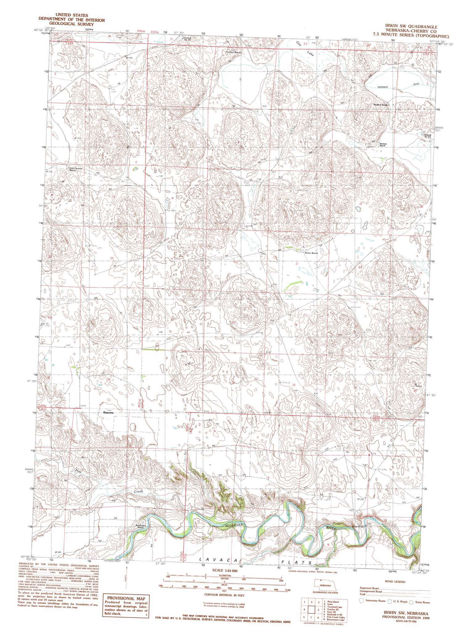
Irwin Sw Topo Map Nebraska
To zoom in, hover over the map of Irwin Sw
USGS Topo Quad 42101g8 - 1:24,000 scale
| Topo Map Name: | Irwin Sw |
| USGS Topo Quad ID: | 42101g8 |
| Print Size: | ca. 21 1/4" wide x 27" high |
| Southeast Coordinates: | 42.75° N latitude / 101.875° W longitude |
| Map Center Coordinates: | 42.8125° N latitude / 101.9375° W longitude |
| U.S. State: | NE |
| Filename: | O42101G8.jpg |
| Download Map JPG Image: | Irwin Sw topo map 1:24,000 scale |
| Map Type: | Topographic |
| Topo Series: | 7.5´ |
| Map Scale: | 1:24,000 |
| Source of Map Images: | United States Geological Survey (USGS) |
| Alternate Map Versions: |
Irwin SW NE 1990, updated 1990 Download PDF Buy paper map Irwin SW NE 2011 Download PDF Buy paper map Irwin SW NE 2014 Download PDF Buy paper map |
1:24,000 Topo Quads surrounding Irwin Sw
Two Lance Lake |
Allan Dam |
|||
Gordon Nw |
Hog Island |
Irwin |
Trumbull Lake |
Merriman |
Gordon |
Gordon Se |
Irwin Sw |
Irwin Se |
Merriman Sw |
Rushville 4 Nw |
Rushville 4 Ne |
Pole Creek Valley |
Bornemann Lake |
Wild Mare Lake Nw |
Rushville 4 Sw |
Rushville 4 Se |
Gypsy Valley |
North Valley |
Wild Mare Lake Sw |
> Back to 42101e1 at 1:100,000 scale
> Back to 42100a1 at 1:250,000 scale
> Back to U.S. Topo Maps home
Irwin Sw topo map: Gazetteer
Irwin Sw: Bridges
Lions Bridge elevation 987m 3238′Irwin Sw: Lakes
Gay Lake elevation 1043m 3421′Irwin Sw: Populated Places
Bayonne elevation 1072m 3517′Irwin Sw: Post Offices
Bayonne Post Office (historical) elevation 1072m 3517′Irwin Sw: Streams
Hay Creek elevation 1006m 3300′Irwin Sw digital topo map on disk
Buy this Irwin Sw topo map showing relief, roads, GPS coordinates and other geographical features, as a high-resolution digital map file on DVD: