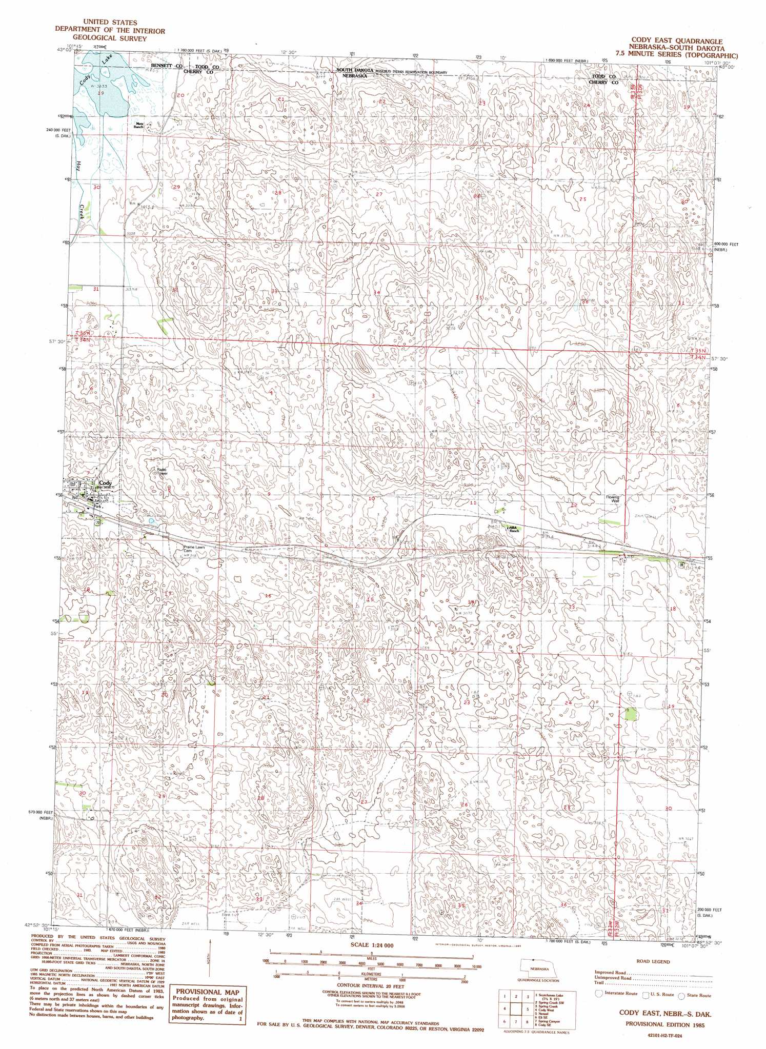
Cody East Topo Map Nebraska
To zoom in, hover over the map of Cody East
USGS Topo Quad 42101h2 - 1:24,000 scale
| Topo Map Name: | Cody East |
| USGS Topo Quad ID: | 42101h2 |
| Print Size: | ca. 21 1/4" wide x 27" high |
| Southeast Coordinates: | 42.875° N latitude / 101.125° W longitude |
| Map Center Coordinates: | 42.9375° N latitude / 101.1875° W longitude |
| U.S. States: | NE, SD |
| Filename: | O42101H2.jpg |
| Download Map JPG Image: | Cody East topo map 1:24,000 scale |
| Map Type: | Topographic |
| Topo Series: | 7.5´ |
| Map Scale: | 1:24,000 |
| Source of Map Images: | United States Geological Survey (USGS) |
| Alternate Map Versions: |
Cody East NE 1985, updated 1985 Download PDF Buy paper map Cody East NE 2011 Download PDF Buy paper map Cody East NE 2014 Download PDF Buy paper map |
1:24,000 Topo Quads surrounding Cody East
Harrington |
Iron Shell Flat West |
Iron Shell Flat East |
Saint Francis |
|
East Of Scotchman Lake |
Spring Creek Sw |
Spring Creek |
Saint Francis Sw |
|
Eli |
Cody West |
Cody East |
Nenzel |
Kilgore |
Eli Sw |
Eli Se |
Spring Canyon |
Cody Se |
Cooper Canyon |
Medicine Lake |
Heath Valley |
Spring Lake |
Powderhorn Valley |
Kennedy Nw |
> Back to 42101e1 at 1:100,000 scale
> Back to 42100a1 at 1:250,000 scale
> Back to U.S. Topo Maps home
Cody East topo map: Gazetteer
Cody East: Lakes
Cody Lake elevation 924m 3031′Cody East: Parks
Cody City Park elevation 945m 3100′Cody East: Populated Places
Cody elevation 945m 3100′Cody East: Post Offices
Cody Post Office elevation 945m 3100′Cody East digital topo map on disk
Buy this Cody East topo map showing relief, roads, GPS coordinates and other geographical features, as a high-resolution digital map file on DVD: