Bangham Topo Map Nebraska
To zoom in, hover over the map of Bangham
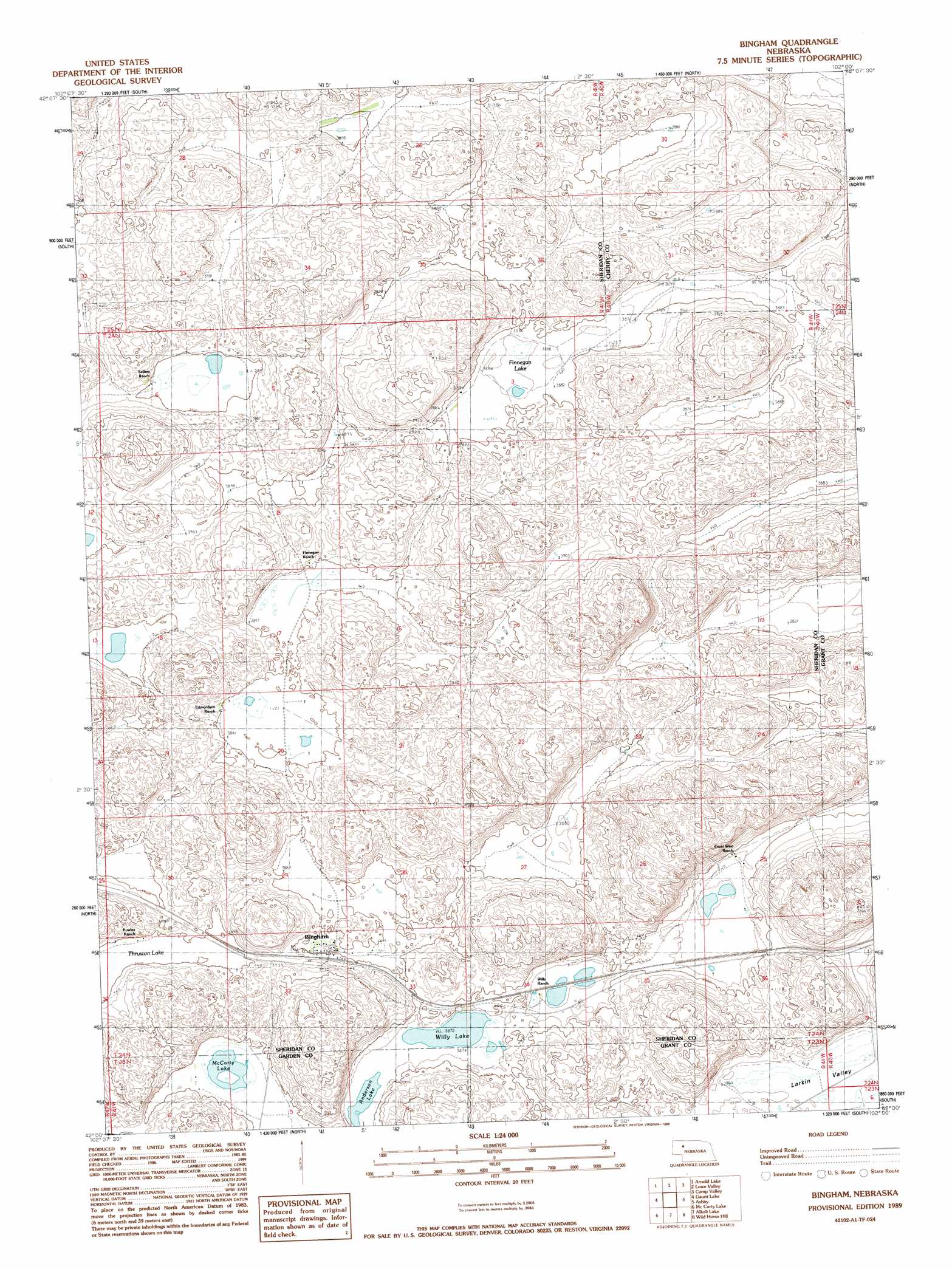
USGS Topo Quad 42102a1 - 1:24,000 scale
| Topo Map Name: | Bangham |
| USGS Topo Quad ID: | 42102a1 |
| Print Size: | ca. 21 1/4" wide x 27" high |
| Southeast Coordinates: | 42° N latitude / 102° W longitude |
| Map Center Coordinates: | 42.0625° N latitude / 102.0625° W longitude |
| U.S. State: | NE |
| Filename: | O42102A1.jpg |
| Download Map JPG Image: | Bangham topo map 1:24,000 scale |
| Map Type: | Topographic |
| Topo Series: | 7.5´ |
| Map Scale: | 1:24,000 |
| Source of Map Images: | United States Geological Survey (USGS) |
| Alternate Map Versions: |
Bingham NE 1989, updated 1989 Download PDF Buy paper map Bingham NE 2011 Download PDF Buy paper map Bingham NE 2014 Download PDF Buy paper map |
1:24,000 Topo Quads surrounding Bangham
Green Lake |
Argo Hill |
Wolford Valley |
Card Lake |
Bristol Lake |
White Lake |
Arnold Lake |
Lowe Valley |
Camp Valley |
Mother Lake |
Ellsworth |
Gaunt Lake |
Bangham |
Ashby |
Hyannis North |
Black Lake |
Mccarty Lake |
Alkali Lake |
Wild Horse Hill |
Hyannis South |
Hessey Lake |
Young Valley |
Curry Lake |
Long Valley |
George Lake Se |
> Back to 42102a1 at 1:100,000 scale
> Back to 42102a1 at 1:250,000 scale
> Back to U.S. Topo Maps home
Bangham topo map: Gazetteer
Bangham: Lakes
Anderson Lake elevation 1179m 3868′Finnegan Lake elevation 1182m 3877′
McCarty Lake elevation 1185m 3887′
Willy Lake elevation 1181m 3874′
Bangham: Populated Places
Bingham elevation 1187m 3894′Bangham: Post Offices
Bingham Post Office elevation 1187m 3894′Bangham: Valleys
Larkin Valley elevation 1177m 3861′Bangham digital topo map on disk
Buy this Bangham topo map showing relief, roads, GPS coordinates and other geographical features, as a high-resolution digital map file on DVD:
Eastern Wyoming & Western South Dakota
Buy digital topo maps: Eastern Wyoming & Western South Dakota