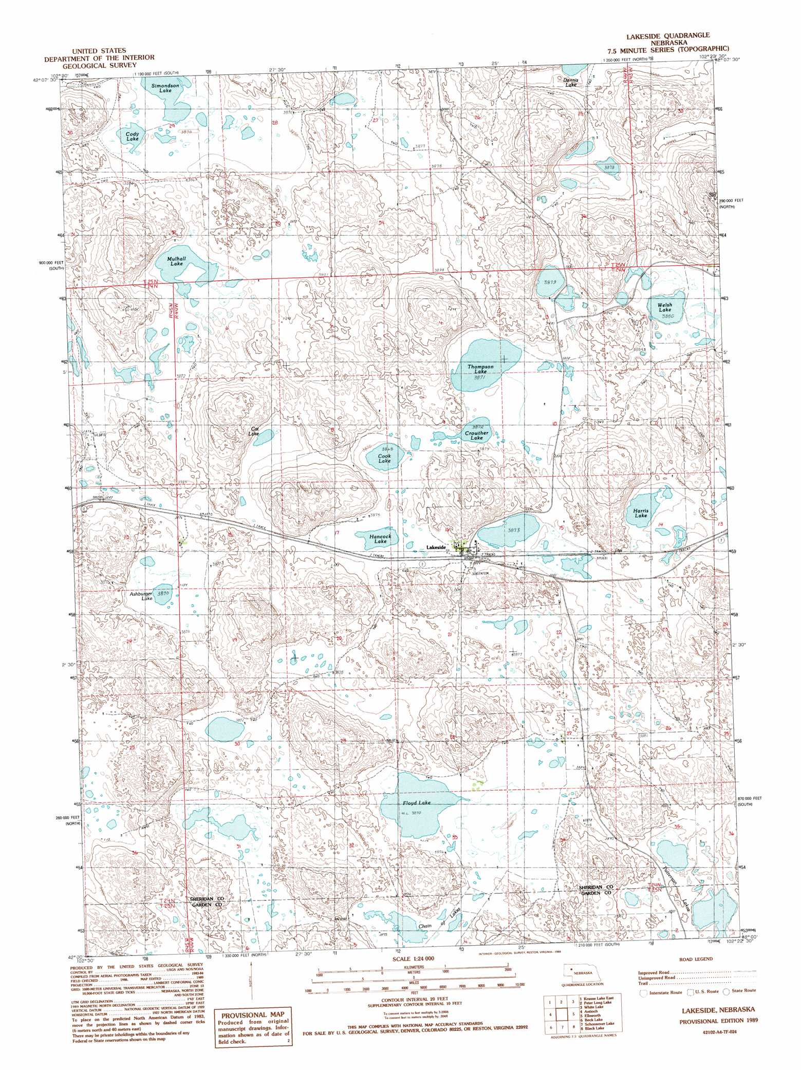
Lakeside Topo Map Nebraska
To zoom in, hover over the map of Lakeside
USGS Topo Quad 42102a4 - 1:24,000 scale
| Topo Map Name: | Lakeside |
| USGS Topo Quad ID: | 42102a4 |
| Print Size: | ca. 21 1/4" wide x 27" high |
| Southeast Coordinates: | 42° N latitude / 102.375° W longitude |
| Map Center Coordinates: | 42.0625° N latitude / 102.4375° W longitude |
| U.S. State: | NE |
| Filename: | O42102A4.jpg |
| Download Map JPG Image: | Lakeside topo map 1:24,000 scale |
| Map Type: | Topographic |
| Topo Series: | 7.5´ |
| Map Scale: | 1:24,000 |
| Source of Map Images: | United States Geological Survey (USGS) |
| Alternate Map Versions: |
Lakeside NE 1989, updated 1989 Download PDF Buy paper map Lakeside NE 2011 Download PDF Buy paper map Lakeside NE 2014 Download PDF Buy paper map |
1:24,000 Topo Quads surrounding Lakeside
Skunk Lake Sw |
Skunk Lake |
Twin Lakes |
Green Lake |
Argo Hill |
Krause Lake West |
Krause Lake East |
Peter Long Lake |
White Lake |
Arnold Lake |
Jesse Lake |
Antioch |
Lakeside |
Ellsworth |
Gaunt Lake |
Mccarthy Lake |
Beck Lake |
Schoonover Lake |
Black Lake |
Mccarty Lake |
Storm Lake |
Bean Lake |
Mumper |
Hessey Lake |
Young Valley |
> Back to 42102a1 at 1:100,000 scale
> Back to 42102a1 at 1:250,000 scale
> Back to U.S. Topo Maps home
Lakeside topo map: Gazetteer
Lakeside: Lakes
Ashburger Lake elevation 1180m 3871′Cat Lake elevation 1180m 3871′
Chain of Lakes elevation 1180m 3871′
Cody Lake elevation 1179m 3868′
Cook Lake elevation 1180m 3871′
Crowther Lake elevation 1181m 3874′
Dennis Lake elevation 1178m 3864′
Floyd Lake elevation 1180m 3871′
Hancock Lake elevation 1180m 3871′
Harris Lake elevation 1181m 3874′
McFall Lake elevation 1178m 3864′
Mulhall Lake elevation 1180m 3871′
Patterson Lakes elevation 1181m 3874′
Simondson Lake elevation 1178m 3864′
Simondson Lake elevation 1178m 3864′
Strong Lake elevation 1183m 3881′
Thompson Lake elevation 1180m 3871′
Welsh Lake elevation 1183m 3881′
Lakeside: Populated Places
Lakeside elevation 1183m 3881′Lakeside: Post Offices
Lakeside Post Office elevation 1182m 3877′Lakeside digital topo map on disk
Buy this Lakeside topo map showing relief, roads, GPS coordinates and other geographical features, as a high-resolution digital map file on DVD:
Eastern Wyoming & Western South Dakota
Buy digital topo maps: Eastern Wyoming & Western South Dakota