Antioch Topo Map Nebraska
To zoom in, hover over the map of Antioch
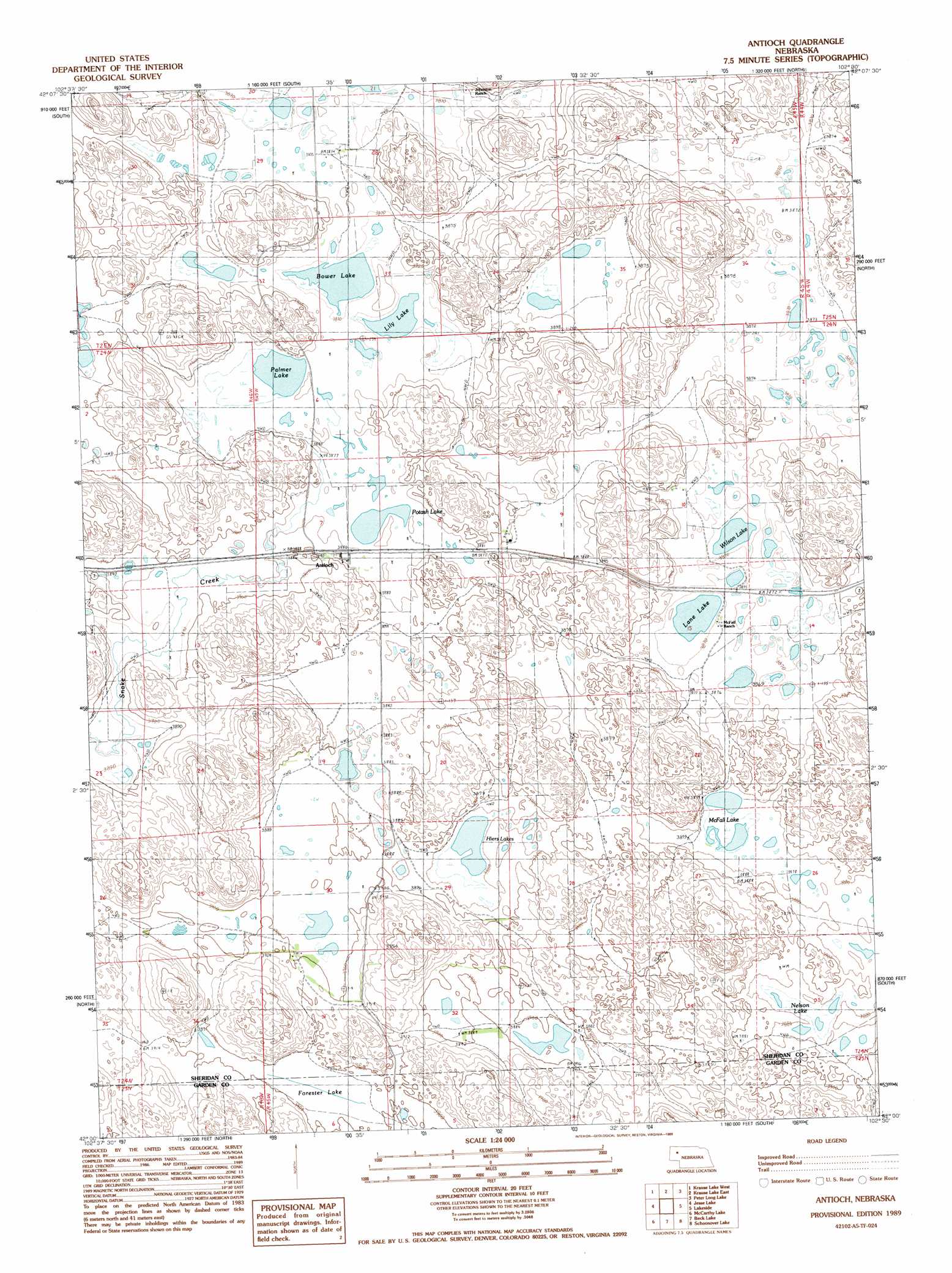
USGS Topo Quad 42102a5 - 1:24,000 scale
| Topo Map Name: | Antioch |
| USGS Topo Quad ID: | 42102a5 |
| Print Size: | ca. 21 1/4" wide x 27" high |
| Southeast Coordinates: | 42° N latitude / 102.5° W longitude |
| Map Center Coordinates: | 42.0625° N latitude / 102.5625° W longitude |
| U.S. State: | NE |
| Filename: | O42102A5.jpg |
| Download Map JPG Image: | Antioch topo map 1:24,000 scale |
| Map Type: | Topographic |
| Topo Series: | 7.5´ |
| Map Scale: | 1:24,000 |
| Source of Map Images: | United States Geological Survey (USGS) |
| Alternate Map Versions: |
Antioch NE 1989, updated 1989 Download PDF Buy paper map Antioch NE 2011 Download PDF Buy paper map Antioch NE 2014 Download PDF Buy paper map |
1:24,000 Topo Quads surrounding Antioch
Box Butte |
Skunk Lake Sw |
Skunk Lake |
Twin Lakes |
Green Lake |
Berea Creek East |
Krause Lake West |
Krause Lake East |
Peter Long Lake |
White Lake |
Alliance East |
Jesse Lake |
Antioch |
Lakeside |
Ellsworth |
Rush Lake |
Mccarthy Lake |
Beck Lake |
Schoonover Lake |
Black Lake |
Norris Lake |
Storm Lake |
Bean Lake |
Mumper |
Hessey Lake |
> Back to 42102a1 at 1:100,000 scale
> Back to 42102a1 at 1:250,000 scale
> Back to U.S. Topo Maps home
Antioch topo map: Gazetteer
Antioch: Lakes
Bower Lake elevation 1180m 3871′Forester Lake elevation 1189m 3900′
Hiers Lakes elevation 1180m 3871′
Lane Lake elevation 1180m 3871′
Lily Lake elevation 1180m 3871′
McFall Lake elevation 1181m 3874′
Nelson Lake elevation 1183m 3881′
Palmer Lake elevation 1180m 3871′
Potash Lake elevation 1180m 3871′
Wilson Lake elevation 1180m 3871′
Antioch: Parks
Antioch Potash Boom-Town Historical Marker elevation 1187m 3894′Antioch: Populated Places
Antioch elevation 1183m 3881′Antioch: Post Offices
Antioch Post Office elevation 1183m 3881′Antioch digital topo map on disk
Buy this Antioch topo map showing relief, roads, GPS coordinates and other geographical features, as a high-resolution digital map file on DVD:
Eastern Wyoming & Western South Dakota
Buy digital topo maps: Eastern Wyoming & Western South Dakota