Alliance West Topo Map Nebraska
To zoom in, hover over the map of Alliance West
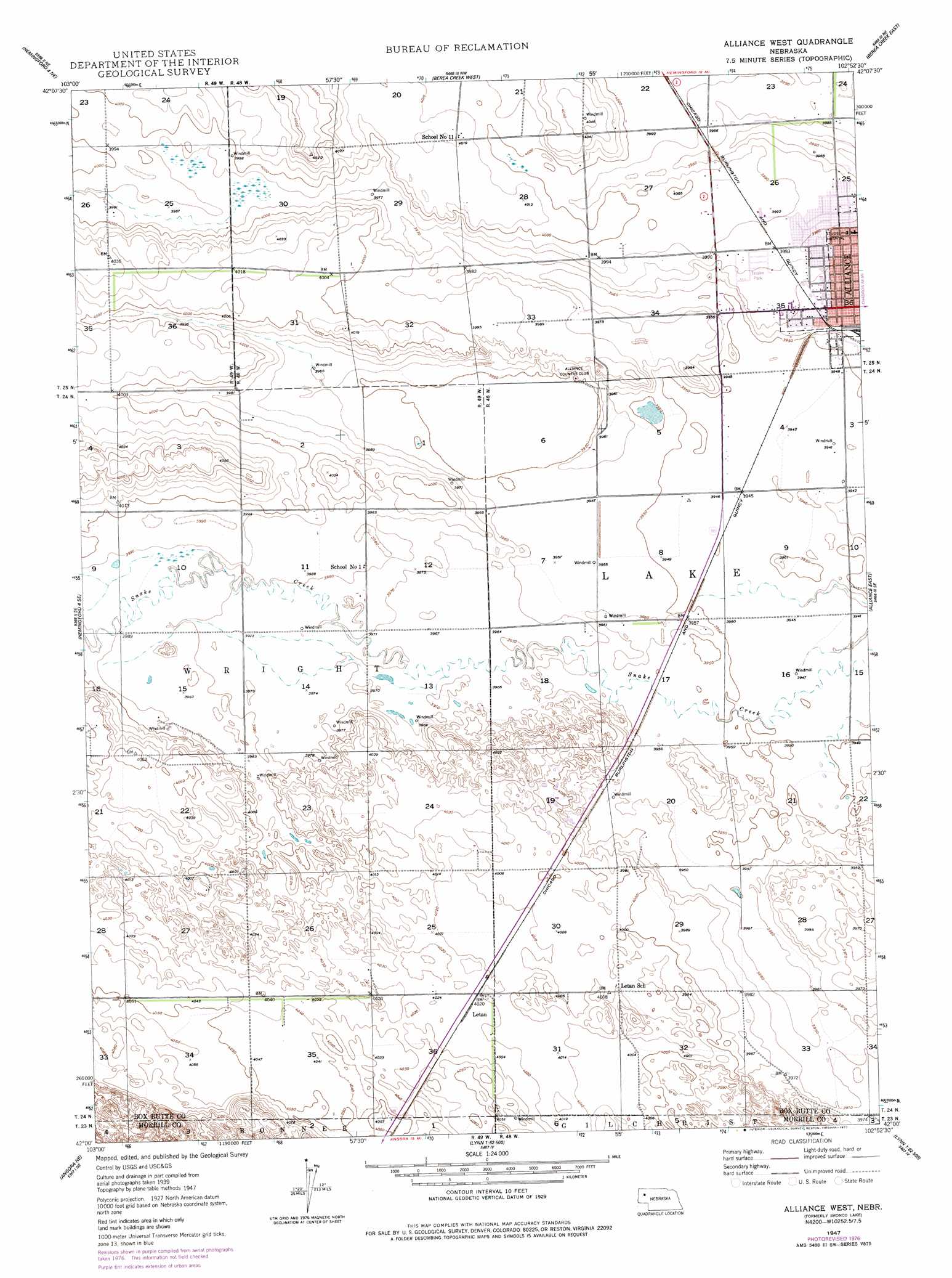
USGS Topo Quad 42102a8 - 1:24,000 scale
| Topo Map Name: | Alliance West |
| USGS Topo Quad ID: | 42102a8 |
| Print Size: | ca. 21 1/4" wide x 27" high |
| Southeast Coordinates: | 42° N latitude / 102.875° W longitude |
| Map Center Coordinates: | 42.0625° N latitude / 102.9375° W longitude |
| U.S. State: | NE |
| Filename: | O42102A8.jpg |
| Download Map JPG Image: | Alliance West topo map 1:24,000 scale |
| Map Type: | Topographic |
| Topo Series: | 7.5´ |
| Map Scale: | 1:24,000 |
| Source of Map Images: | United States Geological Survey (USGS) |
| Alternate Map Versions: |
Bronco Lake NE 1947, updated 1970 Download PDF Buy paper map Alliance West NE 1947, updated 1977 Download PDF Buy paper map Bronco Lake NE 1949, updated 1949 Download PDF Buy paper map Alliance West NE 2011 Download PDF Buy paper map Alliance West NE 2014 Download PDF Buy paper map |
1:24,000 Topo Quads surrounding Alliance West
Nonpareil |
Hemingford |
Box Butte Sw |
Box Butte |
Skunk Lake Sw |
Hemingford 4 Nw |
Hemingford 4 Ne |
Berea Creek West |
Berea Creek East |
Krause Lake West |
Hemingford 4 Sw |
Hemingford 4 Se |
Alliance West |
Alliance East |
Jesse Lake |
Angora Nw |
Angora Ne |
Cowboy Hill |
Rush Lake |
Mccarthy Lake |
Angora |
Angora Se |
Camp Lake |
Norris Lake |
Storm Lake |
> Back to 42102a1 at 1:100,000 scale
> Back to 42102a1 at 1:250,000 scale
> Back to U.S. Topo Maps home
Alliance West topo map: Gazetteer
Alliance West: Lakes
Bronco Lake elevation 1202m 3943′Alliance West: Parks
Hal Murray Softball Complex elevation 1213m 3979′Knight Park elevation 1211m 3973′
Alliance West: Populated Places
Letan elevation 1227m 4025′Alliance West digital topo map on disk
Buy this Alliance West topo map showing relief, roads, GPS coordinates and other geographical features, as a high-resolution digital map file on DVD:
Eastern Wyoming & Western South Dakota
Buy digital topo maps: Eastern Wyoming & Western South Dakota