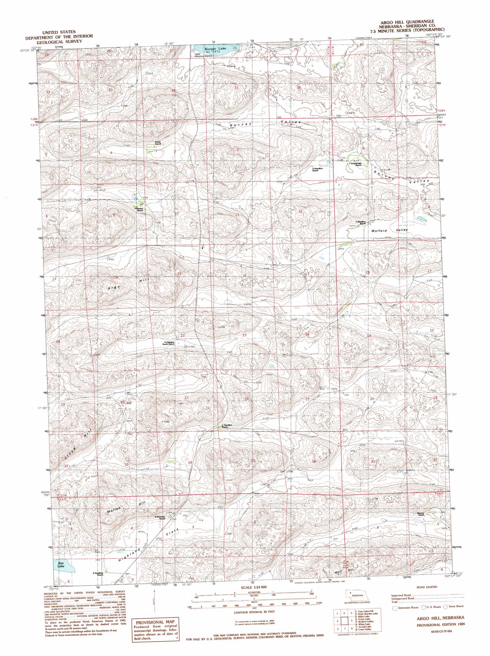
Argo Hill Topo Map Nebraska
To zoom in, hover over the map of Argo Hill
USGS Topo Quad 42102c2 - 1:24,000 scale
| Topo Map Name: | Argo Hill |
| USGS Topo Quad ID: | 42102c2 |
| Print Size: | ca. 21 1/4" wide x 27" high |
| Southeast Coordinates: | 42.25° N latitude / 102.125° W longitude |
| Map Center Coordinates: | 42.3125° N latitude / 102.1875° W longitude |
| U.S. State: | NE |
| Filename: | O42102C2.jpg |
| Download Map JPG Image: | Argo Hill topo map 1:24,000 scale |
| Map Type: | Topographic |
| Topo Series: | 7.5´ |
| Map Scale: | 1:24,000 |
| Source of Map Images: | United States Geological Survey (USGS) |
| Alternate Map Versions: |
Argo Hill NE 1989, updated 1989 Download PDF Buy paper map Argo Hill NE 2011 Download PDF Buy paper map Argo Hill NE 2014 Download PDF Buy paper map |
1:24,000 Topo Quads surrounding Argo Hill
Rushville Sw |
Rushville Se |
Rushville 4 Sw |
Rushville 4 Se |
Gypsy Valley |
Smith Lake |
Twin Lakes Ne |
Dolly Warden Lake |
Billys Lake |
Turpin Lake West |
Twin Lakes |
Green Lake |
Argo Hill |
Wolford Valley |
Card Lake |
Peter Long Lake |
White Lake |
Arnold Lake |
Lowe Valley |
Camp Valley |
Lakeside |
Ellsworth |
Gaunt Lake |
Bangham |
Ashby |
> Back to 42102a1 at 1:100,000 scale
> Back to 42102a1 at 1:250,000 scale
> Back to U.S. Topo Maps home
Argo Hill topo map: Gazetteer
Argo Hill: Flats
Highland Flats elevation 1195m 3920′Argo Hill: Lakes
Bunger Lake elevation 1181m 3874′Star Lake elevation 1194m 3917′
Argo Hill: Parks
Mari Sandoz State Historical Marker elevation 1183m 3881′Argo Hill: Summits
Argo Hill elevation 1284m 4212′Lloyd Hill elevation 1286m 4219′
Morton Hill elevation 1305m 4281′
Wolf Hill elevation 1305m 4281′
Argo Hill digital topo map on disk
Buy this Argo Hill topo map showing relief, roads, GPS coordinates and other geographical features, as a high-resolution digital map file on DVD:
Eastern Wyoming & Western South Dakota
Buy digital topo maps: Eastern Wyoming & Western South Dakota