Rushville 4 Se Topo Map Nebraska
To zoom in, hover over the map of Rushville 4 Se
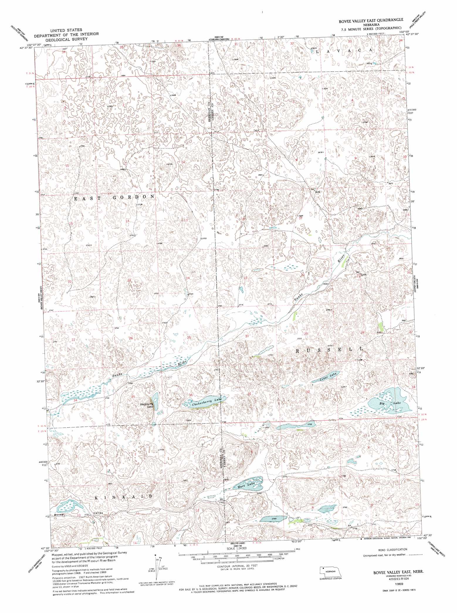
USGS Topo Quad 42102e1 - 1:24,000 scale
| Topo Map Name: | Rushville 4 Se |
| USGS Topo Quad ID: | 42102e1 |
| Print Size: | ca. 21 1/4" wide x 27" high |
| Southeast Coordinates: | 42.5° N latitude / 102° W longitude |
| Map Center Coordinates: | 42.5625° N latitude / 102.0625° W longitude |
| U.S. State: | NE |
| Filename: | O42102E1.jpg |
| Download Map JPG Image: | Rushville 4 Se topo map 1:24,000 scale |
| Map Type: | Topographic |
| Topo Series: | 7.5´ |
| Map Scale: | 1:24,000 |
| Source of Map Images: | United States Geological Survey (USGS) |
| Alternate Map Versions: |
Rushville 4 SE NE 1969, updated 1972 Download PDF Buy paper map Bovee Valley East NE 1969, updated 1993 Download PDF Buy paper map Bovee Valley East NE 2011 Download PDF Buy paper map Bovee Valley East NE 2014 Download PDF Buy paper map |
1:24,000 Topo Quads surrounding Rushville 4 Se
Clinton |
Gordon |
Gordon Se |
Irwin Sw |
Irwin Se |
Rushville Ne |
Rushville 4 Nw |
Rushville 4 Ne |
Pole Creek Valley |
Bornemann Lake |
Rushville Se |
Rushville 4 Sw |
Rushville 4 Se |
Gypsy Valley |
North Valley |
Twin Lakes Ne |
Dolly Warden Lake |
Billys Lake |
Turpin Lake West |
Turpin Lake East |
Green Lake |
Argo Hill |
Wolford Valley |
Card Lake |
Bristol Lake |
> Back to 42102e1 at 1:100,000 scale
> Back to 42102a1 at 1:250,000 scale
> Back to U.S. Topo Maps home
Rushville 4 Se topo map: Gazetteer
Rushville 4 Se: Basins
Bovee Valley elevation 1159m 3802′Rushville 4 Se: Lakes
Big Lake elevation 1132m 3713′Cedar Lake elevation 1133m 3717′
Chokecherry Lake elevation 1137m 3730′
Hackberry Lake elevation 1144m 3753′
Hart Lake elevation 1144m 3753′
Rushville 4 Se digital topo map on disk
Buy this Rushville 4 Se topo map showing relief, roads, GPS coordinates and other geographical features, as a high-resolution digital map file on DVD:
Eastern Wyoming & Western South Dakota
Buy digital topo maps: Eastern Wyoming & Western South Dakota