Gordon Se Topo Map Nebraska
To zoom in, hover over the map of Gordon Se
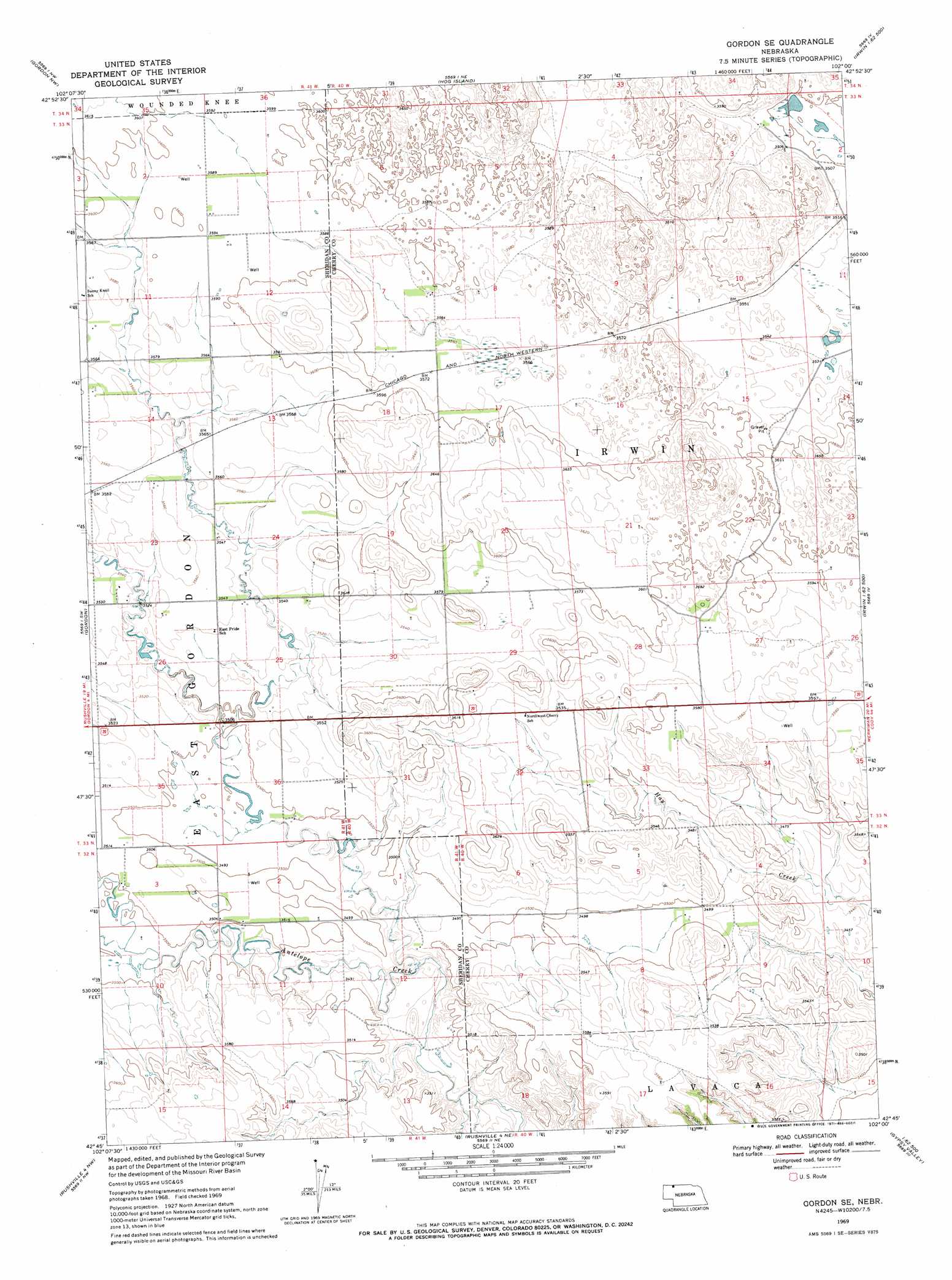
USGS Topo Quad 42102g1 - 1:24,000 scale
| Topo Map Name: | Gordon Se |
| USGS Topo Quad ID: | 42102g1 |
| Print Size: | ca. 21 1/4" wide x 27" high |
| Southeast Coordinates: | 42.75° N latitude / 102° W longitude |
| Map Center Coordinates: | 42.8125° N latitude / 102.0625° W longitude |
| U.S. State: | NE |
| Filename: | O42102G1.jpg |
| Download Map JPG Image: | Gordon Se topo map 1:24,000 scale |
| Map Type: | Topographic |
| Topo Series: | 7.5´ |
| Map Scale: | 1:24,000 |
| Source of Map Images: | United States Geological Survey (USGS) |
| Alternate Map Versions: |
Gordon SE NE 1969, updated 1971 Download PDF Buy paper map Gordon SE NE 2011 Download PDF Buy paper map Gordon SE NE 2014 Download PDF Buy paper map |
1:24,000 Topo Quads surrounding Gordon Se
Denby |
Two Lance Lake |
Allan Dam |
||
Clinton Ne |
Gordon Nw |
Hog Island |
Irwin |
Trumbull Lake |
Clinton |
Gordon |
Gordon Se |
Irwin Sw |
Irwin Se |
Rushville Ne |
Rushville 4 Nw |
Rushville 4 Ne |
Pole Creek Valley |
Bornemann Lake |
Rushville Se |
Rushville 4 Sw |
Rushville 4 Se |
Gypsy Valley |
North Valley |
> Back to 42102e1 at 1:100,000 scale
> Back to 42102a1 at 1:250,000 scale
> Back to U.S. Topo Maps home
Gordon Se topo map: Gazetteer
Gordon Se: Parks
Opening the Sandhills Historical Marker elevation 1092m 3582′Gordon Se digital topo map on disk
Buy this Gordon Se topo map showing relief, roads, GPS coordinates and other geographical features, as a high-resolution digital map file on DVD:
Eastern Wyoming & Western South Dakota
Buy digital topo maps: Eastern Wyoming & Western South Dakota