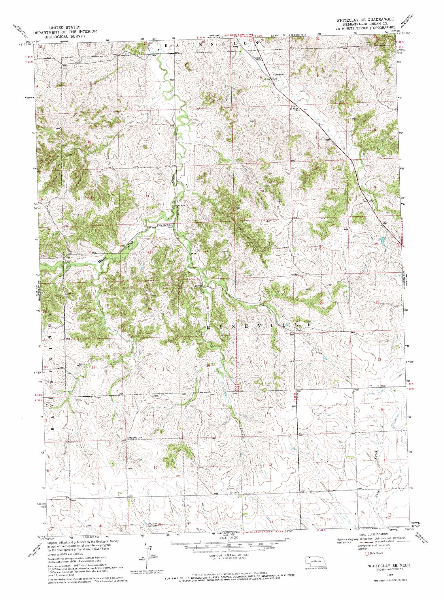
Whiteclay Se Topo Map Nebraska
To zoom in, hover over the map of Whiteclay Se
USGS Topo Quad 42102g5 - 1:24,000 scale
| Topo Map Name: | Whiteclay Se |
| USGS Topo Quad ID: | 42102g5 |
| Print Size: | ca. 21 1/4" wide x 27" high |
| Southeast Coordinates: | 42.75° N latitude / 102.5° W longitude |
| Map Center Coordinates: | 42.8125° N latitude / 102.5625° W longitude |
| U.S. State: | NE |
| Filename: | O42102G5.jpg |
| Download Map JPG Image: | Whiteclay Se topo map 1:24,000 scale |
| Map Type: | Topographic |
| Topo Series: | 7.5´ |
| Map Scale: | 1:24,000 |
| Source of Map Images: | United States Geological Survey (USGS) |
| Alternate Map Versions: |
Whiteclay SE NE 1969, updated 1972 Download PDF Buy paper map Whiteclay SE NE 2011 Download PDF Buy paper map Whiteclay SE NE 2014 Download PDF Buy paper map |
1:24,000 Topo Quads surrounding Whiteclay Se
Slim Butte |
Pine Ridge Sw |
Pine Ridge |
Manderson Sw |
Denby |
Chadron Ne |
Beaver Wall |
Whiteclay |
Clinton Nw |
Clinton Ne |
Bordeaux |
Whiteclay Sw |
Whiteclay Se |
Clinton Sw |
Clinton |
Chadron 3 Ne |
Hay Springs |
Hay Springs Ne |
Rushville |
Rushville Ne |
Chadron 3 Se |
Hay Springs Sw |
Hay Springs Se |
Rushville Sw |
Rushville Se |
> Back to 42102e1 at 1:100,000 scale
> Back to 42102a1 at 1:250,000 scale
> Back to U.S. Topo Maps home
Whiteclay Se topo map: Gazetteer
Whiteclay Se: Dams
Johnson Dam elevation 1139m 3736′Tallon Dam elevation 1109m 3638′
Whiteclay Se: Reservoirs
Johnson Reservoir elevation 1139m 3736′Tallon Reservoir elevation 1109m 3638′
Whiteclay Se digital topo map on disk
Buy this Whiteclay Se topo map showing relief, roads, GPS coordinates and other geographical features, as a high-resolution digital map file on DVD:
Eastern Wyoming & Western South Dakota
Buy digital topo maps: Eastern Wyoming & Western South Dakota