Hog Island Topo Map Nebraska
To zoom in, hover over the map of Hog Island
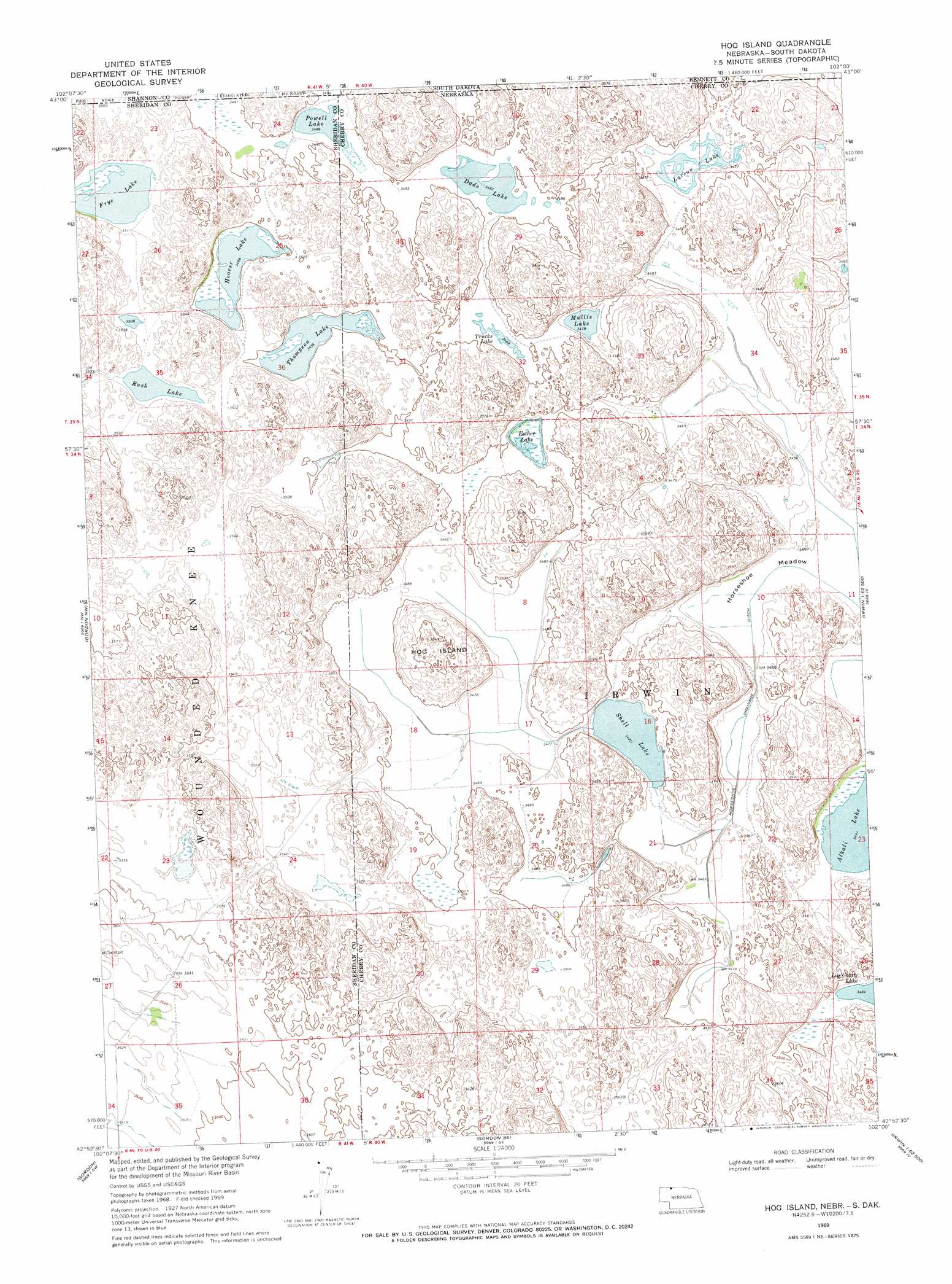
USGS Topo Quad 42102h1 - 1:24,000 scale
| Topo Map Name: | Hog Island |
| USGS Topo Quad ID: | 42102h1 |
| Print Size: | ca. 21 1/4" wide x 27" high |
| Southeast Coordinates: | 42.875° N latitude / 102° W longitude |
| Map Center Coordinates: | 42.9375° N latitude / 102.0625° W longitude |
| U.S. States: | NE, SD |
| Filename: | O42102H1.jpg |
| Download Map JPG Image: | Hog Island topo map 1:24,000 scale |
| Map Type: | Topographic |
| Topo Series: | 7.5´ |
| Map Scale: | 1:24,000 |
| Source of Map Images: | United States Geological Survey (USGS) |
| Alternate Map Versions: |
Hog Island NE 1969, updated 1972 Download PDF Buy paper map Hog Island NE 2011 Download PDF Buy paper map Hog Island NE 2014 Download PDF Buy paper map |
1:24,000 Topo Quads surrounding Hog Island
Wounded Knee |
Batesland |
Swett Ne |
||
Denby |
Two Lance Lake |
Allan Dam |
||
Clinton Ne |
Gordon Nw |
Hog Island |
Irwin |
Trumbull Lake |
Clinton |
Gordon |
Gordon Se |
Irwin Sw |
Irwin Se |
Rushville Ne |
Rushville 4 Nw |
Rushville 4 Ne |
Pole Creek Valley |
Bornemann Lake |
> Back to 42102e1 at 1:100,000 scale
> Back to 42102a1 at 1:250,000 scale
> Back to U.S. Topo Maps home
Hog Island topo map: Gazetteer
Hog Island: Canals
Horseshoe Drainage Ditch elevation 1053m 3454′Hog Island: Dams
Shell Lake Dam elevation 1061m 3480′Hog Island: Flats
Horseshoe Meadow elevation 1054m 3458′Hog Island: Islands
Hog Island elevation 1105m 3625′Hog Island: Lakes
Dads Lake elevation 1062m 3484′Esther Lake elevation 1060m 3477′
Hoover Lake elevation 1066m 3497′
Larson Lake elevation 1060m 3477′
Log Cabin Lake elevation 1062m 3484′
Mullis Lake elevation 1059m 3474′
Powell Lake elevation 1063m 3487′
Rush Lake elevation 1070m 3510′
Shell Lake elevation 1058m 3471′
Thompson Lake elevation 1065m 3494′
Trucks Lake elevation 1064m 3490′
Hog Island: Parks
Shell Lake State Wildlife Management Area elevation 1058m 3471′Hog Island: Reservoirs
Shell Lake elevation 1061m 3480′Hog Island digital topo map on disk
Buy this Hog Island topo map showing relief, roads, GPS coordinates and other geographical features, as a high-resolution digital map file on DVD:
Eastern Wyoming & Western South Dakota
Buy digital topo maps: Eastern Wyoming & Western South Dakota