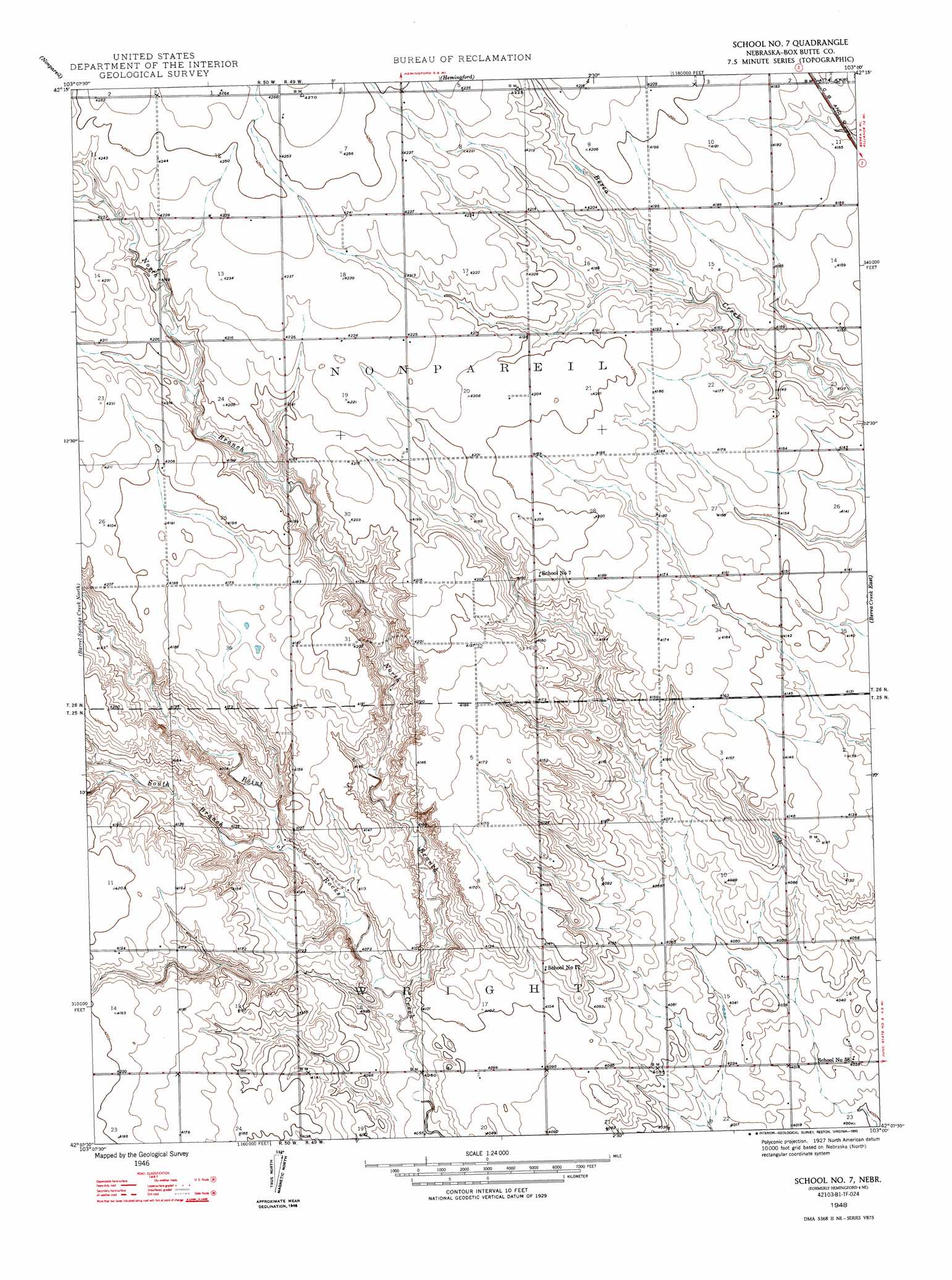
Hemingford 4 Ne Topo Map Nebraska
To zoom in, hover over the map of Hemingford 4 Ne
USGS Topo Quad 42103b1 - 1:24,000 scale
| Topo Map Name: | Hemingford 4 Ne |
| USGS Topo Quad ID: | 42103b1 |
| Print Size: | ca. 21 1/4" wide x 27" high |
| Southeast Coordinates: | 42.125° N latitude / 103° W longitude |
| Map Center Coordinates: | 42.1875° N latitude / 103.0625° W longitude |
| U.S. State: | NE |
| Filename: | O42103B1.jpg |
| Download Map JPG Image: | Hemingford 4 Ne topo map 1:24,000 scale |
| Map Type: | Topographic |
| Topo Series: | 7.5´ |
| Map Scale: | 1:24,000 |
| Source of Map Images: | United States Geological Survey (USGS) |
| Alternate Map Versions: |
Hemingford 4 NE NE 1948 Download PDF Buy paper map School No. 7 NE 1948, updated 1993 Download PDF Buy paper map School No. 7 NE 1948, updated 1993 Download PDF Buy paper map School Number 7 NE 2011 Download PDF Buy paper map School Number 7 NE 2014 Download PDF Buy paper map |
1:24,000 Topo Quads surrounding Hemingford 4 Ne
Marsland Ne |
Box Butte Reservoir West |
Box Butte Reservoir East |
Box Butte Nw |
Box Butte Ne |
Marsland Se |
Nonpareil |
Hemingford |
Box Butte Sw |
Box Butte |
Kilpatrick Lake Ne |
Hemingford 4 Nw |
Hemingford 4 Ne |
Berea Creek West |
Berea Creek East |
Kilpatrick Lake |
Hemingford 4 Sw |
Hemingford 4 Se |
Alliance West |
Alliance East |
Bayard Ne |
Angora Nw |
Angora Ne |
Cowboy Hill |
Rush Lake |
> Back to 42103a1 at 1:100,000 scale
> Back to 42102a1 at 1:250,000 scale
> Back to U.S. Topo Maps home
Hemingford 4 Ne topo map: Gazetteer
Hemingford 4 Ne: Airports
Cullan Airport elevation 1274m 4179′Hemingford 4 Ne: Dams
Frost Dam elevation 1276m 4186′Luce Dam elevation 1268m 4160′
Hemingford 4 Ne: Reservoirs
Frost Reservoir elevation 1276m 4186′Luce Reservoir elevation 1268m 4160′
Hemingford 4 Ne: Streams
North Branch Point of Rocks Creek elevation 1238m 4061′South Branch Point of Rocks Creek elevation 1246m 4087′
Hemingford 4 Ne digital topo map on disk
Buy this Hemingford 4 Ne topo map showing relief, roads, GPS coordinates and other geographical features, as a high-resolution digital map file on DVD:
Eastern Wyoming & Western South Dakota
Buy digital topo maps: Eastern Wyoming & Western South Dakota